Dedicated and detail-oriented SEO Content Writer, Real Estate Writer, and Research Analyst based in Islamabad, with proven expertise in developing accurate, valuable, and well-researched content. Skilled in analytical writing, market research, and reporting, with the ability to turn insights into clear, professional, and impactful content. Passionate about exploring new ideas, analyzing industry trends, and contributing to high-quality writing and research-driven projects.
KARACHI: Pakistan’s capital markets showed renewed vigour in the first half of 2026, with companies raising more than Rs20 billion through initial public offerings, according to figures released by the SECP.
The figures reflect a broader push by Islamabad to strengthen the country’s capital markets and steer businesses toward equity financing as an alternative to conventional bank borrowing.
Nine companies completed public listings during the period, drawing capital from a diverse range of sectors including manufacturing, petroleum, dairy, Islamic finance, poultry, and real estate. The SECP attributed the uptick in market activity to a series of regulatory reforms aimed at streamlining the IPO process and making stock market listings more accessible to companies across industries.
In a related development, the regulator unveiled Pakistan’s first regulatory framework for Environmental, Social and Governance (ESG) mutual funds. Under the new rules, ESG-designated funds will be required to allocate at least fifty percent of their assets to qualifying sustainable investments.
The framework also incorporates safeguards intended to curb “greenwashing,” ensuring that funds marketed as environmentally or socially responsible genuinely meet defined sustainability criteria.
The ESG framework is part of a wider sustainable finance strategy being rolled out by the SECP, which includes new ESG disclosure requirements, sustainability reporting standards, and the introduction of Pakistan’s Green Taxonomy, a classification system meant to identify and standardise environmentally sustainable economic activities.
Taken together, these developments signal a deliberate effort by Pakistani regulators to modernise the country’s financial markets, attract a broader base of investors, and align domestic capital-raising practices with global sustainability standards.
Analysts suggest that continued regulatory simplification could further encourage companies to tap public markets in the coming months, potentially deepening liquidity and investor participation in Pakistan’s equity landscape.
Dedicated and detail-oriented SEO Content Writer, Real Estate Writer, and Research Analyst based in Islamabad, with proven expertise in developing accurate, valuable, and well-researched content. Skilled in analytical writing, market research, and reporting, with the ability to turn insights into clear, professional, and impactful content. Passionate about exploring new ideas, analyzing industry trends, and contributing to high-quality writing and research-driven projects.
ISLAMABAD: The Supreme Court of Pakistan has restored the property inheritance rights of female heirs in a decades-old land dispute, delivering a judgment underscoring that inheritance of ancestral property is a vested legal and religious right, not something that can be surrendered through informal family arrangements.
The dispute traces back to 1955, when, following the death of the parties’ father, two brothers transferred the family’s inherited property into their own names. They claimed their mother and sisters had orally gifted away their share of the ancestral land.
Appellant Noor Muhammad challenged this claim, arguing the so-called gift was a fabricated device to strip female heirs of their legitimate property inheritance. For decades, the trial court, appellate court, and high court upheld the brothers’ claim, leaving the sisters excluded from land that was rightfully theirs.
A two-judge Supreme Court bench, comprising Justices Shahid Bilal Hassan and Shakeel Ahmad, reversed these findings, declaring all prior judgments void and ordering revenue authorities to correct the land record so the sisters’ property inheritance is formally recognised.
The Court ruled that the burden of proving an oral gift lies with those who benefit from it, not with female heirs seeking their inheritance, and reiterated that a valid gift requires clear declaration, acceptance, and delivery of possession. Importantly, it held that revenue mutations serve fiscal record-keeping purposes only and cannot, by themselves, transfer or extinguish property inheritance rights.
The Court also found no unjustified delay in the claim, noting that the sisters had continued to receive income shares from the land for years, indicating no knowledge of the exclusion.
Anchoring its ruling in constitutional guarantees of equality and property rights, alongside Islamic principles, the Court characterised the deprivation of women’s inheritance of property as an entrenched social issue that demands effective enforcement, not just legal recognition on paper.
Dedicated and detail-oriented SEO Content Writer, Real Estate Writer, and Research Analyst based in Islamabad, with proven expertise in developing accurate, valuable, and well-researched content. Skilled in analytical writing, market research, and reporting, with the ability to turn insights into clear, professional, and impactful content. Passionate about exploring new ideas, analyzing industry trends, and contributing to high-quality writing and research-driven projects.
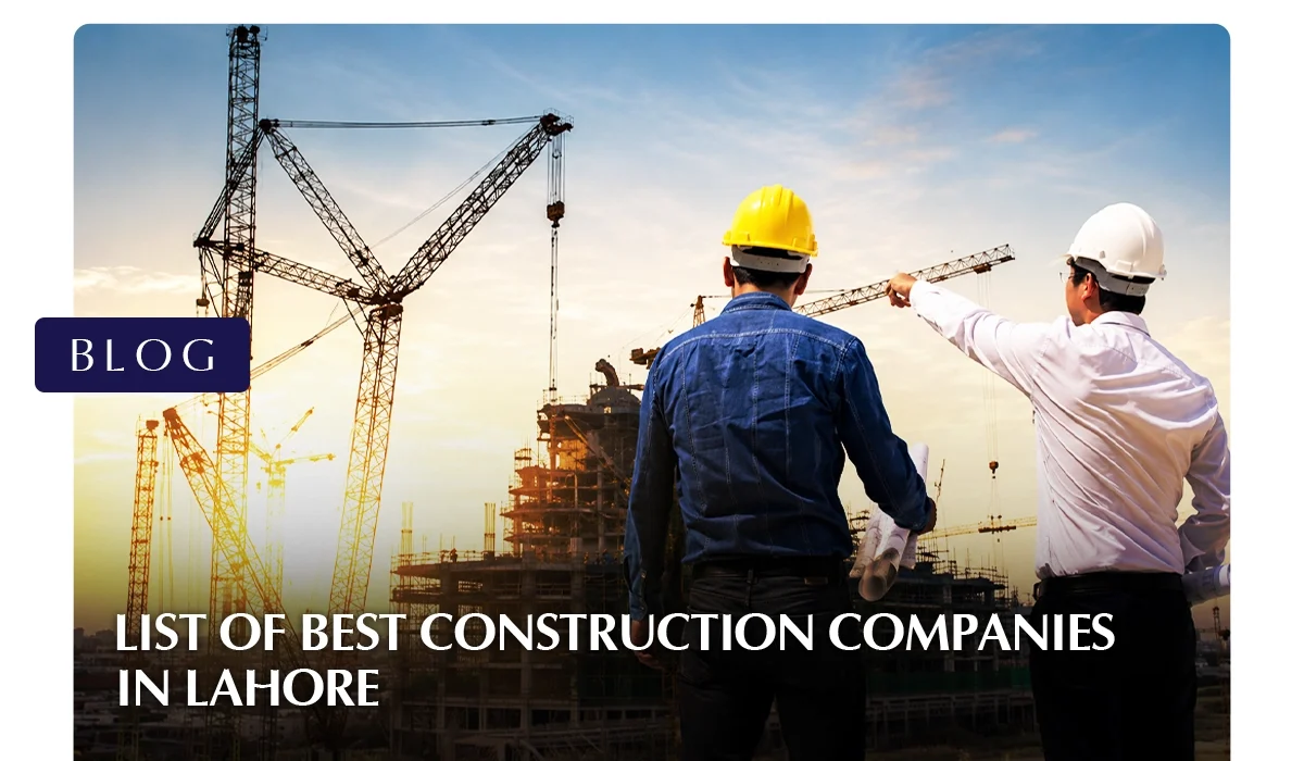
Lahore’s skyline has changed dramatically over the past decade. From the expanding phases of DHA Lahore to the rising towers of Bahria Town, Lake City, and Park View City, construction activity in the city shows no sign of slowing down. With this growth comes a flood of options, and finding the best construction companies in Lahore has become one of the most searched and most important decisions for homeowners, investors, and businesses alike.
Whether you’re planning to build a 5-marla home, a commercial plaza, or a luxury farmhouse, the company you hire will determine whether your project is completed on time, within budget, and to the standard you expect.
Why Choosing the Right Construction Company Matters
Construction is one of the largest financial commitments most people make in their lifetime. A poor choice doesn’t just cost money; it can mean structural issues, legal disputes, and years of regret. This is exactly why so many people now spend time researching the best construction companies in Lahore before signing any contract.
The right firm brings more than just labor. It brings accredited engineers, transparent pricing, proper material sourcing, and a documented process from design to handover. The wrong firm, on the other hand, may quote attractively low prices upfront, only for hidden costs, weak materials, or missed deadlines to surface later. Because of this, due diligence isn’t optional anymore; it’s a core part of any successful construction companies in lahore search.
Best Construction Companies in Lahore
Company
Core Services
Areas Served
Best For
Chakor
Large-scale commercial and mixed-use real estate development
Lahore, Islamabad
Landmark CBD and corporate tower developments
Izhar Construction
Residential, commercial, and industrial construction
Citywide
Large-scale, long-term projects
ARK Design & Construction
Architectural design, interior design, construction management, renovation
DHA Lahore, Lake City, Bahria Town, Bahria Orchard, Park View City
End-to-end home builds in premium societies
Aqsons (Abdul Qadir & Sons)
Grey structure, finishing, and architectural planning
DHA Lahore
Transparent, budget-conscious residential builds
Ahmed Construction Company (ACCO)
Interior design, exterior design, and fabrication evaluation
Construction contracting, architectural design, and investment advisory
Citywide
Clients wanting guidance beyond just the build
Top Construction Companies in Lahore
Here is a closer look at some of the best construction companies in Lahore based on experience, service range, and reputation in the local market.
1. Chakor
Chakor is Pakistan’s leading real estate developer, known for large-scale commercial and mixed-use developments across Lahore and Islamabad.
Under the leadership of CEO Muhammad Abbas Khan, the company has built a reputation for delivering landmark projects that combine modern architecture with long-term investment value, making it a name increasingly featured alongside the city’s established construction companies in Lahore.
Its flagship project, Citadel Prime, is a landmark high-rise development taking shape in Lahore’s Central Business District (CBD), positioned to anchor the next generation of commercial real estate in the city.
On the completed side of its portfolio sits Citadel 7 Corporate Tower in Blue Area, Islamabad, a fully operational corporate office tower in the capital’s primary business district.
The company’s growing international profile was underscored in June 2026, when it hosted a European delegation from OLAE in Lahore and Islamabad, culminating in a $200 million FDI signing covering Citadel Prime and a second Chakor development.
2. Izhar Construction
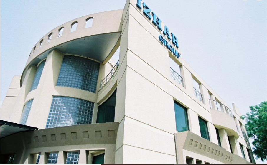
One of the oldest and most established names in the city, Izhar Construction has been active since 1959. With decades of experience across residential, commercial, and industrial projects, the company has played a direct role in shaping Lahore’s urban landscape. Their long history and diverse portfolio make them a consistent presence on lists of the best construction companies in Lahore.
Among its notable ongoing assignments, Izhar was awarded the main civil works contract for Novacare Hospitals’ upcoming 250-bed hospital, a project spanning roughly 590,000 square feet across 12 floors and two basements, won after competing against several other top-category Pakistan Engineering Council (PEC) contractors. The company’s portfolio also includes civil works at Allama Iqbal International Airport in Lahore, including construction of an aircraft hangar shed near the Hajj Terminal.
3. ARK Design & Construction
ARK Design & Construction is among the well-established construction companies in Lahore, known for managing projects from planning through to completion under one roof.
They are particularly active in DHA Lahore, Lake City, Bahria Town, Bahria Orchard, and Park View City, offering architectural design, interior design, construction management, and renovation services tailored to each client’s needs.
Recent examples of their residential and commercial work include an 8-marla house build in DHA Rahbar and a two-floor, 2,700-square-foot office workspace in Lake City Lahore designed for corporate and reception use.
4. Aqsons (Abdul Qadir & Sons)
Aqsons is one of the most trusted construction companies in Lahore, having earned a strong local reputation for combining quality materials with transparent budgeting.
The company handles residential, commercial, and farmhouse projects, and is known for using certified steel and branded cement while keeping clients informed through clear communication and accurate cost estimates throughout the build.
Its project work is concentrated mainly in DHA Lahore, where the firm has delivered a mix of custom residential builds and smaller commercial plots, alongside architectural planning and landscape design services for private clients.
5. Ahmed Construction Company (ACCO)
Founded in 1999, ACCO has become a trusted name among Construction Companies in Lahore for residential and commercial projects across the city. The firm specializes in interior design, exterior architecture, and fabrication evaluation, and is known for delivering eco-friendly building solutions without compromising on project timelines.
ACCO’s work spans multi-storey buildings, private residences, and industrial facilities, and the firm has also taken on hospital and healthcare-related construction assignments alongside its core residential and commercial project load.
6. Glorious Builders
Glorious Builders is recognized primarily for home construction services, with completed projects in some of Lahore’s most desirable localities, including DHA, Model Town, Valencia Town, and Bahria Town Lahore.
Their focus on consistency and craftsmanship has made them a recurring recommendation among the best construction companies in Lahore, specifically for residential clients.
Their portfolio in these societies covers everything from mid-sized family homes to larger custom residences, with an emphasis on structural consistency and finish quality across each build.
7. Habib Construction Services (HCS)
HCS is one of the most recognized construction companies in Lahore, having built its reputation on large-scale infrastructure and commercial projects, including roads, bridges, and urban development.
Their portfolio reflects significant experience in managing complex, large-budget projects, making them a strong option for clients with bigger commercial or infrastructure needs.
HCS has worked as a contractor on multiple packages of the Lahore Ring Road, including the Saggian Interchange package, and has also built high-voltage power transmission infrastructure such as the 220kV transmission line connecting Chimtalla to Kabul.
Beyond infrastructure, the company has expanded into residential and commercial construction, delivering luxury villas and modern homes across Bahria Town, DHA, and Lake City.
8. Urban Developers
Urban Developers is an established constructioncompanies in Lahore, with nearly three decades of experience in the local real estate and construction sector.
They have left a visible mark on Lahore’s skyline, and known projects like the I.T. Tower showcase their ability to combine modern architecture with energy-efficient, sustainable design elements.
The firm’s portfolio also includes Midland Farmhouses, reflecting its focus on blending modern living amenities with education- and healthcare-oriented development goals across both commercial and residential segments.
9. Kingcrete
Serving Lahore since 1976, Kingcrete is an engineering, project management, and construction company in Lahore with a long track record in commercial and residential development, as well as runways, roads, bridges, and pipeline infrastructure. Their longevity speaks to consistent reliability over multiple decades.
The company’s project list includes the DHA Business Hub in Lahore and Penta Square at DHA Phase V, alongside corporate office construction for clients such as FFC and the Bank of Khyber. Kingcrete has also carried out rehabilitation works on the Pearl Continental Hotel in Lahore.
While primarily known as an engineering consultancy, NESPAK has played a central role in some of the country’s most significant infrastructure and development projects.
Their expertise in design, feasibility studies, and construction supervision makes them a respected name, especially for large institutional or government-linked projects.
NESPAK’s landmark assignments include the Neelum-Jhelum Hydropower Project and the Diamer Bhasha Dam, both national-scale water and power infrastructure schemes. Closer to home, the firm also provided engineering and supervisory input on Lahore’s Orange Line Metro Train Project.
11. Amer Adnan Associates
Amer Adnan Associates is one of the well-known construction companies in Lahore that focuses on architectural design and construction execution, specializing in spaces that blend functionality and aesthetics from cafes and offices to residential interiors. Their design-forward approach sets them apart from purely execution-focused builders.
Its featured residential portfolio includes projects such as Mr. Kamran’s Residence and Qaisar Shaheen’s Residence, both in DHA Lahore, alongside a range of commercial interior work covering cafes, restaurants, and technology-oriented office spaces.
12. Multi Construction Services
Established in 2000, Multi Construction Services has grown from an engineering solutions provider into one of the full-service construction companies in Lahore, offering architectural, interior, renovation, and maintenance services. Their involvement in city infrastructure projects also reflects broader civil engineering capability.
The firm, headquartered on Main Boulevard in Johar Town, has built a track record around building renovation and maintenance work across Lahore, alongside architectural design and technical consultancy services for both residential and commercial clients.
13. Mohsin Shaheen Construction Company
Known for reliability and efficient deadline management, Mohsin Shaheen Construction Company is among the construction companies in Lahore that offer a combination of construction contracting, architectural design, and investment advisory services, making it a practical choice for clients seeking guidance beyond the physical build.
The firm’s project mix leans toward private residential and commercial contracting assignments, where its investment advisory arm provides clients with added financial planning support alongside the physical build.
What to Look for in a Construction Company in Lahore
When evaluating any of the best construction companies in Lahore, keep the following in mind:
Registration and Accreditation Check whether the company is registered with the Pakistan Engineering Council (PEC). This is one of the simplest ways to verify legitimacy and confirm the firm employs qualified engineers.
Portfolio and Project History A company’s past work tells you more than any sales pitch. Look at completed residential and commercial projects, ideally ones you can visit or see in detailed photos, to judge construction quality firsthand.
Transparent Pricing Reliable firms provide detailed, itemized quotes covering labor, material, and finishing costs. Vague or unusually low estimates are often a warning sign of hidden charges later in the project.
Range of Services The most capable companies handle everything in-house: architectural design, structural planning, grey structure work, electrical and plumbing, and interior finishing. This reduces the hassle of coordinating multiple vendors.
Client Reviews and Reputation Online reviews, word-of-mouth referrals, and testimonials are strong indicators of consistency. A firm with a long track record of satisfied clients is generally a safer bet.
After-Service Support Construction doesn’t end at handover. The better companies offer warranties and post-completion maintenance support, which protects your investment long after the project is finished.
With these criteria in mind, let’s look at some of the most recognized names currently operating in the city.
Cost and Budget Considerations
One of the most common questions when researching construction companies in Lahore Pakistan, is around pricing. Costs vary significantly depending on the size of the plot, the quality of materials selected, the level of interior finishing, and the location (rates in DHA or Bahria Town generally differ from older parts of the city).
Reputable firms will break down their estimates into grey structure, finishing, and labour costs separately, rather than giving a single vague figure. It’s worth requesting at least two to three quotes before committing, and confirming what’s included, utility connections, legal approvals, and material brands can all affect the final number significantly.
Red Flags to Watch For
Not every firm claiming to be among the best construction companies in Lahore actually deserves that reputation. Watch for these warning signs:
No registered office or verifiable address
Unwillingness to provide a written, itemized contract
Quotes that seem unusually low compared to market averages
No visible portfolio of completed projects
Reluctance to share client references
Taking the time to verify these details before signing anything can save significant money and stress later in the project.
Frequently Asked Questions
Several firms specialize specifically in residential work, including Glorious Builders, ARK Design & Construction, and Aqsons. Each offers slightly different strengths, so it’s worth comparing portfolios in your specific area, such as DHA or Bahria Town, before deciding.
Check for Pakistan Engineering Council (PEC) registration, ask for a portfolio of completed projects, and request a written contract that clearly outlines costs and timelines. This is one of the most reliable ways to filter the list of construction companies in Lahore down to trustworthy options.
Most full-service firms provide architectural design, structural engineering, grey structure construction, electrical and plumbing work, interior finishing, and sometimes post-completion maintenance, all under one roof.
Pricing varies widely. Many companies, including Aqsons and ACCO, offer flexible packages designed for different budgets, so cost alone shouldn’t be the only factor; quality, transparency, and reviews matter just as much.
Yes. A clear, written contract detailing costs, materials, and timelines is essential, regardless of which firm you choose. This protects both parties and is a standard practice among the best construction companies in Lahore.
Final Thoughts
Lahore’s construction sector continues to grow alongside the city itself, and with that growth comes more choice but also more risk if due diligence is skipped. The best construction companies in Lahore combine experience, transparency, and a genuine track record of completed projects, rather than just attractive marketing.
Whether you’re drawn to the decades-long legacy of firms like Izhar Construction and Kingcrete, or the design-focused approach of ARK Design & Construction and Amer Adnan Associates, the key is matching a company’s strengths to your specific project. Take time to compare quotes, verify credentials, and review past work. A little research now can save considerable time, money, and stress once construction is underway, and it’s the single best step toward finding the right partner among Lahore’s many building construction companies in Lahore.
Dedicated and detail-oriented SEO Content Writer, Real Estate Writer, and Research Analyst based in Islamabad, with proven expertise in developing accurate, valuable, and well-researched content. Skilled in analytical writing, market research, and reporting, with the ability to turn insights into clear, professional, and impactful content. Passionate about exploring new ideas, analyzing industry trends, and contributing to high-quality writing and research-driven projects.
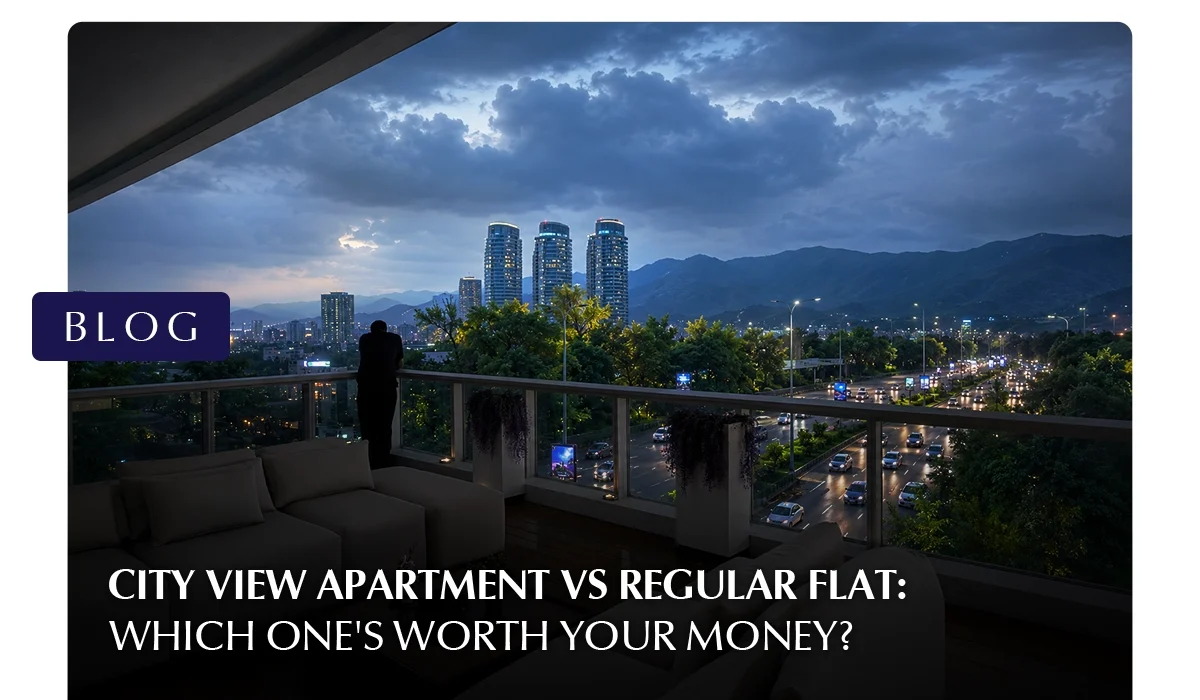
If you are comparing a city view apartment vs regular flat in Pakistan, you are not alone. More buyers today are asking whether the extra cost of a high-rise city view apartment is actually worth it. The answer depends on what you want from the property: a home, a rental investment, or a long-term asset.
This guide breaks down the real differences between a city view apartment vs regular flat. No lifestyle fluff. Just what matters to a Pakistani buyer.
City View Apartment vs Regular Flat
When weighing a city view apartment vs regular flat, it is not just about the scenery. There are structural and practical differences that affect how you live in the unit every day.
Windows and Natural Light
Source:
Vecteezy
Source: Peerspace
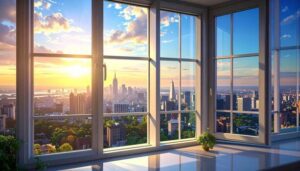
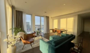
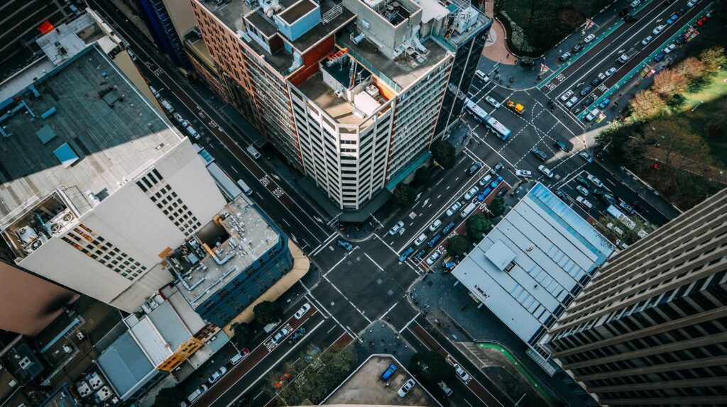
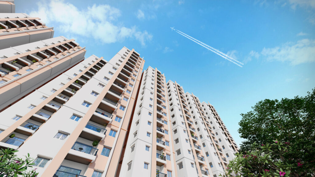
City view flats typically sit on higher floors and interior design of city view apartment are with larger windows, often floor-to-ceiling, to maximise the view. Regular ground or mid-floor flats use smaller standard windows. More glass means more natural light throughout the day, which reduces electricity use during daylight hours. In cities with long power outages, this matters more than it sounds. One of the first practical differences buyers notice in the city view apartment vs regular flat comparison.
Floor Level
Most genuine city-view flats start on the 10th floor and above. Below that, surrounding buildings, boundary walls, and trees block sight lines in Pakistani cities. Projects in Gulberg Lahore, Blue Area Islamabad, and Clifton Karachi typically mark anything from the 8th floor upward as a “view floor,” but the actual open cityscape usually begins at the 10th or higher.
Noise and Air Quality
Higher floors are eco-friendly city view apartment and can be naturally reduce street noise. In dense urban areas, this is a significant benefit in the city view apartment vs regular flat decision. Road traffic, vendors, and construction noise stay below. Air quality also improves with height, particularly in cities with high dust and pollution levels.
Privacy
A regular ground or lower-floor flat in Pakistan has a genuine privacy problem. Passersby, security guards, and neighbouring buildings can see directly inside. You end up keeping curtains closed most of the day, which defeats the purpose of having windows. A higher-floor city view flat removes this problem entirely. Another point that tilts the city view apartment vs regular flat debate toward the higher unit.
High Floor vs Low Floor Apartment: What Pakistani Buyers Should Know
The high floor vs low floor apartment, city view flat Pakistan debate has a different texture in Pakistan. Local conditions change the calculation, and they feed directly into the broader city view apartment vs regular flat question.
High Floor Flat
Advantages of a High Floor Flat
Better views and natural light. The main draw. Unobstructed cityscape, cleaner sky, and sunrise or sunset visibility depending on orientation.
Less noise. Street traffic, car horns, and neighbourhood sounds fade significantly above the 8th floor.
More privacy. No risk of passers-by or neighbours looking in.
Better ventilation. Higher floors receive more natural airflow, which can reduce dependence on air conditioning.
Higher resale and rental value.
Disadvantages of a High Floor Flat in Pakistan
Elevator dependency. This is the big one. Pakistan’s urban areas still experience regular load shedding. If the building lacks a reliable generator or UPS backup for elevators, living on the 15th floor becomes a serious inconvenience. Always confirm backup power arrangements before buying any high-floor unit.
Water pressure. Many high-rises in Pakistani cities struggle with water supply on upper floors. Check whether the building uses a dedicated overhead tank and booster pump system.
Moving costs. Bringing furniture, appliances, and household goods to upper floors in buildings with smaller lifts adds cost and difficulty.
Emergency access. In an emergency, getting out of a high-floor unit takes more time. Fire safety equipment in many Pakistani buildings is also inconsistently maintained.
Low Floor Flat
Advantages of a Low Floor Flat
No elevator dependency. You can walk up if needed. This is a genuine comfort during outages.
Easier access. Better for elderly residents, families with young children, and frequent movement of goods.
Lower purchase price. Standard flats without view premiums are more affordable. Floor-rise charges in Pakistan typically add PKR 2,000–5,000 per square foot per additional floor in premium developments.
Cooler interiors. Lower floors stay shaded by the building above and receive less direct sun, reducing cooling costs in summer.
Disadvantages of a Low Floor Flat
Noise. Street traffic, generators, parking area sounds, and neighbourhood activity are loudest at lower levels.
Security concerns. Ground and lower-floor windows require iron grilles, which add cost and give the flat a closed, darker feel.
Dust and dirt. Lower units accumulate more road dust, particularly in areas near main roads.
Less privacy. Neighbours, security staff, and passers-by can easily see inside.
Pest risk. Insects, rodents, and other pests enter more easily at lower levels, a real concern in older buildings.
City View Apartment vs Regular Flat in Pakistan: What the Market Looks Like
city view apartments
Regular Flat
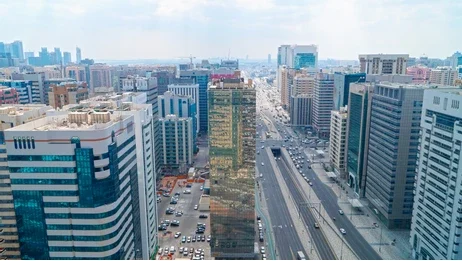
Demand for high-floor units has grown steadily as vertical construction expands in Lahore, Karachi, and Islamabad, sharpening the city view apartment vs regular flat debate for buyers in all three cities. Here is what the current market reflects.
Islamabad
The Blue Area and the F-8 corridor have the highest concentration of high-rise residential projects with city view units. Gullberg Greens and Goldcrest Highlife in DHA Phase 2 are among the established names. A 1-bed luxury flat in this belt currently starts around PKR 1.7 crore and goes significantly higher for upper floors with unobstructed Margalla-facing views.
Karachi
Clifton, DHA Defence, and the HMR Waterfront corridor in Kemari offer high-rise flats with sea and city views. Luxury flats here cater to both end-users and investors. Bahria Town Karachi also has mid-rise projects with city view units at comparatively lower price points.
Lahore
Main Boulevard, Gulberg, Raiwind Road, and DHA Lahore are seeing rapid vertical growth. Many towers offering city views across 1-, 2-, and 3-bedroom layouts. Prices vary, but premium view floors command a clear markup over lower-floor units in the same project.
Is a City View Apartment a Better Investment in Pakistan?
For investors and overseas buyers weighing a city view apartment vs regular flat, this is the right question to ask.
Rental Yield
City view flats on higher floors command higher monthly rents than standard units in the same building, one of the clearest financial differences in the city view apartment vs regular flat comparison. In premium Islamabad and Karachi projects, furnished city view units are consistently let to corporate tenants, expats, and short-stay travellers at a premium. The rental gap between a lower-floor standard flat and a high-floor city view unit in the same building can range from 20% to 40% in well-located projects.
Resale Value
View units hold their value better and appreciate faster. When a new project launches in the same area, the low-floor standard flats face direct price competition. A premium high-floor unit with a view has fewer direct comparables and retains a scarcity premium, a key factor in the city view apartment vs regular flat resale comparison.
Tax and Cost Considerations
FBR valuation rates in Pakistan do not always reflect the actual premium on city-view units. This creates a gap between the market price and the declared value, relevant for capital gains tax (CGT) calculations. Stamp duty and registration costs are based on the FBR valuation, so the formal transaction cost for a premium unit is not disproportionately higher. Buyers should confirm current FBR rates for their specific project and city with a property lawyer before signing.
Verdict for Investors
If the building has a reliable generator backup, a good maintenance track record, and is located in a high-demand rental zone, a city-view flat is a stronger long-term asset than a comparable standard flat. In the city view apartment vs regular flat comparison, the purchase price premium is real, but so are the rental yield and resale advantage.
Citadel One3: A City View Condominium in the Heart of Islamabad
If you are actively looking for a city-view condominium in Islamabad, Citadel One3 by Chakor is a project worth a close look and a useful real-world example in the city view apartment vs regular flat conversation.
It is a 40+ storey residential condominium rising on Jinnah Avenue in the Blue Area, one of Islamabad’s most central and high-demand addresses. The building offers direct views of the Faisal Mosque and F-9 Park from its upper floors, which is about as strong a view corridor as Islamabad gets.
The project addresses the two concerns that matter most to Pakistani high-rise buyers. First, it includes an advanced firefighting system and secure entry and exit points infrastructure that many local projects skip or underfund. Second, with 350+ car smart parking, it handles a practical problem that most Islamabad high-rises ignore entirely.
What Citadel One3 offers:
40+ floors with panoramic Faisal Mosque and F-9 Park views
Culinary court, gym, sports and kids’ play area within the building
Rental stay management relevant for investors targeting short-stay or corporate tenants
24/7 CCTV surveillance and secure entry/exit
Advanced firefighting system
For buyers evaluating a city view apartment vs regular flat in Islamabad, Citadel One3 makes the comparison concrete: you are not just buying a higher floor, you are buying a verified view, a managed building, and a central address that supports both lifestyle and investment goals.
Which Should You Choose? City View Apartment vs Regular Flat
Buyer type
Better choice
Young professional, single occupant
City view flat, privacy, light, lifestyle
Family with elderly members
Low-floor flat elevator independence, easy access
Rental investor in a premium zone
City view flat higher yield, stronger resale
Budget-conscious buyer
Standard flat lower entry cost, no floor-rise premium
Overseas Pakistani buyer
City view flat with verified generator backup
Frequently Asked Questions
Yes, if the building has reliable backup power and sits in a strong rental zone, the premium pays off through rent and resale. Without a confirmed generator backup, it’s a risky trade-off in the city view apartment vs regular flat decision.
The 10th floor and above usually offer genuinely open views in Pakistani cities, since lower floors are often blocked by nearby buildings and walls. Always confirm the actual view from the specific unit before committing.
The terms are used interchangeably, with “flat” more common in everyday speech and “apartment” favoured in premium marketing. There’s no legal difference, so the city view apartment vs regular flat comparison applies either way.
They offer better security against break-ins, but emergency evacuation takes longer. Check the building’s fire safety certification before buying.
Yes, in well-located premium projects, since view units are scarcer and face less direct competition. Standard mid-floor flats resell faster but at a lower price ceiling.
Final Words
There is no single right answer in the city view apartment vs regular flat debate, only the right answer for your situation. A young professional or a rental investor in a premium zone will usually get more long-term value from a city view unit, provided the building has reliable backup power, good water pressure, and a solid maintenance track record. A family with elderly members or a buyer working with a tight budget may find a regular flat the more practical, lower-stress choice.
Before signing on either option, walk the building, talk to existing residents, and verify the basics: generator backup, water supply, fire safety, and the actual view from the specific unit on offer. Get those details right, and whichever side of the city view apartment vs regular flat decision you land on will feel like the right one.
Dedicated and detail-oriented SEO Content Writer, Real Estate Writer, and Research Analyst based in Islamabad, with proven expertise in developing accurate, valuable, and well-researched content. Skilled in analytical writing, market research, and reporting, with the ability to turn insights into clear, professional, and impactful content. Passionate about exploring new ideas, analyzing industry trends, and contributing to high-quality writing and research-driven projects.
ISLAMABAD: In a major relief measure for consumers, Prime Minister Shehbaz Sharif on Friday announced a substantial cut in fuel prices, reducing petrol by Rs74 per litre and high-speed diesel by Rs67 per litre, as the government moves to pass on the benefits of falling international oil prices to the public.
According to the announcement, the formal notification confirming the new rates had not yet been issued at the time of reporting. Prices have been adjusted weekly since the outbreak of the US-Iran war, reflecting the volatility conflict has introduced into global energy markets.
Once the revision takes effect, petrol will be priced at Rs299.78 per litre, while diesel will be priced at Rs311.78 per litre, sharply lower than the previous rates of Rs373.78 and Rs378.78, respectively.
Explaining the rationale behind the decision, the Prime Minister stated that the government was responding to an improved regional economic climate alongside the broader decline in oil prices, describing the move as the fulfilment of a commitment previously made to the nation.
The announcement follows remarks PM Shehbaz delivered earlier in the day in the National Assembly, where he had pledged a “significant” reduction in fuel prices, attributing the shift to de-escalating tensions in the Middle East following the recently brokered US-Iran peace agreement and the resumption of energy shipments through the Strait of Hormuz.
In his official statement, the Prime Minister also acknowledged the difficulties faced by ordinary citizens during the period of elevated fuel costs, commended the public for its patience and resilience, and expressed appreciation for their continued support for the government throughout the challenging period.
The development is being viewed as a direct economic dividend of the broader regional stabilisation following the recent ceasefire arrangement between Washington and Tehran, which has restored confidence in global oil supply chains.
Dedicated and detail-oriented SEO Content Writer, Real Estate Writer, and Research Analyst based in Islamabad, with proven expertise in developing accurate, valuable, and well-researched content. Skilled in analytical writing, market research, and reporting, with the ability to turn insights into clear, professional, and impactful content. Passionate about exploring new ideas, analyzing industry trends, and contributing to high-quality writing and research-driven projects.
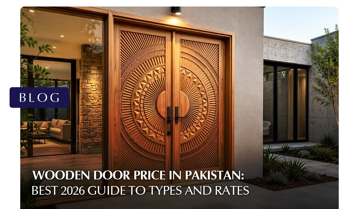
If you are searching for the different types of doors and wooden door price in Pakistan, here is a quick answer. A standard wooden door costs between PKR 8,000 and PKR 60,000, while premium solid-wood doors made from Deodar, Sheesham, or Mahogany can go up to PKR 130,000 or more, depending on size, design, and finish. Custom-carved doors can cost PKR 150,000.
This guide breaks down the current wooden door price for every type of wooden door, popular design ideas, and lock and polish costs, so you can budget accurately before you buy.
What Is the Average Wooden Door Price in Pakistan in 2026?
Door Type
Material
Price Range (Per Door)
Solid Wood Door
Diyar, Ash, Sheesham
PKR 25,000 to PKR 130,000
Semi-Solid Door
MDF Core with Veneer
PKR 16,000 to PKR 30,000
Plywood Flush Door
Commercial Ply
PKR 8,000 to PKR 12,000
PVC Door
Plastic or Polymer
PKR 6,000 to PKR 10,000
Fiberglass Door
Fiber and Resin
PKR 11,000 to PKR 18,000
uPVC Door
Unplasticized PVC
PKR 15,000 to PKR 35,000
For custom doors made by a carpenter, wooden door price are usually quoted per square foot rather than per door.
Wooden Door Price Per Square Foot
Wood Quality
Price Per Sq. Ft. (Labour and Material)
Premium (Diyar or Afghan)
PKR 1,400 to PKR 1,800
Standard (Ash or Oak)
PKR 1,100 to PKR 1,450
Mid Range (Kail or Malaysian)
PKR 850 to PKR 1,000
Budget (Panel or Semi Solid)
PKR 450 to PKR 600
A standard bedroom door measuring 3.5 by 7 feet works out to roughly 24.5 sq. ft, so multiply that figure by the rate above to estimate your total cost.
What Are the Different Types of Wood Used for Doors in Pakistan?
Choosing the right wood is the biggest factor behind any wooden door price in Pakistan.
Wood Type
Price Per Cubic Foot
Best Suited For
Deodar (Diyar)
PKR 8,500
Main entrance, exterior doors
Sheesham (Rosewood)
PKR 9,000 to PKR 12,000
Main doors, premium interiors
Ash Wood
PKR 10,500
Main doors, modern designs
Mahogany
PKR 8,500
Exterior doors in humid climates
Oak
PKR 9,500
Exterior doors, furniture-grade
Kail (Pinewood)
PKR 4,000
Interior and budget doors
Partal (Himalayan Spruce)
PKR 3,500
Interior doors, window panels
Kikar (Acacia)
PKR 3,500 to PKR 5,000
Budget-friendly doors
Poplar
Budget range
Interior doors, kitchen cabinets
Which Wood Performs Best?
Deodar has even, straight grains and resists termites and moisture well, which is why it remains the top pick for a wooden main door in Pakistan despite its wooden door price, though it scratches more easily than harder woods. Sheesham and Mahogany sit at the premium end, valued for strength and a rich, dark finish that ages well.
Ash wood is sturdy and resists shrinkage, but it needs protection from harsh sunlight. Oak is long-lasting and resistant to warping but can darken unevenly over time. Kail, Partal, Kikar, and Poplar are softer, more affordable woods that work well for interior doors but are not recommended for exterior use, as they are more prone to termite damage and general wear.
How Much Does a Main Wooden Door Price in Pakistan?
The wooden main door carries the highest price tag of any internal or external door because it needs extra thickness, strength and a premium finish for security and curb appeal. A solid Deodar or Sheesham main door typically costs PKR 35,000 to PKR 80,000 or more, with carved or custom wooden main door design work pushing prices well past PKR 100,000.
Experts recommend a main door thickness of at least 1.5 to 2 inches for proper security. Budget alternatives like Engineered Wood or a semi-solid main wooden door price down to PKR 18,000 to PKR 30,000 while still offering a wood grain finish.
What Are the Latest Wooden Door Design Ideas for Home?
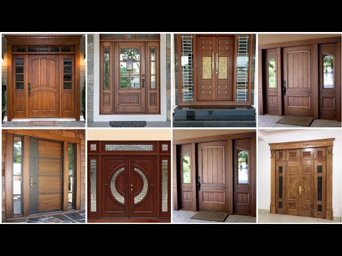
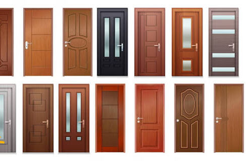
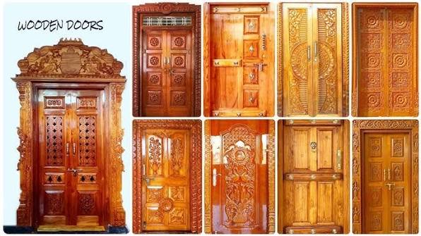
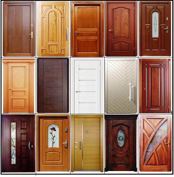
Wooden door design trends in Pakistan have moved well beyond plain flat panels. Below is a detailed breakdown of each style so you know exactly the wooden door price and where it fits best in your home.
Modern Wooden Door Design
Source: Modern Wooden Door Designs
Source: Modern Wooden Door Designs
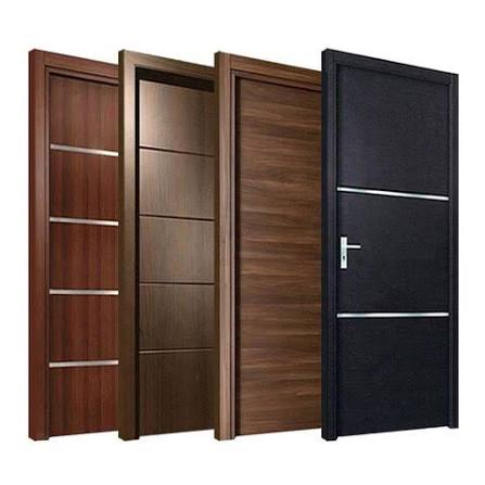
A modern wooden door design strips away ornamentation and focuses on clean geometry. The panel is usually a single flush surface or split into two or three equal vertical or horizontal sections using thin recessed grooves instead of raised mouldings. Hardware is kept minimal, often a slim stainless-steel or matte-black handle set flush against the door rather than a bulky traditional knob.
The finish is almost always matte rather than glossy, which lets the natural wood grain show without looking shiny or old-fashioned. When comparing options, the wooden door price can vary significantly depending on the wood type, panel design, and hardware quality, so it’s worth checking a few designs before deciding on the one that best fits both your aesthetic and your budget.
This style works best in Ash wood or Oak because both woods have a tight, even grain that looks sharp under a matte coat. It suits main doors on contemporary house facades, drawing room entrances, and any home where the rest of the interior follows a minimalist theme. Ash wood with a matte finish is currently the most requested wooden door design for home interiors in Pakistan, largely because it photographs well and pairs easily with both warm and cool-toned wall colours.
Simple Wooden Door Design
A simple wooden door design is the most economical and widely used style for bedrooms, storerooms and secondary entrances, making the wooden door price quite affordable for everyday use. It consists of a single flat or lightly moulded panel with no carving, no glass insert and minimal detailing. The only visual interest usually comes from the natural grain of the wood itself or a thin border moulding running around the edge of the panel.
Because there is no carving labour involved, this design keeps both material and craftsmanship costs low, which is why it is commonly built from Kail, Partal or Kikar rather than premium woods like Sheesham or Deodar. It is the right choice if you need to fit out multiple doors across a house on a tight budget, since the savings per door add up quickly across an entire property.
Wooden Door Design for Room
A wooden door design for room interiors generally falls between the simple flat-panel and the more decorative main-door styles. Common features include two or three raised or recessed panels arranged vertically, lighter wood tones than what you would use for an exterior door, and occasionally a small frosted or fluted glass cutout near the top to allow some light or ventilation between rooms without sacrificing privacy.
A room door design with a raised-panel or shaker style is particularly popular because the shallow three-dimensional panel adds visual texture without requiring carving. This style is forgiving on the wooden door price since it can be made in Poplar or Kail and still look more refined than a completely flat door, making it a good middle ground for bedrooms, studies, and home offices.
Carved or Decorative Wooden Doors
Source:
Source: StockCake
Source: Make My Piece
Source: ArchiExpo
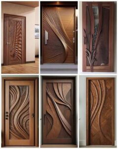
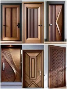
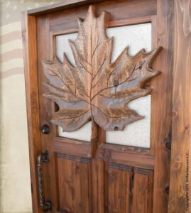
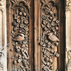
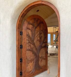
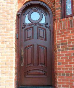
Carved doors represent the top end of wooden door design in Pakistan, both visually and in price. The design typically features deep-relief carving of floral motifs, geometric Islamic patterns, or vine-and-leaf borders cut directly into solid wood panels, most often Sheesham or Deodar, because both woods are dense enough to hold fine-carved detail without chipping. Some designs combine carving with a raised centre panel that sits proud of the surrounding frame, creating a layered, three-dimensional look from a distance.
This style is almost exclusively used for main entrance doors, where the door itself serves as a design statement for the entire property. Because every carved door requires a skilled craftsman to work by hand for several days, pricing reflects labour as much as material, which is why carved wooden door price in Pakistanrange from PKR 30,000 for simpler border carving to PKR 70,000 or more for full-panel relief work.
If you are browsing pictures of wooden door designs for inspiration, pay close attention to the depth of the carving in the photo, since shallow machine-routed patterns look very different in person compared to genuine hand-carved relief work.
What Is the Price of a Wooden Double Door in Pakistan?
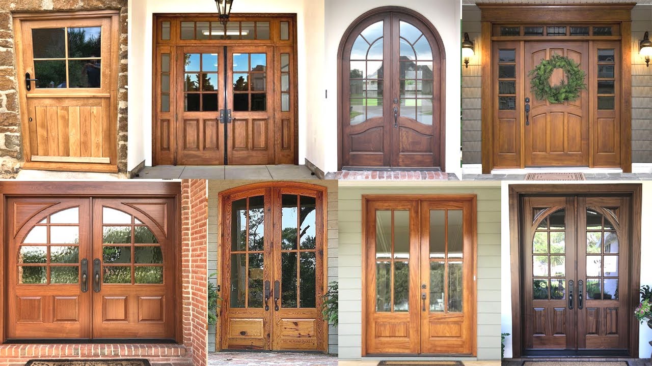
A wooden double door is a common choice for grand entrances, drawing rooms and villas. Because it uses roughly twice the material and labour of a single door, wooden door price ranges from PKR 60,000 to PKR 180,000, depending on wood and design. A wooden double door design with matching carved panels and brass fittings sits at the higher end, while a simpler flush double door in Kail or Partal can be done for PKR 35,000 to PKR 60,000.
How Much Does a Wooden Sliding Door or Bifold Door Cost?
A wooden sliding door is increasingly used for drawing rooms, balconies and space-saving interior partitions. Wooden door price depends on track hardware and panel count, but typical costs range from PKR 25,000 to PKR 70,000 for a standard two-panel sliding setup.
Wooden bifold doors and wooden folding doors are popular for wardrobes, kitchen partitions and patio openings where a swinging door would take up too much space. These typically cost PKR 15,000 to PKR 40,000 per opening, depending on the panel count and wood grade, with hardware (rollers, hinges, tracks) adding PKR 3,000 to PKR 8,000.
What Are the Best Wooden Glass Door Designs?
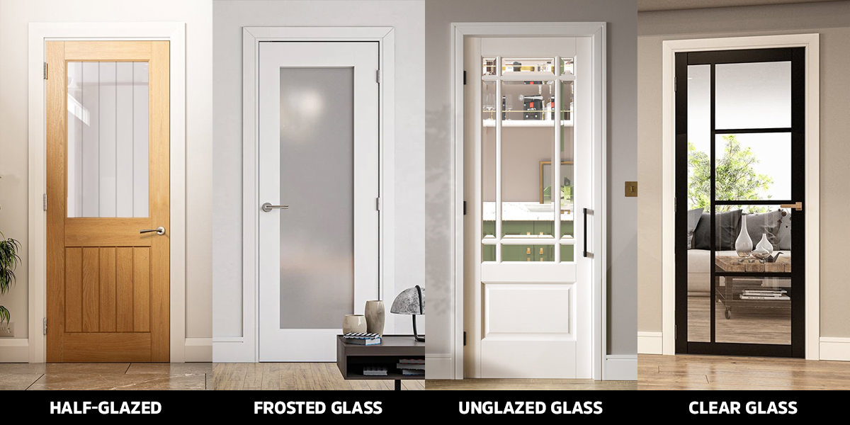
A wooden glass door design combines a wooden frame with full or partial glass panels and is commonly used for balconies, study rooms, and modern drawing rooms. A glass door with a wooden frame design typically costs more than a solid-panel door of the same size because of the tempered or frosted glass insert, which usually adds PKR 5,000 to PKR 15,000 to the base wooden door price. These designs work especially well in Ash or Oak frames, which complement the clean lines that glass panels call for.
What Do Wooden Main Door Designs in Indian Style Look Like?
Wooden main door designs in the Indian style remain a popular reference point for Pakistani homeowners who want an ornate, traditional entrance. These designs typically feature deep-relief carving, jali (lattice) patterns, arched tops, and brass or antique-gold hardware, usually crafted from Teak, Sheesham, or Deodar. Due to labour-intensive carving, wooden door price for this style generally starts at PKR 60,000 and can exceed PKR 150,000 for hand-carved pieces.
How Much Do Wooden Door Locks Cost in Pakistan?
Lock and hardware costs add a meaningful amount to your total wooden door price in Pakistan, sometimes PKR 5,000 to PKR 40,000 per door once everything is included.
Accessory
Quality or Material
Price Range (PKR)
Main Door Handle Lock
Zinc Alloy or Brass
PKR 8,500 to PKR 35,000
Bedroom Handle Lock
Standard (Wista or Nexen)
PKR 3,500 to PKR 9,000
Cylindrical Knob Lock
For Bathrooms
PKR 1,200 to PKR 2,500
Door Hinges (Kabzay)
Stainless Steel, Set of 3
PKR 800 to PKR 2,500
Door Stopper
Magnetic or Rubber
PKR 450 to PKR 1,200
Digital Smart Lock
Fingerprint or Card, Imported
PKR 25,000 to PKR 65,000
Wooden door lock prices in Pakistan vary mainly by brand and finish. Local zinc alloy locks are budget-friendly, while imported brass or digital smart locks cost significantly more but offer better durability and added security for the main entrance.
What Are the Best Wooden Door Paint Colours and Polish Options?
Finishing is one of the easiest ways to change how a door looks without changing the wood itself.
Finish Type
Description
Rate (Per Sq. Ft.)
Standard Wood Polish
Hand rubbed (Lakh Dana)
PKR 150 to PKR 250
Deco Paint
High gloss or solid colors
PKR 350 to PKR 550
PU or Lacquer Finish
Premium machine finish
PKR 500 to PKR 800
Simple Oil Paint
For steel or flush doors
PKR 80 to PKR 120
For wooden door paint colours, walnut brown, mahogany red, and natural honey tones remain the most requested for main doors, as they highlight the grain and influence wooden door price. Matte black and charcoal grey are trending for modern facades, while soft white or off-white finishes work well for interior room doors. A proper wooden door polish job using the Lakh Dana hand-rubbed method brings out the natural shine of Deodar and Sheesham and remains ideal for humid climates.
Is Buying an Old Wooden Door a Good Idea?
An old wooden door, whether reclaimed from a demolished property or bought from an antique dealer, can be a budget-friendly and characterful option for a wooden door price, especially for Diyar or Sheesham pieces that are no longer commercially available at the same quality level.
Before buying, check carefully for termite damage, warping and loose joints, since restoration (stripping, sanding, repolishing) can add PKR 5,000 to PKR 15,000 to the upfront cost. If the structure is sound, an old wooden door often outperforms a new budget door in both durability and appearance.
What Additional Costs Affect Wooden Door Price?
Cost Item
Type or Material
Price Range (PKR)
Chaukhat (Steel Frame)
16 Gauge Standard
PKR 5,500 to PKR 8,500
Chaukhat (Wooden Frame)
Diyar, A Grade
PKR 18,000 to PKR 28,000
Chaukhat (WPC Frame)
Waterproof, Termite Proof
PKR 12,000 to PKR 16,000
Installation
Carpenter Labor
PKR 2,000 to PKR 7,000
Polish or Paint
Per Sq. Ft, Finish Dependent
PKR 80 to PKR 800
Locks and Hardware
Standard to Digital
PKR 5,000 to PKR 40,000
Frequently Asked Questions
As of 2026, prices range from PKR 8,000 for a basic plywood or PVC door to PKR 130,000 or more for a premium solid Deodar or Sheesham main door, with custom-carved designs going even higher.
A semi-solid door has a solid wood frame around the edges with an MDF or honeycomb core in the centre, covered by a thin wood veneer. It looks similar to solid wood but costs roughly half the price.
Solid Deodar, Sheesham, or Ash wood is the top choice for main doors because of its strength and resistance to weather. A thickness of at least 1.5 to 2 inches is recommended for security.
No. Standard door rates usually refer only to the door leaf. A wooden or steel chaukhat typically adds PKR 5,000 to PKR 28,000, depending on the material.
Check the weight first, since solid doors are noticeably heavier. Then inspect the top or bottom edge. A solid door shows continuous wood grain throughout, while a semi-solid door reveals a layered, sandwich-like structure.
A wooden double door generally costs close to twice as much as a single door of the same wood and design, typically PKR 60,000 to PKR 180,000, since it uses twice the material and hardware.
Final Thoughts: Wooden door price in Pakistan
Choosing the right door for your home comes down to balancing budget, durability, and design. As this guide shows, wooden door price in Pakistan can range from PKR 8,000 for a basic plywood or PVC door to over PKR 130,000 for a premium solid Deodar or Sheesham main door, with custom-carved designs going even higher. The wood type, design complexity, hardware, and finishing all play a major role in determining your final cost, so it helps to decide on these priorities before you start shopping.
If you’re on a tight budget, woods like Kail, Partal, or Poplar, paired with a simple or shaker-style design, will keep costs low without sacrificing much in appearance. For a long-lasting main door, investing in Deodar or Sheesham with a properly polished finish is worth the higher wooden door price. Remember to also budget for the chaukhat, installation, and locks, as these add to your overall cost and ensure you get a complete, well-fitted door rather than just the door leaf.
Dedicated and detail-oriented SEO Content Writer, Real Estate Writer, and Research Analyst based in Islamabad, with proven expertise in developing accurate, valuable, and well-researched content. Skilled in analytical writing, market research, and reporting, with the ability to turn insights into clear, professional, and impactful content. Passionate about exploring new ideas, analyzing industry trends, and contributing to high-quality writing and research-driven projects.
ISLAMABAD: The Islamabad High Court (IHC) has suspended the collection of property tax from residents of the federal capital, delivering interim relief to taxpayers who had challenged the levy imposed by the Metropolitan Corporation Islamabad (MCI).
The order was issued by a single bench during the first hearing of a writ petition filed by Muhammad Munir Ahmed Chaudhary and Ahmed Hasan Rana, with the latter also appearing as counsel for the case.
The petition contests Gazette Notification No. 404(1)-4/2024, issued on March 14, 2024, as well as a subsequent property tax bill of Rs. 846,398, served on the petitioners on April 24, 2026. Given that thousands of property owners across Islamabad face similar demands, the case has emerged as a key test case with wide-reaching implications.
Counsel for the petitioners argued that the notification contravened the Islamabad Capital Territory Local Government Act, 2015, and the Urban Immovable Property Tax Act, 1958. They contended that MCI lacked the legal authority to impose such a tax and that the notification had been issued by an administrator rather than an elected local government body, as required by law.
It was further argued that the tax demand was arbitrary, lacking proper assessment and failing to provide taxpayers a hearing. The petitioners cited a relevant Supreme Court ruling to reinforce their position.
After hearing preliminary arguments, the court concluded that the petitioners had established a prima facie case, with the balance of convenience favouring the taxpayers. Consequently, notices were issued to MCI, its Directorate of Revenue, the Capital Development Authority, and federal authorities through the Interior and Cabinet divisions.
The bench suspended the disputed tax bills until the next hearing and adjourned proceedings for four weeks, meaning affected residents will not be required to make payments in the interim.
Dedicated and detail-oriented SEO Content Writer, Real Estate Writer, and Research Analyst based in Islamabad, with proven expertise in developing accurate, valuable, and well-researched content. Skilled in analytical writing, market research, and reporting, with the ability to turn insights into clear, professional, and impactful content. Passionate about exploring new ideas, analyzing industry trends, and contributing to high-quality writing and research-driven projects.
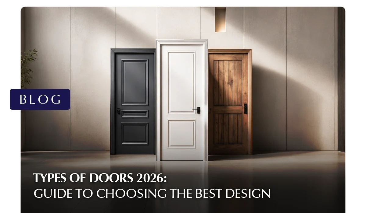
Choosing the right door is one of the most overlooked decisions in home design. Yet doors affect your security, energy efficiency, privacy, and curb appeal every single day. Whether you are building a new home, renovating, or simply replacing an old door, understanding the types of doors available in 2026 can save you time, money, and regret.
This guide walks you through every major category by material, design, operation, and room so you can make a confident, informed choice.
Why Knowing Your Types of Doors Matters
Most homeowners pick a door based on how it looks in a showroom. But the best door for your home depends on far more than aesthetics. Climate, room function, space constraints, security needs, and budget all play a role.
The market in 2026 offers more variety than ever before. From smart automated entry doors to eco-friendly WPC panels, the types of doors available today combine performance with style in ways that were not possible even five years ago. Understanding your options before you buy is the single best thing you can do.
Types of Doors by Room: A Quick Reference Guide
Room
Best Door Types
Key Reason
Main Entrance
Steel, Fiberglass, Solid Wood, Pivot
Security + durability
Bedroom
Panel, Flush, Barn Sliding
Privacy + aesthetics
Bathroom
uPVC, WPC, Pocket
Moisture resistance
Kitchen
Dutch, Sliding, Hinged
Ventilation + ease of use
Balcony
Sliding Glass, French, Bi-fold
View + airflow
Living Room
French, Glass, Pivot
Light + style
Closet / Wardrobe
Bypass Sliding, Bi-fold
Space-saving
Types of Doors by Material
Material is the foundation of any door’s performance. It determines durability, maintenance, insulation, and cost. Here are the most widely used materials across the different types of doors you will find today.
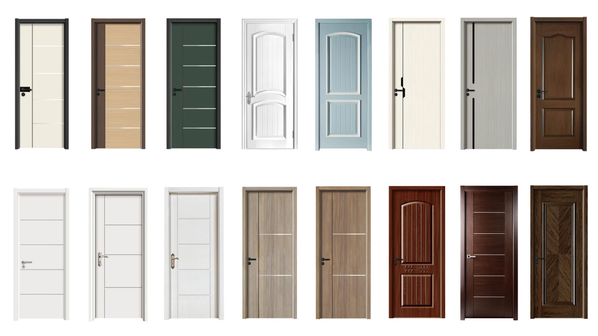
Wooden Doors
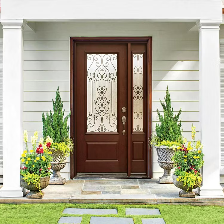
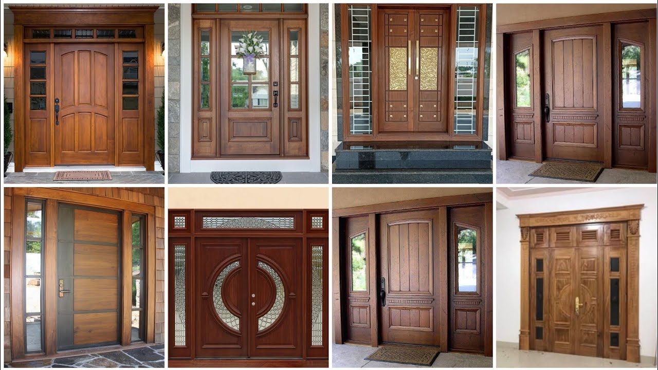
Wood remains the most popular material globally. Solid wood doors offer outstanding natural beauty, excellent insulation, and a timeless appeal that suits both traditional and contemporary homes. Engineered wood doors (made from plywood or MDF cores with veneer) are more affordable and resist warping better in humid climates.
Best for: Bedrooms, living rooms, main entrances in dry climates
Maintenance: Moderate, requires periodic sealing or painting
Steel and Metal Doors
Steel doors are among the strongest types of doors available for residential use. They resist forced entry, fire, and extreme weather. Modern steel doors are often insulated with a foam core, making them energy-efficient as well.
Best for: Main entrances, garages, security-sensitive areas
Maintenance: Low, occasional rust treatment in coastal areas
Glass Doors
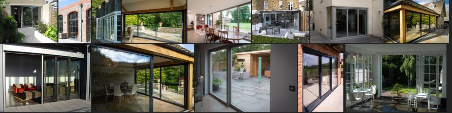
Glass doors flood interiors with natural light and create a seamless indoor-outdoor connection. Tempered or toughened glass is used for safety, while frosted or textured variants offer privacy without sacrificing light.
Best for: Balconies, living rooms, patios
Maintenance: Low, regular cleaning keeps them looking pristine
uPVC and PVC Doors
Source: Wishkarma Blog
Source: GreenFortune
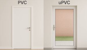
uPVC (unplasticized polyvinyl chloride) doors are weather-resistant, moisture-proof, and virtually maintenance-free. They are particularly well-suited to bathrooms, coastal homes, and high-humidity environments. PVC doors are the lighter, more budget-friendly variant used in interior applications.
Best for: Bathrooms, kitchens, coastal properties
Maintenance: Very low, wipe clean
WPC Doors (Wood Plastic Composite)
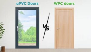
WPC is one of the fastest-growing materials in the 2026 door market. It combines the look of wood with the water and termite-resistance of plastic, making it ideal for tropical climates. It does not swell, crack, or warp.
Best for: Bathrooms, kitchens, any moisture-prone area
Maintenance: Very low
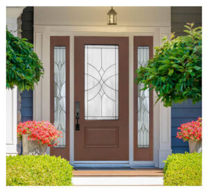
Fiberglass Doors
Source: DSA Doors
Source: Thompson Creek Window Company
Source: Steves Doors
Source: Made-in-China.com
Source: The Door & Window Centre
Source: Knockety
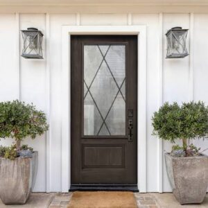
Fiberglass doors mimic the grain and texture of wood but require far less maintenance. They are highly durable, resist dents and scratches, and offer excellent thermal insulation.
Best for: Main entrances, exterior doors in harsh climates
Maintenance: Low
Types of Doors by Design and Style
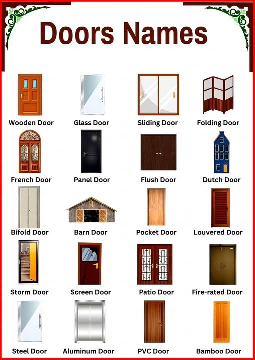
Once you have chosen a material, the design determines the visual personality of your space. These are the most commonly chosen design-based types of doors in modern homes.
Panel Doors
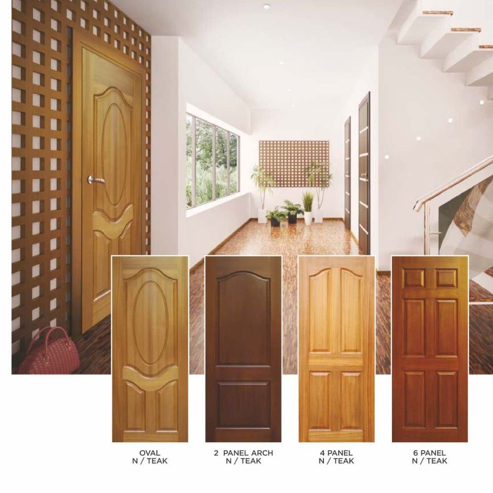
Panel doors feature a frame-and-panel construction with raised or recessed rectangular sections. They are traditional in appearance and available in 2-, 4-, 6-, or more-panel configurations. Panel doors work beautifully as both interior and exterior doors.
Flush Doors
Flush doors have a completely flat, smooth surface on both sides. They are the most common choice for bedrooms and offices because they are affordable, easy to paint or laminate, and available in a wide range of finishes.
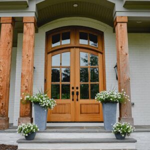
French Doors
Source: RealCraft
Source: ProVia
Source: Custom Iron Door
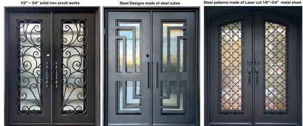
French doors consist of two door panels hinged on opposite sides, meeting in the middle. They typically feature glass panels running the full or partial length of the door. French doors add elegance and are ideal for connecting a living room to a balcony or garden.
Dutch Doors
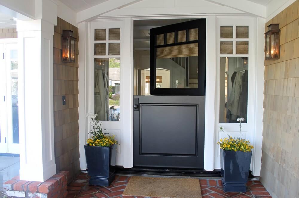
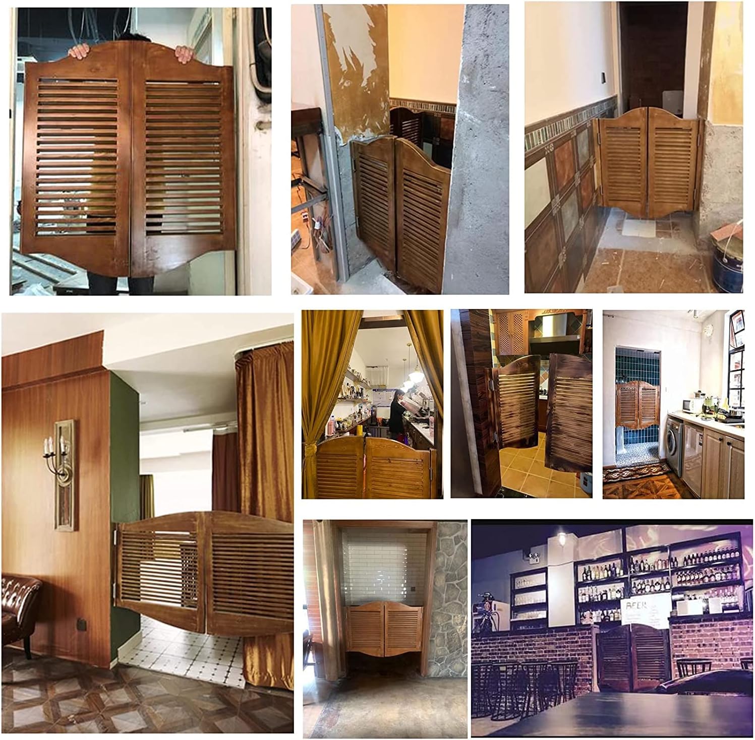
A Dutch door is split horizontally, allowing the top and bottom halves to open independently. They are charming, practical, and increasingly popular in kitchen and nursery applications where ventilation is needed without a fully open door.
Pivot Doors
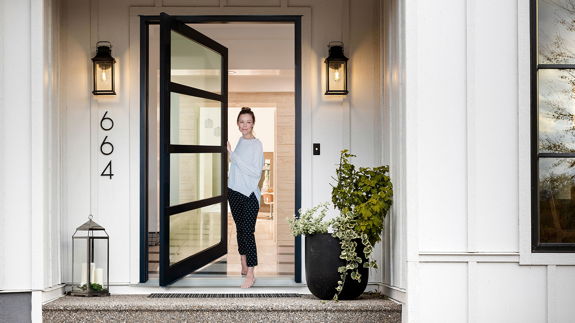
Pivot doors rotate on a top-and-bottom pivot point rather than side hinges. This allows for dramatically oversized door panels, sometimes floor-to-ceiling, making them one of the defining luxury design trends of 2026. They create a powerful architectural statement at any entrance.
Barn Doors
Source: Ark Design
Source: Luxury Screens
Source: Signature Hardware
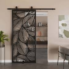
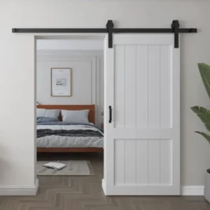
Barn doors slide along an exposed overhead track mounted on the wall. They are space-saving, visually striking, and popular in industrial and rustic-modern interiors. They work particularly well for bedroom closets and living room dividers.
Louvered Doors
Louvered doors feature horizontal slats angled to allow airflow while maintaining privacy. They are excellent for utility rooms, laundry areas, and wardrobes where ventilation matters.
Different Types of Sliding Doors
Sliding doors deserve special attention because they are among the most versatile and widely used types of doors for modern homes. Unlike hinged doors, they require no swing clearance, making them ideal for tight spaces and open-plan layouts.
Here are different types of sliding doors available in 2026:
Standard Sliding Glass Doors: Two panels where one slides behind the other. The classic choice for balconies and patios.
Multi-Slide / Stacking Doors: Multiple panels that stack neatly to one or both sides, opening up an entire wall. Ideal for connecting living spaces to outdoor areas.
Lift-and-Slide Doors: A premium German-engineered system where the panel lifts slightly off its seal and glides effortlessly. Exceptional insulation and smooth operation make these a 2026 favourite for luxury homes.
Pocket Doors: Panels that slide completely into a cavity within the wall. When open, they are invisible, perfect for bathrooms, small bedrooms, and anywhere you want to save every centimetre of space.
Bypass Doors: Two panels that slide past each other on parallel tracks, commonly used for wardrobe and closet openings.
Barn-Style Sliding Doors: Wall-mounted sliding doors with visible hardware, doubling as a design feature in modern and rustic interiors.
Types of Doors for Main Entrance
Your front door is the first impression your home makes. Among all the types of doors for main entrance, the right choice must balance security, durability, weather resistance, and curb appeal.
Here are the best options for a main entrance in 2026:
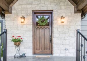
Solid Wood Entry Doors: Timeless, warm, and customizable. Best for dry climates and traditional home styles. Pair with a quality mortise lock for maximum security.
Steel Security Doors: The strongest choice for main entrances. Modern designs have moved well beyond the industrial look; steel doors now come in beautiful finishes and panel styles.
Fiberglass Entry Doors: The best of both worlds: the look of wood with the durability of synthetic material. Resistant to denting, warping, and harsh weather.
Double / French Entry Doors: Make a grand architectural statement. Best suited for larger entrances in independent homes and villas.
Pivot Entry Doors: The ultimate luxury entrance door in 2026. Oversized, dramatic, and unmistakably modern.
Smart / Automated Entry Doors: Increasingly mainstream in 2026, these integrate keypad, fingerprint, and smartphone access with motorized operation. Ideal for urban apartments and gated communities.
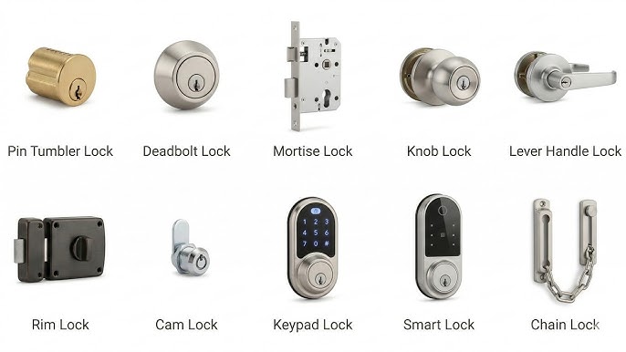
Different Types of Door Locks
No guide to types of doors is complete without covering security. The different types of door locks you choose are just as important as the door itself.
Deadbolt Locks: The gold standard for exterior door security. Single- or double-cylinder variants offer strong resistance to forced entry.
Mortise Locks: Installed within the door body, mortise locks are extremely secure and widely used on main entrance doors across South Asia.
Lever Handle Locks: Easy to operate and ADA-compliant, these are the most common choice for interior door locks.
Smart / Digital Locks: Keypad, fingerprint, RFID, and app-controlled locks are the fastest-growing lock category in 2026. Compatible with most door types and home automation systems.
Rim Latches Surface-mounted, simple, and affordable. Suitable for light security on interior doors.
How to Choose the Right Door: 6 Key Factors
With so many types of doors on the market, use these six factors to narrow down your choice:
Security: Exterior and main entrance doors need stronger materials and quality locks. Interior doors can prioritise style.
Climate: Humid or coastal areas demand moisture-resistant materials like WPC, uPVC, or fiberglass. Dry climates suit solid wood.
Space: Small rooms benefit from sliding or pocket doors that eliminate the need for swing clearance.
Budget: Flush and PVC doors are the most affordable. Pivot, lift-and-slide, and solid hardwood sit at the premium end.
Design Style: Match the door to your interior language. Minimalist homes suit flush or pivot; traditional homes suit panel or French doors.
Maintenance Willingness: If you want low upkeep, choose uPVC, WPC, or fiberglass. If you love the look of wood and do not mind periodic care, solid wood rewards you over time.
Door Trends to Watch in 2026
The types of doors gaining momentum this year reflect a broader shift toward smart living, sustainability, and bold architecture:
Lift-and-slide glass walls replacing traditional balcony doors in premium apartments
Pivot doors are becoming the signature entrance statement in architect-designed homes
WPC doors are gaining ground over solid wood as eco-conscious homeowners switch materials
Smart locks integrated at the factory level, with doors pre-wired for digital access
Hidden frame flush doors that blend seamlessly into walls, the invisible door trend
Frequently Asked Questions
Broadly, there are dozens of types of doors when classified by material, design, operation, and use. The most common categories include hinged, sliding, folding, and pivot doors across materials like wood, steel, glass, uPVC, and fiberglass.
Steel, fiberglass, and solid wood doors are the top choices for main entrances because of their strength, insulation, and durability. In 2026, pivot and smart entry doors are also gaining popularity.
uPVC and WPC are the best bathroom door materials because they are fully waterproof, termite-proof, and require almost zero maintenance.
A panel door has a framed construction with raised or recessed panels, giving it a decorative look. A flush door has a completely flat, smooth surface, simpler, more modern, and generally more affordable.
Final Thoughts
Understanding the full range of types of doors available to you is the first step toward making a smart purchase. Whether you are choosing a grand pivot door for your main entrance, a moisture-proof WPC door for your bathroom, or a sleek lift-and-slide glass door for your balcony, every choice shapes how your home looks, feels, and functions.
Dedicated and detail-oriented SEO Content Writer, Real Estate Writer, and Research Analyst based in Islamabad, with proven expertise in developing accurate, valuable, and well-researched content. Skilled in analytical writing, market research, and reporting, with the ability to turn insights into clear, professional, and impactful content. Passionate about exploring new ideas, analyzing industry trends, and contributing to high-quality writing and research-driven projects.
LAHORE: Punjab’s government has announced plans to create a unified revenue authority modelled on the Federal Board of Revenue, consolidating all provincial tax streams under a single institutional framework during the upcoming fiscal year.
Finance Minister Mian Mujtaba Shujaur Rehman disclosed the initiative at a post-budget press conference on Wednesday, citing strong performance in the outgoing fiscal year as grounds for the reform. The province met 99 percent of its tax collection target, prompting officials to raise the revenue goal for FY 2026-27 by 46 percent. Own-source revenues are projected to grow between 30 and 40 percent, a gain the minister attributed to curbing corruption within tax administration and broadening the provincial tax base.
Under the new targets, the Punjab Revenue Authority has been assigned a collection goal of Rs528 billion, while the Excise and Taxation Department will aim for Rs124 billion. Non-tax departments are expected to contribute Rs461 billion, with the Mines and Minerals Department emerging as the leading performer in that category.
Rehman noted that only modest revisions to existing tax rates were proposed for the coming year, given current economic conditions. He explained that a Rs546 billion grant to the federal government had reduced Punjab’s development budget from Rs1,240 billion to Rs752 billion, though officials maintained that no development priorities were compromised.
Addressing reporters’ questions, the minister confirmed that proposed amendments to the agricultural tax, unchanged since 1998, would apply only to landholdings exceeding 12.5 acres.
Senior Minister Marriyum Aurangzeb, also present at the briefing, rejected claims that southern Punjab or the agriculture sector were being neglected, pointing to rising acreage and crop output. She further clarified that reports of a Rs145 billion traffic-fine target were inaccurate, stating that the actual figure is Rs45 billion. Officials added that documentation for 493 new development schemes, including a laptop distribution programme, would be finalised by June 30.
Dedicated and detail-oriented SEO Content Writer, Real Estate Writer, and Research Analyst based in Islamabad, with proven expertise in developing accurate, valuable, and well-researched content. Skilled in analytical writing, market research, and reporting, with the ability to turn insights into clear, professional, and impactful content. Passionate about exploring new ideas, analyzing industry trends, and contributing to high-quality writing and research-driven projects.
ISLAMABAD: The Federal Board of Revenue (FBR) has introduced a digital solution designed to expedite the resolution of tax disputes and curb prolonged litigation through a technology-driven process. The initiative was formalised under a new provision in the Finance Bill 2026, which empowers the FBR to establish a digital system to generate settlement offers for registered taxpayers prior to the issuance of final assessment orders.
The mechanism is intended to facilitate early resolution of tax proceedings by giving taxpayers an opportunity to settle disputes through a transparent, automated framework rather than pursuing lengthy adjudication.
According to officials, the system-generated settlement offers will take into account several factors, including the stage of the proceedings, the taxpayer’s compliance history on record with the FBR, the nature of the identified discrepancy, and any other criteria the Board deems relevant.
Under the proposed framework, taxpayers who receive a settlement offer will have a ten-day window to accept it through the IRIS portal and deposit the specified settlement amount. Once payment is made, the issues raised in the relevant notice or audit report will stand abated, effectively closing those proceedings.
Commenting on the development, tax expert Arshad Shehzad said the mechanism has the potential to significantly reduce litigation, accelerate dispute resolution, and improve revenue collection by encouraging voluntary compliance.
He noted, however, that the framework could be further strengthened by introducing an additional layer of review, suggesting that a specialised committee be established to examine taxpayers’ responses and objections before assessments are finalised, to ensure greater fairness and equity in the process.
Shehzad described the initiative as part of broader efforts to modernise Pakistan’s tax administration through technology-driven reforms, reduce compliance costs for taxpayers, and enhance certainty in tax matters.
Dedicated and detail-oriented SEO Content Writer, Real Estate Writer, and Research Analyst based in Islamabad, with proven expertise in developing accurate, valuable, and well-researched content. Skilled in analytical writing, market research, and reporting, with the ability to turn insights into clear, professional, and impactful content. Passionate about exploring new ideas, analyzing industry trends, and contributing to high-quality writing and research-driven projects.