BBC-featured Content Specialist with a sharp eye for search intent and a proven ability to turn content into a growth engine. I leverage cutting-edge digital marketing tools to craft strategies that fuel organic traffic, amplify brand growth, and own the local SEO landscape, particularly across the competitive real estate market. I help brands dominate search rankings and convert visibility into measurable business success.
F-6 is one of the most popular dining hubs in Islamabad, packed with everything from cozy cafés to upscale steakhouses. Whether you’re craving BBQ, international cuisine, or a relaxed brunch spot, the variety of restaurants in F6 Islamabad makes it a go-to food destination. This guide helps you discover the best restaurants in F6 Markaz for every mood, taste, and budget.
List of Top Restaurants in F6 Islamabad
Restaurant
Address (as given)
Contact
Google Rating
Category (only if stated)
Social / Web Links (only if stated)
Taus Islamabad Premium
House of Turk, 3rd floor, Kingsely Plaza, F-6 Markaz, 24, F6 School Rd, Islamabad, 04403, 24 School Rd, F-6 Markaz F-6, Islamabad, 44220
1 Agha Khan Rd, F-6 Markaz F 6 Markaz F-6, Islamabad, 44220
0302 6333367
4.2 (1.5K)
Modern European restaurant
Not provided
Rumba – The Meat Factory
Roomy Signature, Block 7, Agha Khan Rd, F-6 Markaz F 6 Markaz F-6, Islamabad, 44000
(051) 8434755
4.2 (603)
Restaurant
instagram.com (Menu)
The Carnivore
Block – 07, Roomy Hotel Super Market, Markaz, F-6 Markaz F 6 Markaz F-6, Islamabad, 46000
0300 5326559
4.7 (5.4K)
Restaurant
thecarnivore.com.pk (Menu)
DAHLIA Islamabad (Nursery + Cafe)
1 Agha Khan Rd, F-6 Markaz F 6/3 F6, Islamabad, 25000
0327 5000969
4.0 (371)
Restaurant
Website (not specified)
El Momento Islamabad
Shop#06, Ground Floor f6, Beverly Centre, 1 Jinnah Ave, F 6/1 Blue Area, Islamabad, 44000
0311 1100317
4.4 (1.4K)
Steak house
elmomento.pk (Menu)
The Smokey Cauldron
near Pizza Hut, F-6 Markaz F 6 Markaz F-6, Islamabad
(051) 8430133
4.3 (3.6K)
Restaurant
Website (not specified)
Aanch
Block C, Super Market, F-6 Markaz F 6 Markaz F-6, Islamabad
(051) 2275999
4.5 (499)
Pakistani restaurant
aanch.pk (Menu & Reservations)
MêZ Islamabad Turkish Restaurant
Block 7, F-6 Markaz F 6 Markaz F-6, Islamabad
0342 0002982
4.2 (862)
Turkish restaurant
Not provided
Miso Asian Fusion
24 School Rd, F-6 Markaz F 6 Markaz F-6, Islamabad, 04403
0320 1116476
3.6 (389)
Restaurant
miso.pk (Menu)
Café Biblio
P3HF+5MX, 6 Street 6 Agha Khan Rd, next to CDA Facilitation Centre, F-6 Markaz F 6 Markaz F-6, Islamabad, 44000
0311 1145556
3.8 (744)
Restaurant
Not provided
District 6
Shop 7, Block C, F-6 Markaz F 6 Markaz F-6, Islamabad, 44000
0303 7776216
4.1 (1.2K)
Restaurant
Not provided
Bawa & Co – Parsi & South Asian Cuisine
Main Agha Khan Rd, next to KAF coffee shop, inside Roomy Hotel, F-6 Markaz F 6 Markaz F-6, Islamabad
Not provided
4.9 (52)
Restaurant
Not provided
Pamir Restaurant
Unit 6, Block C, Markaz, F-6 Markaz F 6 Markaz F-6, Islamabad, 44000
(051) 2600825
4.8 (30)
Restaurant
Not provided
Gai’a Japanese Fusion
Mount view plaza, Islamabad
0300 0453636
4.3 (228)
Japanese restaurant
gaia.com.pk (Menu)
Eggspectation Restaurant Cafe
P3PH+683, Street 10, F-6/3 F 6/3 F-6, Islamabad, 44000
0336 1113447
4.5 (2.9K)
Restaurant
eggspectation.pk (Menu)
Taus Islamabad Premium
A lively buffet-style restaurant popular for group dinners and celebrations, making it one of the best restaurants in Islamabad. Taus specialises in Pakistani and BBQ cuisine, offering a wide variety of grilled meats and traditional dishes. Its energetic atmosphere and generous serving style make it ideal for large gatherings and family outings.
Santorini Steak House By Bread Chef Café & Bakers
A well-known steak spot offering hearty grilled meals in a comfortable dine-in setting. The cuisine focuses on steaks, burgers, and Western-style grilled dishes. It’s a great choice for relaxed dinners with friends.
Adaab
A favourite for traditional desi meals served in a welcoming environment. Adaab’s cuisine revolves around Pakistani and North Indian dishes, including rich curries and BBQ. It’s especially popular among families looking for familiar, comforting flavours. Hence, its one of the best desi restaurants in Islamabad.
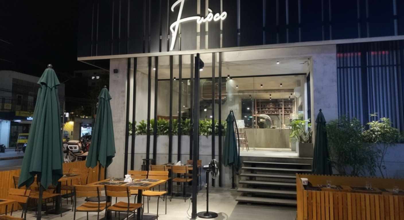
Fuoco
A stylish venue with a modern European vibe and elegant ambience. Fuoco serves European and Italian-inspired cuisine, with a focus on pastas, steaks, and gourmet mains. It’s a popular pick for special occasions.
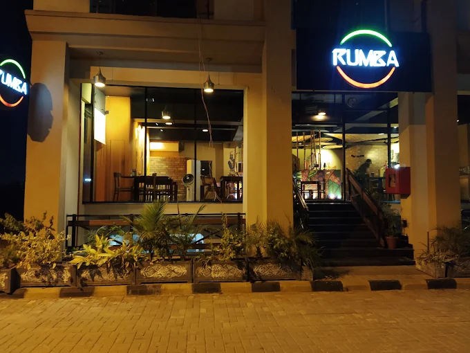
Rumba – The Meat Factory
A casual meat-focused restaurant offering a laid-back steakhouse feel. The cuisine highlights grilled meats, steaks, and hearty Western-style platters. It’s perfect for diners craving bold, smoky flavours.
The Carnivore
An upscale steakhouse known for premium cuts and a refined dining experience. The Carnivore specialises in meat-based cuisine, offering a variety of steaks and grilled selections. It’s a top destination for serious meat lovers and fine-dining fans.
DAHLIA Islamabad (Nursery + Cafe)
A café surrounded by greenery that provides a calm escape from city life. DAHLIA offers café-style continental cuisine, light meals, and beverages in a relaxed garden setting. It’s ideal for brunch, coffee meetups, and peaceful afternoons.
El Momento Islamabad
A fine-dining steakhouse offering an elegant atmosphere and premium service. The cuisine centres on steaks and continental dishes prepared in a refined style. It’s well-suited for celebrations, business dinners, and special nights out.
The Smokey Cauldron
A cozy café-style spot with warm interiors and a casual vibe. The menu leans toward continental and café cuisine, with a focus on comfort foods and grilled items. Popular with youngsters for relaxed hangouts and informal meals.
Aanch
A well-loved Pakistani restaurant serving rich traditional dishes in a lively setting. Aanch specialises in Pakistani and BBQ cuisine, known for its grilled meats and flavorful curries. Its vibrant ambience makes it a favourite for family dinners.
MêZ Islamabad Turkish Restaurant
A Turkish-themed dining spot in Islamabad bringing Middle Eastern flavours to the area. The cuisine focuses on Turkish and Mediterranean dishes, especially grilled meats and traditional specialities. Its décor and menu create a distinctive cultural dining experience.
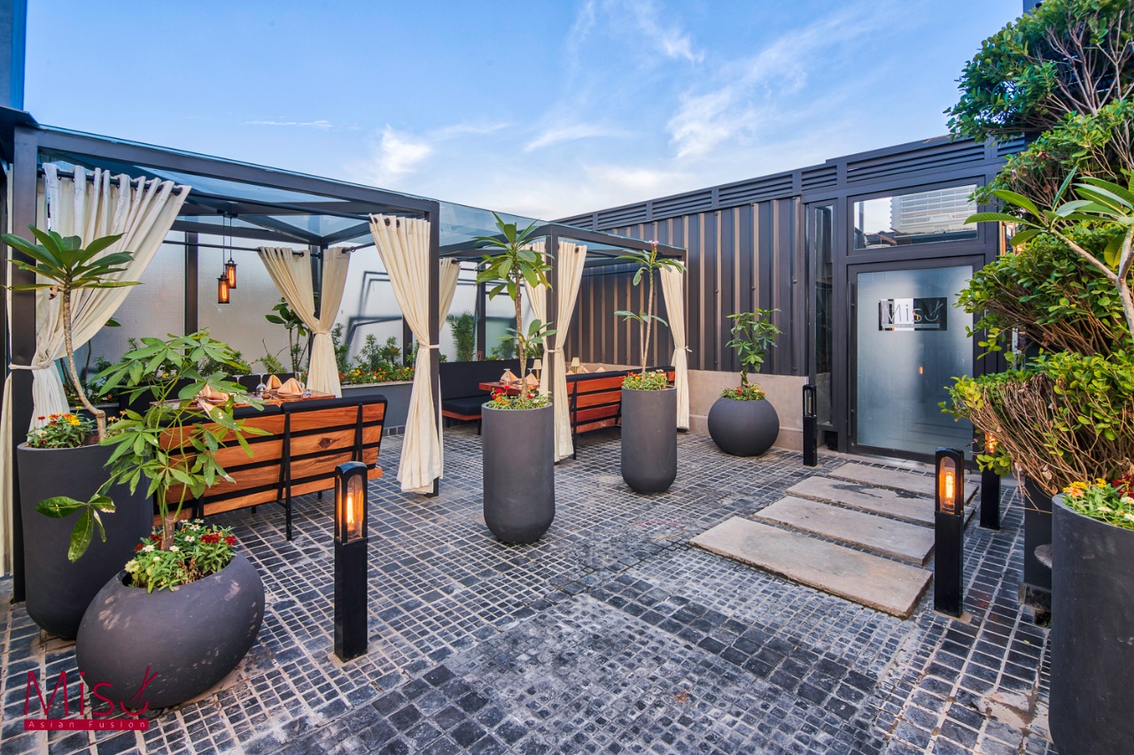
Miso Asian Fusion
A contemporary Asian dining venue in Islamabad offering a mix of flavours in a modern setting. Miso’s cuisine includes Asian fusion dishes, often blending East Asian influences in creative ways. It’s suitable for casual dinners and group outings. One of the best restaurants in f6 islamabad.
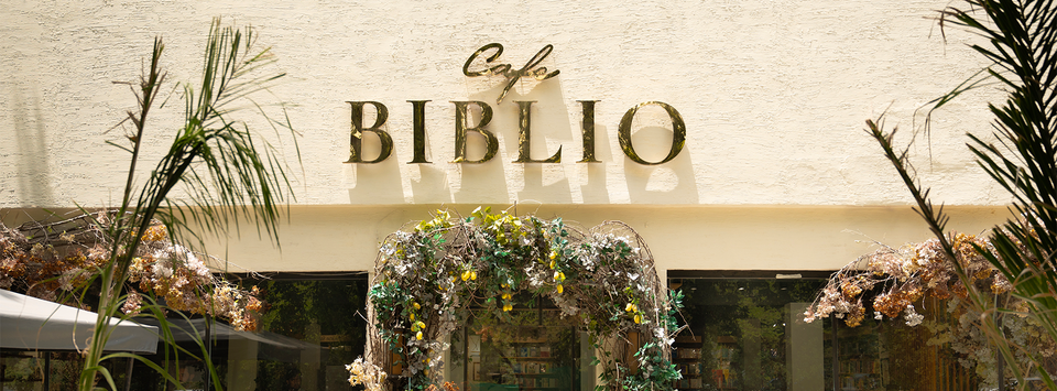
Café Biblio
A quiet café known for its relaxed and cozy atmosphere is one of the best restaurants in F6 Islamabad. The cuisine is café-style with light continental dishes, snacks, and beverages. It’s great for coffee meetups, reading sessions, or working in a calm environment.
District 6
A casual dining café offering comfort foods in a laid-back environment. The menu includes continental-style café dishes and quick bites. It’s a good stop for easy meals and informal meetups. Hence, making it the best among restaurants in F6 Islamabad.
Bawa & Co – Parsi & South Asian Cuisine
A unique restaurant serving distinctive regional flavours. Bawa & Co focuses on Parsi and South Asian cuisine, offering dishes not commonly found elsewhere. Its niche menu and cosy ambience set it apart from restaurants in F6 Islamabad.
Pamir Restaurant
A hidden gem offering regional flavours in a simple, welcoming setting. Pamir Restaurant specialises in Afghan and Central Asian cuisine, known for hearty, flavourful dishes. It’s a good option for trying something different from mainstream dining making it the best among restaurants in f6 islamabad.
Gai’a Japanese Fusion
A sleek Japanese fusion restaurant known for stylish presentation and a modern dining atmosphere. The cuisine blends Japanese flavours with contemporary techniques, often featuring sushi and fusion dishes. It’s popular among fans of Asian cuisine.
Eggspectation Restaurant Cafe
A vibrant all-day dining café loved for brunches and international-style meals. Eggspectation serves international and café-style cuisine, including breakfast, sandwiches, and comfort dishes. It’s a favourite for families and relaxed weekend outings, making it one of the best restaurants in f6 islamabad.
Conclusion | Restaurants in F6 Islamabad
From upscale steakhouses to cozy cafés and diverse international kitchens, F-6 truly stands out as one of Islamabad’s top dining destinations. Whether you’re planning a family dinner, a casual brunch, or a special night out, the variety of restaurants here means there’s something for every taste and budget. Exploring F-6 Markaz isn’t just about eating; it’s about experiencing the city’s vibrant and ever-evolving food culture.
BBC-featured Content Specialist with a sharp eye for search intent and a proven ability to turn content into a growth engine. I leverage cutting-edge digital marketing tools to craft strategies that fuel organic traffic, amplify brand growth, and own the local SEO landscape, particularly across the competitive real estate market. I help brands dominate search rankings and convert visibility into measurable business success.
ISLAMABAD: The Federal Board of Revenue (FBR) recorded a notable rise in tax collection during January, signalling renewed momentum in Pakistan’s revenue performance. The authority collected Rs1.031 trillion for the month, reflecting a 16 percent increase compared to the same period last year. Although the figure fell slightly short of the monthly target, it points to strengthening fiscal trends heading into the second half of the financial year.
Officials reported particularly strong gains in direct taxation, while indirect taxes showed moderate improvement. January’s income tax receipts posted an impressive 26 per cent year-on-year surge, indicating better enforcement and progress in resolving outstanding tax matters. Sales tax collection also grew by 12 per cent, supported by a rebound in large-scale manufacturing activity.
For the first seven months of FY26, total tax collection reached Rs7.176 trillion, representing an 11 per cent increase from the previous year, though still below the projected target. Shortfalls were largely linked to weaker domestic sales tax performance and earlier uncertainty surrounding the super tax. A recent court decision upholding the levy is expected to generate significant additional revenue, helping narrow the gap in the coming months.
Refund disbursements rose moderately during the period, reflecting improved processing and compliance mechanisms. Federal Excise Duty outperformed expectations, while income tax, sales tax, and customs duties all registered year-on-year growth despite missing individual targets.
FBR officials attribute the improved performance to ongoing structural reforms, expanded digital monitoring, and enhanced enforcement efforts that are broadening the tax base and encouraging voluntary compliance. With economic activity gradually picking up, authorities remain hopeful that sustained growth in manufacturing and trade will help the country move closer to achieving its full-year revenue objectives.
BBC-featured Content Specialist with a sharp eye for search intent and a proven ability to turn content into a growth engine. I leverage cutting-edge digital marketing tools to craft strategies that fuel organic traffic, amplify brand growth, and own the local SEO landscape, particularly across the competitive real estate market. I help brands dominate search rankings and convert visibility into measurable business success.
Global gold and silver markets experienced a sharp reversal after a historic price rally earlier this week, erasing roughly $3.4 trillion in market value as investors rushed to take profits and reduce exposure to volatile assets.
Precious metals had surged to unprecedented levels in recent sessions, with gold approaching around $5,600 per ounce and silver crossing above $120 per ounce, benchmarks rarely seen outside exceptional market conditions. However, a broad sell-off in major equities, particularly in U.S. technology and artificial intelligence sectors, dampened risk sentiment and triggered significant declines in commodity trading.
Gold prices fell sharply from their record peak, retreating by nearly $500 per ounce in recent trading. Silver also surrendered gains, sliding after reaching new highs that had drawn speculative interest from investors seeking safe-haven assets amid global uncertainty.
Analysts note that the steep drop highlights how rapidly prices can adjust after an intense surge driven by speculative inflows. Bullion markets, which saw unprecedented turnover and record trading volumes in the weeks leading up to the retreat, reacted sensitively to shifts in broader financial markets as traders recalibrated positions and exited volatile holdings.
Despite the recent pullback, longer-term factors such as geopolitical tensions, inflationary pressures, and ongoing central bank purchases continue to lend structural support to gold and silver. Still, the swift reversal serves as a reminder that even traditionally defensive assets can experience dramatic price swings when market sentiment shifts.
Investors are watching closely to see whether the latest correction signals a temporary pullback or the beginning of a wider recalibration in precious metals markets.
BBC-featured Content Specialist with a sharp eye for search intent and a proven ability to turn content into a growth engine. I leverage cutting-edge digital marketing tools to craft strategies that fuel organic traffic, amplify brand growth, and own the local SEO landscape, particularly across the competitive real estate market. I help brands dominate search rankings and convert visibility into measurable business success.
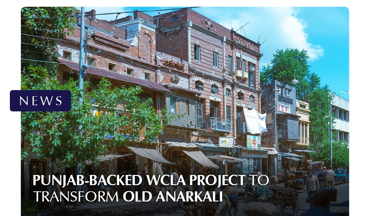
LAHORE: The Punjab government has directed the Walled City of Lahore Authority to begin a large-scale heritage restoration project in Old Anarkali. The initiative reflects a renewed focus on protecting Lahore’s historic identity. Officials describe it as one of the most significant conservation efforts in the area in recent years.
The project is estimated to cost Rs 1.097 billion. Work is expected to continue through December 2027. The restoration covers the historic stretch between Jain Temple and Lohari Gate, an area known for its architectural and cultural value.
The plan includes street resurfacing and improved pedestrian pathways. Modern underground electrical wiring will replace overhead cables. Street lighting will also be upgraded to improve safety and visual appeal. Authorities will introduce uniform shop signage to create a more organized streetscape. Directional signs will be installed to help visitors navigate the area.
Landscaping is another key component. Both hard and soft landscape features will be added to enhance the environment without disturbing the historic character. Selected building facades will undergo careful conservation to retain their original appearance.
A key part of the initiative focuses on the restoration of 71 building façades in both Old and New Anarkali, including 29 structures located within Old Anarkali. Prominent sites such as the Old Anarkali Food Street, Nashaman Building, and Bakhshi Market are also included in the conservation plans, highlighting the project’s emphasis on preserving well-known commercial and cultural landmarks.
Officials say the goal is to balance heritage preservation with modern urban needs. The project also aims to support tourism and local businesses. By improving infrastructure and restoring visual harmony, the government hopes to revive the historic charm of Old Anarkali.
The initiative forms part of broader provincial efforts to conserve heritage zones across Lahore while promoting sustainable urban development.
BBC-featured Content Specialist with a sharp eye for search intent and a proven ability to turn content into a growth engine. I leverage cutting-edge digital marketing tools to craft strategies that fuel organic traffic, amplify brand growth, and own the local SEO landscape, particularly across the competitive real estate market. I help brands dominate search rankings and convert visibility into measurable business success.
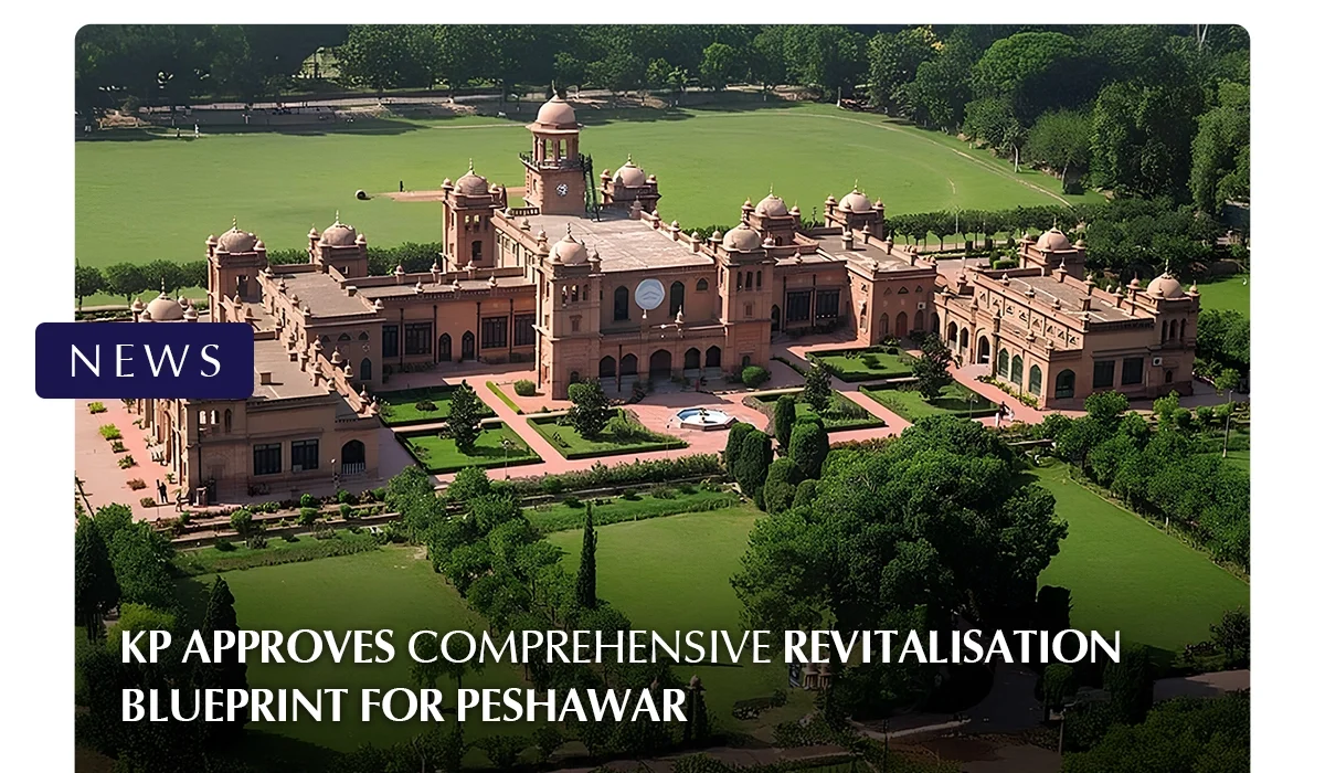
PESHAWAR: The Khyber Pakhtunkhwa government has granted initial approval to a wide-ranging urban revitalisation plan aimed at reshaping Peshawar into a more modern, livable, and well-connected city. The decision was made during a high-level review meeting chaired by the provincial chief minister, who directed departments to prioritise projects that are both technically sound and practically achievable.
The proposed plan spans multiple sectors and will be executed through coordinated efforts of key provincial departments and development authorities. A major focus will be on upgrading dozens of important city roads to improve traffic flow and accessibility. Authorities also intend to install underground electricity cabling along selected corridors to enhance safety and urban aesthetics.
To ease congestion, several underpasses are proposed at high-traffic intersections, alongside a new link road connecting the Hayatabad Industrial Estate with major surrounding routes. Urban beautification and recreation also form a central component of the initiative, with plans for theme parks, a modern children’s park, and new public landmarks designed to enhance community spaces.
Heritage preservation is included through proposed conservation work in the historic Walled City, while technical studies are being planned to guide improvements in public transportation. Infrastructure upgrades will extend to water supply, sanitation, irrigation channels, street lighting, and waste management systems. New municipal facilities, including slaughterhouses and sewerage treatment infrastructure, are also part of the blueprint.
The chief minister emphasised the timely completion of feasibility studies and planning documentation to prevent delays and ensure that development delivers visible improvements to residents. The revitalisation program is expected to significantly enhance Peshawar’s infrastructure, environmental conditions, and overall quality of urban life.
BBC-featured Content Specialist with a sharp eye for search intent and a proven ability to turn content into a growth engine. I leverage cutting-edge digital marketing tools to craft strategies that fuel organic traffic, amplify brand growth, and own the local SEO landscape, particularly across the competitive real estate market. I help brands dominate search rankings and convert visibility into measurable business success.
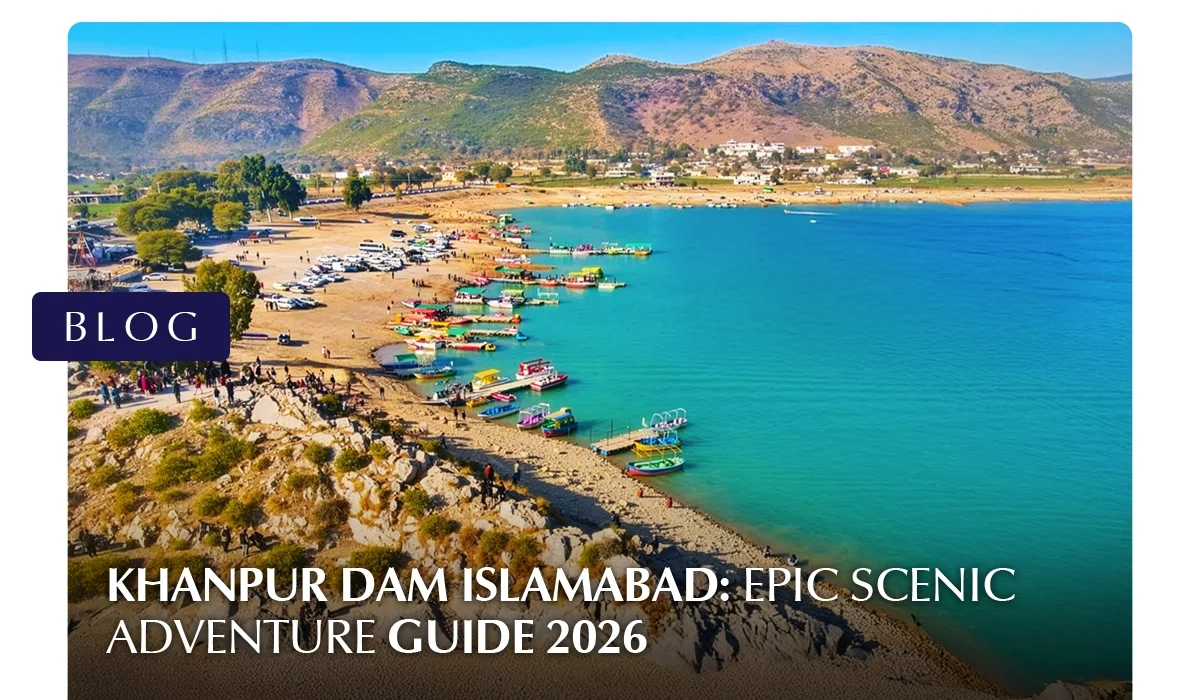
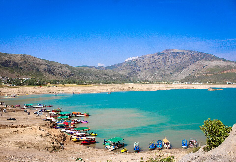
Khanpur Dam is one of the most exciting and scenic outdoor destinations near Islamabad. Known for its turquoise waters, rocky hills, and high-energy adventure scene, the dam has become a favourite spot for families, students, photographers, and thrill seekers alike.
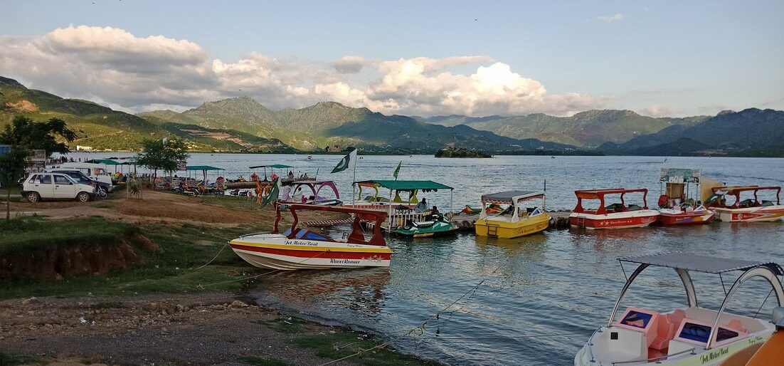
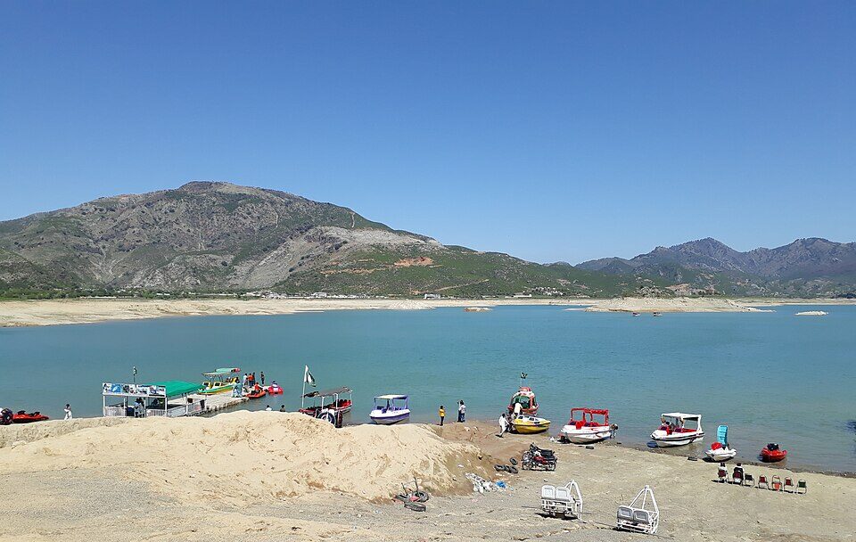
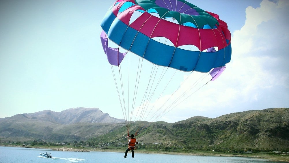
Beyond being a vital water reservoir, Khanpur Dam now offers water sports, paragliding, camping, hiking, and boating, making it a complete outdoor getaway within easy reach of the capital.
This guide covers Khanpur Dam location, distance, weather, resorts, viewpoints, spillway, water sports, and activities, everything you need to plan the perfect visit.
About Khanpur Dam
Khanpur Dam is a major water reservoir built on the Haro River in Khyber Pakhtunkhwa. While its primary function is to supply drinking water to Islamabad and Rawalpindi and support irrigation, its dramatic landscape has transformed it into a tourism hotspot in Islamabad.
Key Facts at a Glance
Feature
Detail
River
Haro River
Purpose
Water supply + Irrigation
Region
Near Khanpur, Khyber Pakhtunkhwa
Popular For
Tourism, water sports, adventure
Why It’s Famous Today
Crystal-blue lake surrounded by rugged hills
Wide range of adventure sports
Scenic picnic and photography locations
Easy day trip from Islamabad
The mix of natural beauty and outdoor recreation gives the Khanpur Dam Islamabad region a unique appeal.
Khanpur Dam Location and Distance
The Khanpur Dam location is near the town of Khanpur in Khyber Pakhtunkhwa, situated between Taxila and Haripur. The dam is built on the Haro River and lies within a rocky gorge surrounded by low hills, giving the area a dramatic and scenic landscape.
Although it is outside Islamabad’s city limits, the dam is close enough to serve as a convenient day-trip destination for residents of the capital and Rawalpindi.
Its position between historic Taxila and the green hills of Haripur also makes it a natural stop for travellers exploring northern Pakistan.
Khanpur Dam Distance from Major Cities
The dam’s accessibility is one of the reasons it is so popular. Travel times are manageable even for short weekend outings.
Route
Distance
Average Travel Time
Khanpur Dam distance from Islamabad
45–50 km
About 1 hour
Rawalpindi to Khanpur Dam
50–55 km
1–1.5 hours
Taxila to Khanpur Dam
20–25 km
30–40 minutes
Haripur to Khanpur Dam
35–40 km
45–60 minutes
Lahore to Khanpur Dam distance
300–320 km
5–6 hours
Travel times may increase during peak traffic hours or holiday weekends.
Best Routes to Reach Khanpur Dam
Visitors usually choose one of the following road routes:
From Islamabad / Rawalpindi:
Islamabad → Taxila → Khanpur Road
Islamabad → GT Road → Taxila → Khanpur
From the Haripur side:
Haripur → Khanpur Road
These routes are generally well-maintained, but some stretches near the dam become narrow and winding as you approach the hills.
Transport Options
Following are some of the transport options:
By Private Car
Driving is the most convenient option. It allows flexibility for stops at viewpoints and easy transport of picnic supplies or adventure gear.
By Ride-Hailing Services
Ride-hailing apps operate between Islamabad and Khanpur Dam. This is suitable for small groups but may be costlier for round trips.
By Tour Operators
Adventure clubs and tour companies often run:
Day trips from Islamabad
Group packages including water sports
Camping and paragliding tours
Parking and Arrival Area
Near the lakeside activity zones, visitors will find:
Open parking areas for cars and vans
Designated drop-off points for tour groups
Small stalls and adventure operator counters
On busy weekends, parking areas close to the water fill early, so arriving in the morning is recommended.
Travel Tips Based on Distance
Start early if travelling from Islamabad to avoid city traffic
Keep extra travel time during weekends or holidays
Ensure fuel tanks are sufficient, as fuel stations are limited near the dam
Use GPS navigation, but follow local signage near the final approach
Khanpur Dam Weather and Best Time to Visit
The experience at Khanpur Dam can vary greatly depending on the weather. Because most activities here are outdoors, including boating, water sports, hiking, and paragliding, choosing the right season and time of day can make a big difference.
Khanpur Dam Weather Overview
Khanpur Dam has a semi-arid climate with hot summers and mild winters. The surrounding rocky hills can intensify daytime heat, while evenings near the water often feel cooler due to lake breezes.
Season
Temperature Trend
Conditions
Spring (Mar–Apr)
Mild to warm
Clear skies, pleasant
Summer (May–Aug)
Hot
Sunny, strong sunlight
Monsoon (Jul–Sep)
Warm with rain
Occasional showers
Autumn (Oct–Nov)
Comfortable
Dry and clear
Winter (Dec–Feb)
Cool
Crisp air, sunny days
Best Time to Visit Khanpur Dam
Spring
Spring is considered one of the best times to visit. The weather is pleasant, the landscape looks fresh, and outdoor activities are comfortable throughout the day.
Best for:
Water sports
Hiking and sightseeing
Photography
Summer
Summer is peak season for water-based fun, though daytime temperatures can be high.
Tips for summer visits:
Plan water sports in the morning or late afternoon
Carry sun protection and plenty of water
Avoid rocky hikes during peak heat
Monsoon
The monsoon season brings occasional rain, making the scenery greener but also increasing the risk of slippery surfaces.
Keep in mind:
Water activities may be paused during heavy rain
Trails and rocks can be slippery
Always check the forecast before visiting
Autumn
Autumn offers comfortable weather and clear skies, making it another excellent time to visit.
Ideal for:
Paragliding
Picnics and family outings
Scenic drives and viewpoints
Winter
Winter days are cool but often sunny, making them suitable for relaxed outdoor trips.
Best for:
Hiking and nature walks
Photography
Quiet picnics
Water sports may be less popular due to cooler water temperatures.
Best Time of Day to Visit
Time of Day
Experience
Morning
Cool air, calm water, fewer crowds
Midday
Bright sunlight, peak for water sports
Late Afternoon
Pleasant breeze, good for sightseeing
Evening
Scenic sunsets, relaxing atmosphere
Mornings and evenings are the most comfortable, especially in summer.
Weather Tips for Visitors
Check the forecast before planning paragliding or boating
Wear breathable clothing in summer
Bring a light jacket in winter evenings
Use sunscreen and hats year-round
Stay hydrated, especially during hot months
Quick Planning Guide
Goal
Best Season
Best Time
Water sports
Spring, Summer
Morning / Late afternoon
Paragliding
Spring, Autumn
Late morning
Hiking
Autumn, Winter
Morning
Photography
Autumn, Winter
Sunrise / Sunset
Family picnic
Spring, Autumn
Afternoon
Khanpur Dam Activities and Things to Do
There is no shortage of Khanpur Dam activities for visitors of all ages.
Khanpur Dam Water Sports
The dam is widely known for its water adventure scene.
Popular water sports include:
Jet skiing
Speed boating
Banana boat rides
Wake tubing
Cliff diving (with guides)
These activities are operated by local adventure providers near the lakeshore.
Paragliding in Khanpur Dam
Paragliding at Khanpur Dam is a major highlight for thrill-seekers.
Khanpur Dam Paragliding offers:
Tandem flights with trained pilots
Panoramic views of the lake and hills
Unique photo and video opportunities
Flights operate depending on wind and weather conditions.
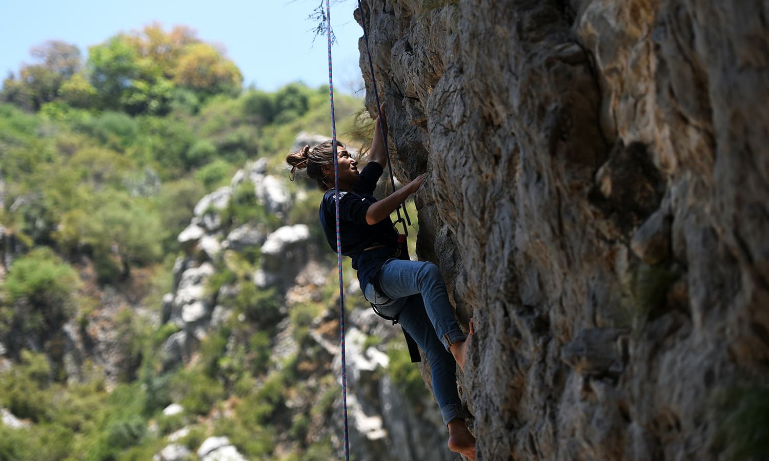
Land-Based Adventure Activities
Land adventures include:
Rock climbing
Rappelling
Hiking trails in the surrounding hills
Camping under the stars
These activities make the area popular for student trips and group outings.
Khanpur Dam Island and Viewpoints
One of the most visually striking aspects of Khanpur Dam is its combination of open water, rugged hills, and elevated vantage points. These natural features create excellent opportunities for sightseeing, photography, and peaceful moments away from the more crowded adventure zones.
Khanpur Dam Island
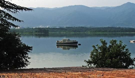
A small landmass commonly referred to as Khanpur Dam Island sits within the reservoir and is one of the lake’s most talked-about features. While not a developed island in the traditional sense, it appears like an isolated patch of land surrounded by deep blue water, making it a scenic highlight.
What Makes the Island Special
Surrounded by calm lake waters
Dramatic backdrop of rocky hills
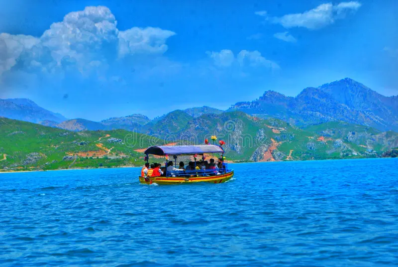
Popular stop during boat rides
Ideal for photography from a distance
Boat operators often take visitors near the island area, giving them a close-up view and a chance to capture panoramic photos of the reservoir.
Things to Know Before Visiting
Direct access to the island itself may not always be permitted
Conditions depend on water levels and operator policies
Always follow safety instructions during boat trips
Khanpur Dam Viewpoint Areas
The surrounding terrain offers several natural Khanpur Dam viewpoints where visitors can enjoy elevated views of the reservoir.
Common Viewpoint Locations
Hilltops along the approach road
Rocky ledges near adventure activity zones
Elevated roadside stops overlooking the lake
These spots allow visitors to see the full expanse of the water, the spillway area in the distance, and the surrounding landscape.
Best Times to Visit Viewpoints
Time
Why It’s Ideal
Early Morning
Soft light, calm surroundings
Late Afternoon
Cooler weather, clearer skies
Sunset
Golden reflections on the lake
Sunset is particularly popular because the changing light enhances the contrast between the blue water and the brown hills.
Photography Opportunities
The island and viewpoints are especially attractive to photographers.
Popular photo subjects include:
Wide landscape shots of the reservoir
Boats moving across the water
Reflections during sunset
Aerial-style views from higher ground
A zoom lens can help capture the island more clearly from a distance.
Why These Spots Are Worth Visiting
The Khanpur Dam Island and surrounding viewpoints offer a calmer, more scenic side of the destination. They balance out the high-energy water sports areas by providing space for:
Quiet reflection
Scenic walks
Photography
Enjoying nature’s scale and beauty
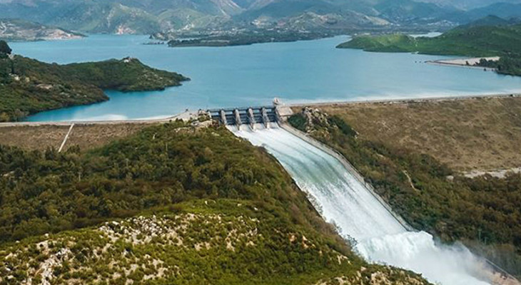
Khanpur Dam Spillway
The Khanpur Dam spillway is one of the most important structural features of the dam. While many visitors come for recreation and adventure, the spillway highlights the dam’s engineering and plays a vital role in water management and safety.
What is the Spillway?
A spillway is a controlled channel that allows excess water to flow out of a reservoir when water levels rise beyond safe limits. At Khanpur Dam, the spillway helps regulate the reservoir’s capacity and prevents overflow that could damage the structure or surrounding areas.
Viewing the Khanpur Dam Spillway
Direct access to the spillway is often restricted for safety reasons, but visitors may view it from:
Elevated viewpoints around the reservoir
Designated observation areas
Roadside vantage points at a safe distance
Always follow local guidelines and avoid entering restricted zones.
Photography Opportunities
The spillway becomes especially impressive when water is flowing at full force.
Ideal conditions for photos:
After heavy rainfall
Clear daylight for sharp contrast
From elevated viewpoints for a wide-angle shot
Long-exposure photography can capture the smooth motion of cascading water.
Khanpur Dam Resort and Hotels
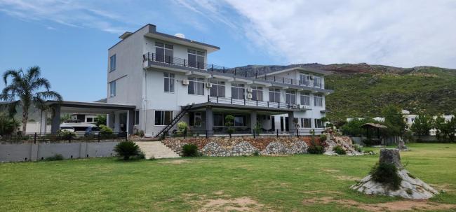
While many visitors explore Khanpur Dam as a day trip, staying overnight allows more time to enjoy the scenery, adventure activities, and peaceful atmosphere around the reservoir. Accommodation options range from basic guest houses to private resorts and organised camping experiences.
Khanpur Dam Resort Options
A few private facilities and lakeside setups operate near the dam, offering a resort-style experience for visitors who want comfort alongside adventure.
What Resorts Typically Offer
Rooms or huts with views of the lake or surrounding hills
On-site dining or BBQ arrangements
Activity packages including water sports or paragliding
Outdoor seating areas for relaxation
These resorts are often chosen by families, couples, and corporate groups looking for a short getaway close to nature.
Area
Type of Accommodation
Distance to Dam
Khanpur Town
Guest houses, small hotels
10–15 minutes
Taxila
Budget and mid-range hotels
30–40 minutes
Haripur
Hotels and lodges
45–60 minutes
Islamabad
Wide range of hotels
About 1 hour
Staying in Islamabad provides the most comfort and dining options, while staying closer to Khanpur allows earlier access to activities.
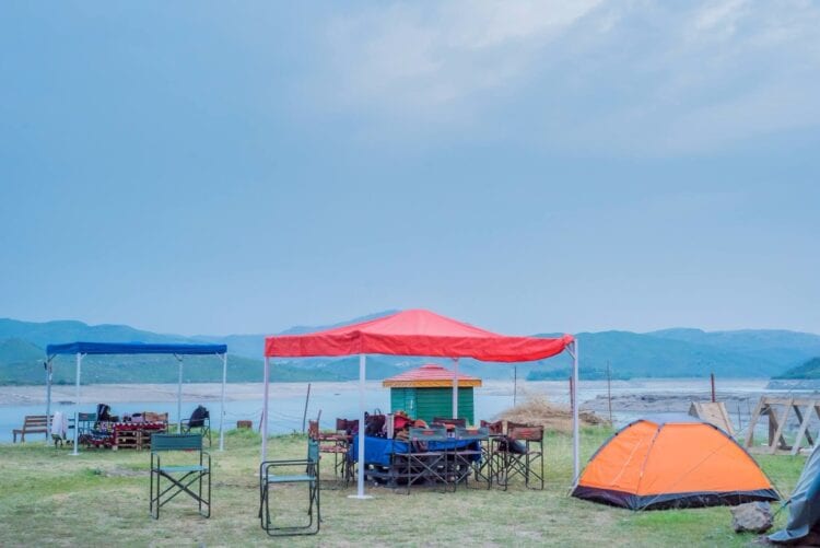
Camping Near Khanpur Dam
Camping is a popular alternative for adventure enthusiasts.
Camping Options Include
Organised camping trips by adventure clubs
Tented stays near designated safe areas
Group camping packages with meals and activities
Camping allows visitors to enjoy the night sky, early morning lake views, and a quieter environment after day tourists leave.
Travel Tips for Visiting Khanpur Dam
Safety Tips
Always wear life jackets during water sports
Choose certified operators
Avoid slippery rocks during the monsoon
Comfort Tips
Carry sunscreen and hats
Wear sturdy shoes
Bring extra water
Timing Tips
Arrive early on weekends
Avoid midday heat in summer
Check the weather before booking paragliding
Frequently Asked Questions
How far is Khanpur Dam from Islamabad?
The Khanpur Dam distance from Islamabad is about 45–50 km.
What activities are available at Khanpur Dam?
Visitors can enjoy water sports, paragliding, hiking, camping, boating, and photography.
Is paragliding available at Khanpur Dam?
Yes, Khanpur Dam Paragliding is a popular activity when weather conditions are suitable.
What is the best season to visit Khanpur Dam?
Spring and autumn provide the most comfortable weather.
Final Thoughts
Khanpur Dam offers a rare blend of natural beauty and high-energy adventure close to Islamabad. With its exciting water sports, scenic viewpoints, paragliding experiences, and relaxing picnic spots, it remains one of the top outdoor destinations in the region. Whether you’re looking for adrenaline or a peaceful lakeside escape, Khanpur Dam delivers both in one unforgettable setting.
BBC-featured Content Specialist with a sharp eye for search intent and a proven ability to turn content into a growth engine. I leverage cutting-edge digital marketing tools to craft strategies that fuel organic traffic, amplify brand growth, and own the local SEO landscape, particularly across the competitive real estate market. I help brands dominate search rankings and convert visibility into measurable business success.
ISLAMABAD: Pakistan and Russia have agreed on a target year of 2027 to begin reconstruction and expansion work on the long-inactive Pakistan Steel Mills (PSM). This timeline was outlined during a review session, where officials shared plans to move the stalled revival project toward implementation.
The next major milestone for the project will be the signing of a formal Engineering, Procurement and Construction (EPC) contract with the Russian side, after which physical work on the mill’s rehabilitation is expected to commence. An EPC agreement is being drafted to ensure the project’s financial viability and readiness for execution.
Progress toward the revival has been ongoing since late 2025, when Pakistan and Russia formalised cooperation through a protocol aimed at rehabilitating and modernising the steel complex. As part of preparatory efforts, a Russian engineering firm conducted a technical audit of the mill and evaluated its assets, which are currently estimated to have a book value of roughly Rs. 139 million.
During discussions, lawmakers also raised legacy issues related to past disputes, including disagreements over gas supply contracts with a former operating partner. The session also addressed the status of shareholdings at the mill: the majority stakeholder has divested most of his equity, while a remaining small share cannot be transferred without regulatory approval. Government authorities retain the right to seize these shares if contractual obligations remain unmet.
The agreed 2027 timeline reflects renewed cooperation between Pakistan and Russia to restart operations at Pakistan Steel Mills, which remains one of the country’s largest industrial assets and a key component of its heavy industry sector.
BBC-featured Content Specialist with a sharp eye for search intent and a proven ability to turn content into a growth engine. I leverage cutting-edge digital marketing tools to craft strategies that fuel organic traffic, amplify brand growth, and own the local SEO landscape, particularly across the competitive real estate market. I help brands dominate search rankings and convert visibility into measurable business success.
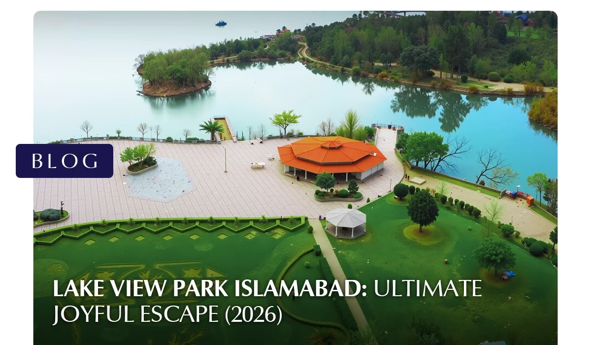
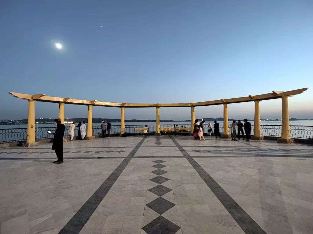
Lake View Park is one of Islamabad’s most popular tourist destinations in Islamabad, offering a mix of natural beauty, family entertainment, and adventure activities. Also known as Rawal Lake View Park, the park sits beside the scenic Rawal Lake and attracts families, tourists, and thrill-seekers year-round. From boating and bird watching to go-karting and amusement rides, the park delivers a full day of activities in one location. This guide covers everything visitors need to know, including Lake View Park timing, location, rides, ticket prices, and travel tips.
About Lake View Park, Islamabad
Lake View Park Islamabad is a CDA-managed recreational park designed as both a nature retreat and an entertainment hub. Its lakeside setting and wide range of activities make it suitable for visitors of all ages.
Key Highlights
Located on the banks of Rawal Lake
Also known as Rawal Lake View Park Islamabad
Hosts seasonal festivals and public events
Combines picnic areas, rides, and adventure zones
Home to a large walk-in bird aviary with hundreds of bird species
The park is divided into multiple sections, including the main park, F1 Traxx, Ibex Club, and Battlefield Islamabad.
Lake View Park Location and How to Reach
Find the details in the following sections:
Where is Lake View Park Located?
The Lake View Park location is along Murree Road near Malpur village, right on the edge of Rawal Lake in Islamabad. Its setting at the foothills of the Margalla range gives visitors a mix of waterfront scenery and green landscapes, making the journey itself part of the experience.
Because of its position between central Islamabad and the route toward Murree, the park is easy to reach from both Islamabad and Rawalpindi. It is far enough from dense city traffic to feel peaceful, yet close enough for a short drive from major residential and commercial areas.
Landmarks Near the Entrance
Visitors often recognise they are close to the park when they see:
Rawal Lake viewpoints and roadside scenic stops
Signboards for Lake View Park along Murree Road
The turn toward Malpur village just before the Barakahu area (when coming from Isthe lamabad side)
The park entrance is well marked, and security staff usually guide vehicles toward the designated parking zones.
Reaching Lake View Park by Car
Travelling by private car is the most convenient option.
Why driving is easy:
Direct access from Murree Road
Wide entry gates and organised parking
Suitable for family trips and group outings
Parking areas inside the park are spacious and can accommodate:
Cars
Vans
Buses for school trips or tour groups
During peak weekends, parking may fill quickly in the late afternoon, so earlier arrival is recommended.
Using Ride-Hailing Services and Taxis
Ride-hailing services are widely available in Islamabad and can drop visitors directly at the park entrance. This option is convenient for:
Tourists without personal transport
Students or small groups
Visitors staying in central Islamabad hotels
Return rides are generally available as well, though during busy hours you may experience short waiting times.
Public Transport Options
While there is no direct metro or train stop at the park entrance, visitors can still reach Lake View Park using a combination of public transport and short taxi rides.
Common approach:
Take a local bus or van heading toward Murree Road or Barakahu
From there, use a taxi or ride-hailing service for the remaining distance
This option is budget-friendly but may take longer compared to travelling by car.
Travel times can increase during rush hours, weekends, or public holidays.
Lake View Park Timing and Best Time to Visit
Find the details in the following subsections:
Best Time of Day for Travel
Traffic conditions can affect your journey, so planning ahead helps.
Recommended travel times:
Morning (before noon) for smoother roads
Early afternoon on weekdays for minimal congestion
Heavier traffic expected:
Weekend evenings
Public holidays
Late afternoon, when families head to the park
Navigation Tips
To avoid confusion on the way:
Use a GPS navigation app and search for Lake View Park, Islamabad
Follow Murree Road signs toward Rawal Lake
Look for official park signage as you approach the area
Official Lake View Park Timing
Lake View Park generally operates on a full-day schedule, allowing visitors to enjoy both daytime scenery and evening views of Rawal Lake.
Regular operating hours:
10:00 AM to 10:00 PM (Daily)
These hours apply on most days of the year, including weekends. However, during special events, public holidays, or peak tourist seasons, timings may be extended slightly, especially in the evening when the park becomes livelier.
Because individual rides and activity zones operate separately, some attractions may close earlier than the main park gates. It is a good idea to try major rides earlier in your visit.
Extra timing tip that helps on busy days: Many visitors prefer arriving right at opening time (around 10:00 AM) or visiting later in the evening (closer to closing) to avoid peak crowd pressure in the middle hours.
When Is the Park Least Crowded?
Crowd levels can greatly affect your experience, especially if you plan to enjoy Lake view park Islamabad rides or boating.
Quieter visiting times:
Weekday mornings
Early afternoons on non-holiday weekdays
Busiest periods:
Friday evenings
Saturdays and Sundays
Public holidays and school vacation periods
Arriving earlier in the day helps you avoid long queues and makes it easier to find good picnic spots, especially near the lakeside lawns.
Best Time of Day to Visit
Different times of day offer different experiences inside the park.
Morning (10:00 AM – 1:00 PM):
Cooler temperatures
Fewer crowds
Ideal for walking, photography, and bird watching
Afternoon (1:00 PM – 4:00 PM):
Suitable for indoor or shaded activities
Ride areas start getting busier
Evening (4:00 PM – 8:00 PM):
Most popular visiting time
Pleasant weather and lake breezes
Best time for family outings and social gatherings
Late Evening (After 8:00 PM):
Cooler and calmer atmosphere
Good for short walks and relaxing views before closing
Best Seasons to Visit Lake View Park
Islamabad’s changing seasons strongly influence the park experience.
Spring (March – April)
Spring is widely considered the best season to visit. Flowers bloom, the weather is mild, and the park’s gardens are at their most colourful. Outdoor activities and picnics are especially enjoyable.
Summer (May – August)
Summers can be hot during midday, but mornings and evenings remain pleasant. Visitors often prefer lakeside areas and shaded lawns during this season.
Monsoon (July – September)
Rain showers make the park greener and cooler, but pathways may become slippery. It is advisable to check the weather forecast before visiting.
Autumn (October – November)
Autumn offers clear skies, comfortable temperatures, and excellent conditions for photography and long walks.
Winter (December – February)
Winters are cool but usually sunny during the day. This season is ideal for peaceful picnics and bird watching, especially when migratory birds appear around the lake.
Special Events and Seasonal Attractions
The park often hosts events that can influence the best time to visit:
Flower exhibitions during spring
Public celebrations on national holidays
Seasonal festivals and cultural programs
These events create a festive atmosphere but also draw larger crowds. On event days, food stalls and vendors usually increase too, which adds to the overall experience.
Timing Tips for Different Visitors
Families with children
Visit in the morning or early evening
Start with rides before queues build up
Keep the kids’ play zones earlier in the plan so little ones don’t get tired before the fun starts
Couples and photographers
Late afternoon and sunset offer the most scenic lighting
Lakeside areas provide calm, picturesque settings
Adventure seekers
Arrive early to enjoy go-karting, paintball, or climbing without waiting
Quick Timing Overview
Factor
Recommendation
Opening Hours
10:00 AM – 10:00 PM
Quietest Time
Weekday mornings
Busiest Time
Weekend evenings
Best Season
Spring and Autumn
Best for Photography
Late afternoon and sunset
Lake View Park, Islamabad Rides and Attractions
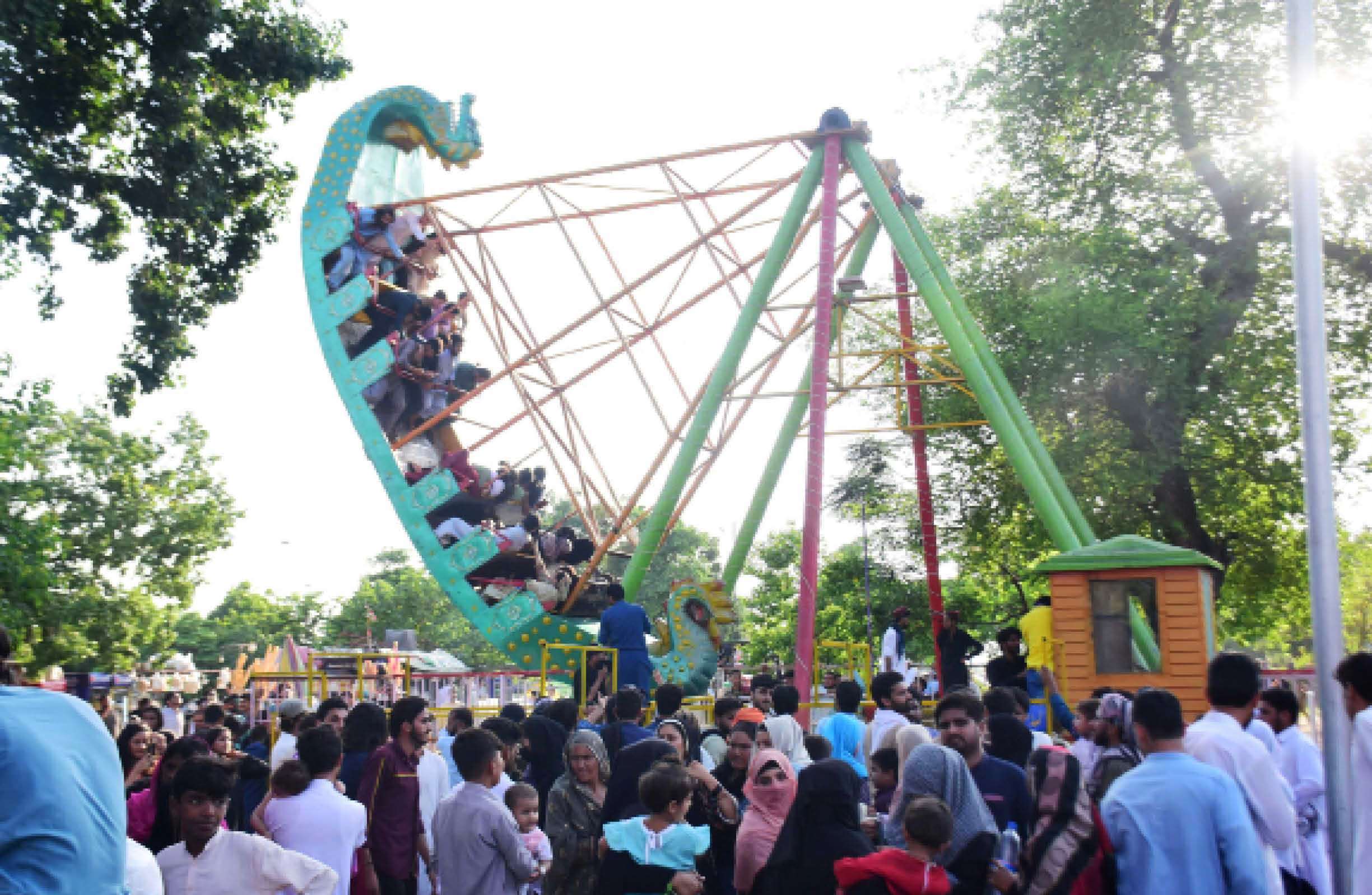
Lake View Park is not just a scenic picnic destination; it is also one of the capital’s most diverse outdoor entertainment hubs. The variety of rides and attractions at Lake View Park Islamabad, makes it a suitable amusement park in Islamabad for children, families, couples, and adventure seekers alike.
The park is divided into multiple activity zones, each offering a different type of experience, from gentle amusement rides to high-energy adventure sports and peaceful nature activities.
Family and Children’s Amusement Rides
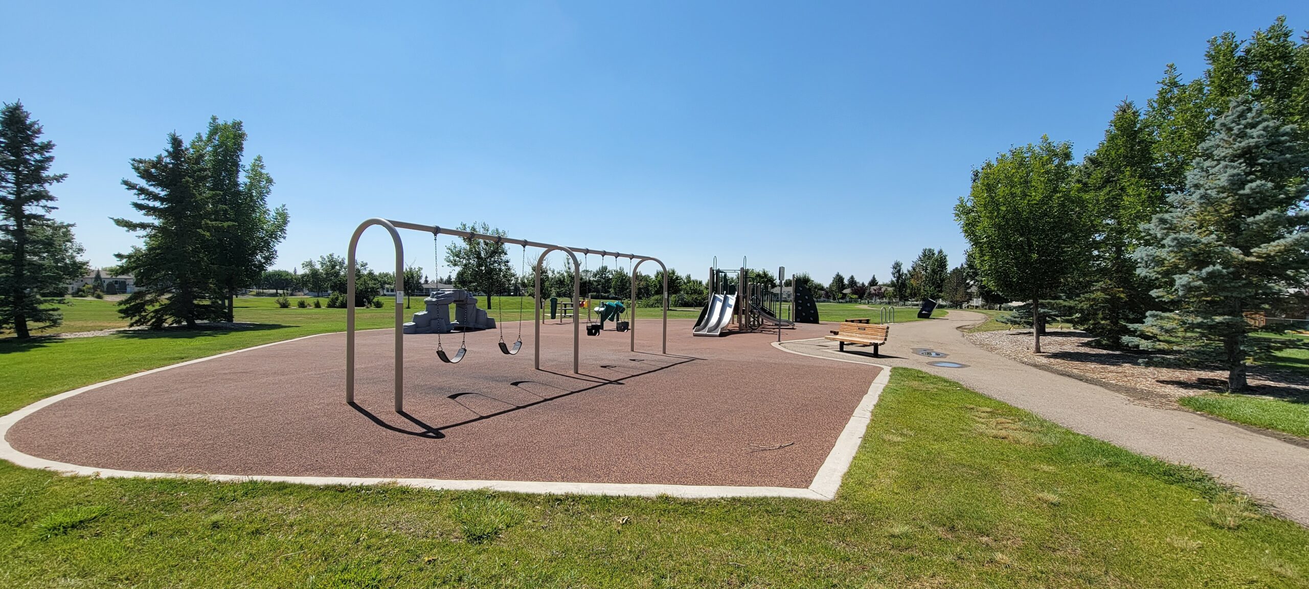
A large section of the park is dedicated to traditional amusement rides that appeal especially to children and families. These rides are designed to be fun, safe, and suitable for younger visitors.
Popular family-friendly rides include:
Carousel (merry-go-round)
Small mechanical rides for children
Bumper cars
Motion and simulator-style rides
Jumping castles and soft play areas
These attractions are usually located close together, allowing parents to supervise children easily while enjoying a relaxed environment.
Lake View Park Go Karting and Motor Sports
One of the most exciting highlights of the park is Lake View Park go-karting, which draws teenagers and adults looking for a racing-style thrill.
The go-karting track offers:
Fast-paced driving experience
Safe, supervised environment
Suitable options for beginners and casual drivers
In addition to karting, the park also features other motor-based attractions in designated zones, such as:
F1-style track experiences
Mini motor sports activities
Occasional motorsport-themed events
These areas are popular with groups of friends and older children seeking more energetic entertainment.
Adventure Activities and Outdoor Challenges
Beyond rides, Lake View Park also caters to visitors who enjoy physical and team-based activities.
Adventure attractions include:
Paintball at Battlefield Islamabad is ideal for group competitions
Rock climbing at the Ibex Club, offering a controlled climbing environment
ATV and quad bike rides for off-road-style excitement
These activities provide a more active alternative to traditional amusement rides and are particularly appealing to teens and young adults.
Bird Aviary and Wildlife Experience
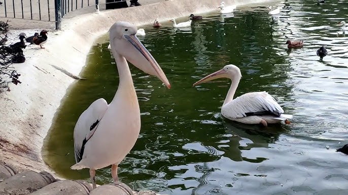
One of the park’s most unique features is its large walk-in bird aviary, often described as among the largest walk-in aviaries in the region. It spans a significant area and houses a wide variety of birds, making it one of the most visited sections of the park.
Visitors can:
Walk through enclosed aviary pathways
Observe colourful and exotic birds up close
Learn about different bird species
Enjoy a quieter, educational experience within the park
Additional wildlife touch: Besides birds, visitors may also see small animals in dedicated sections, which adds to the family-friendly “mini wildlife experience” feel; especially for children.
Lakeside Activities and Boating
Because the park is located next to Rawal Lake, water-based recreation is an important part of the overall experience.
When available, visitors may enjoy:
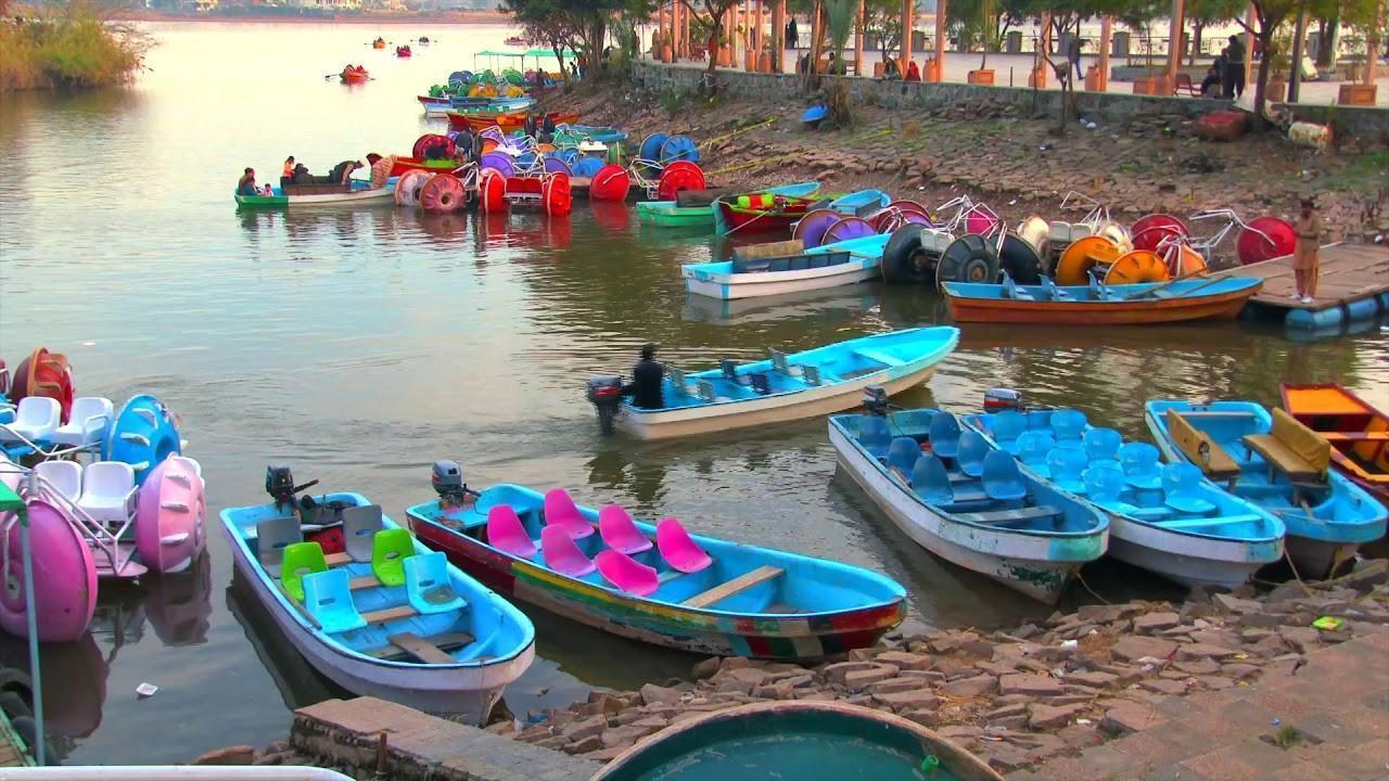
Pedal boats for a relaxed ride on the water
Motor boats for a faster experience
Occasional speedboat options
Boating offers scenic views of the lake and surrounding hills, making it a favourite activity during pleasant weather.
Horse Riding and Leisure Attractions
For a more traditional outdoor experience, the park also includes:
Horse riding areas where visitors can take short guided rides
Passenger road train rides that travel through different parts of the park
Golf carts are used for internal transport and easy exploration
These attractions are especially enjoyable for families and visitors who prefer slower-paced activities.
Nature Walks and Scenic Spots
Not all attractions involve rides or adventure. Many visitors come to Lake View Park simply to enjoy the natural setting.
Relaxing activities include:
Walking along tree-lined paths
Sitting by the lakeside for views and fresh air
Taking photographs of the Margalla foothills and Rawal Lake
Enjoying sunset views over the water
These quieter experiences balance out the more energetic parts of the park.
Summary of Ride and Attraction Types
Category
Examples
Children’s Rides
Carousel, small rides, jumping castles
Family Rides
Bumper cars, motion rides
Adventure
Go karting, paintball, rock climbing, ATV
Nature & Wildlife
Bird aviary, walking paths
Water Activities
Pedal boats, motor boats
Leisure
Horse riding, road train, scenic seating
Lake View Park Entry Fee and Ride Prices
Entry and activity costs are generally affordable, though prices may change over time.
Entry and Parking
Item
Approximate Cost
Adult Entry
Rs. 20–50
Child Entry
Rs. 10–50
Car Parking
Around Rs. 20
Popular Ride and Activity Prices
Activity
Estimated Price
Go Karting
Rs. 250
3D Motion Ride
Rs. 150
Bumper Car
Rs. 70
Boating (Half Round)
Rs. 100
Boating (Full Round)
Rs. 200
Horse Riding
Rs. 200–300
Bird Aviary Ticket
Adults Rs. 100 / Children Rs. 50
Washroom Use
Rs. 20
Prices may vary by operator and season.
Picnic Spots, Food, and Facilities
Lake View Park is widely known as one of Islamabad’s best outdoor picnic destinations. Beyond its rides and adventure zones, the park offers spacious lawns, lakeside seating, and practical facilities that make it comfortable for families and groups to spend several hours or even an entire day.
Picnic Areas and Relaxation Spaces
The park’s design includes multiple open and shaded areas where visitors can relax, spread out picnic mats, and enjoy time outdoors.
Popular picnic features include:
Large green lawns are suitable for family gatherings
Tree-shaded spots that provide relief during warmer months
Lakeside seating areas with scenic views
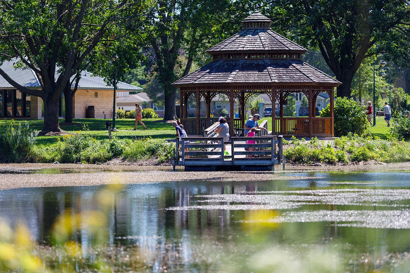
Gazebos and benches are placed throughout the park
These areas are especially busy on weekends and public holidays, when families arrive early to secure the best locations. Many visitors prefer spots near the lake for cooler breezes and better views.
Barbecue and Group Gathering Areas
For visitors planning longer outings, certain parts of the park are suitable for group meals and social gatherings.
You may find:
Designated BBQ-friendly zones
Open spaces for birthday parties or small celebrations
Areas where extended families can sit together comfortably
While cooking arrangements can vary, many families bring prepared food, snacks, and picnic baskets to enjoy outdoors.
Food and Refreshment Options
Lake View Park offers a variety of food options, making it easy for visitors to stay energised during their visit.
Common food and drink options include:
Tea stalls serving hot beverages
Cold drinks and bottled water
Snack counters offering chips, sweets, and light bites
Small cafes and seasonal food vendors
Street-style foods are often available during peak seasons and busy days. While choices may not be as extensive as a shopping mall food court, visitors can easily find refreshments throughout the park.
Bringing Your Own Food
Many visitors prefer to bring their own picnic items, which is generally acceptable within the park.
Typical picnic items families bring include:
Home-cooked meals
Sandwiches and snacks
Fruits and drinks
Picnic mats and small folding chairs
This flexibility makes the park especially popular for affordable family outings.
Visitor Facilities and Amenities
To support a comfortable experience, the park provides several basic facilities.
Available amenities include:
Restrooms are located in multiple sections of the park
Benches and seating areas near walking paths
Wide pedestrian pathways for easy movement
Trash bins are placed around the park to maintain cleanliness
During busy days, restrooms and seating areas may experience higher demand, so planning short breaks can help avoid queues.
Walking Paths and Landscaped Areas
The park is not just about sitting and eating. Its layout encourages visitors to explore.
Features include:
Paved walking tracks suitable for families and elderly visitors
Landscaped gardens with seasonal flowers
Open areas where children can play freely
These spaces make the park ideal for gentle exercise, casual strolls, and photography.
Event and Festival Areas
Lake View Park also includes open grounds that are occasionally used for public events.
These may host:
Flower exhibitions
Cultural programs
National day celebrations
Seasonal fairs and festivals
During such events, food stalls and entertainment options often increase, adding to the festive atmosphere.
Nearby Attractions to Explore
Several major Islamabad attractions are located near Rawal Lake View Park Islamabad.
These spots can be combined with a Lake View Park visit for a full day of sightseeing.
Visitor Tips for Lake View Park Islamabad
Planning ahead can make your visit smoother.
Practical Tips
Arrive early to avoid long ride queues
Carry cash for ride tickets and small vendors
Wear comfortable walking shoes
Supervise children near water and rides
Experience Tips
Visit during spring or autumn for the best weather
Weekdays offer a more relaxed environment
Sunset at Rawal Lake is a great time for photography
FAQs Lake View Park
What are Lake View Park timings?
The park usually operates from 10:00 AM to 10:00 PM daily, though hours may vary seasonally.
Is go karting available at Lake View Park?
Yes, Lake View Park go karting is one of the main adventure attractions.
How much is entry to Lake View Park Islamabad?
Entry is typically affordable, ranging from Rs. 20 to Rs. 50, depending on age and policy updates.
Can you go boating at Rawal Lake View Park?
Yes, boating options such as pedal and motor boats are often available, depending on conditions.
What can visitors do besides rides?
Visitors can enjoy picnics, bird watching, walking tracks, horse riding, and seasonal events.
Conclusion
Lake View Park is one of the best family parks in Islamabad, which offers a well-rounded outdoor experience that blends nature, adventure, and family entertainment. With its wide variety of rides, scenic lake views, and picnic facilities, it remains one of the top recreational spots in the capital. Whether you are planning a relaxed family picnic or an action-packed outing, Lake View Park in Islamabad provides something for everyone.
BBC-featured Content Specialist with a sharp eye for search intent and a proven ability to turn content into a growth engine. I leverage cutting-edge digital marketing tools to craft strategies that fuel organic traffic, amplify brand growth, and own the local SEO landscape, particularly across the competitive real estate market. I help brands dominate search rankings and convert visibility into measurable business success.
ISLAMABAD: The Capital Development Authority (CDA) has begun work on a new underpass at Margalla Enclave along Park Road in Islamabad, marking another step in its ongoing efforts to improve urban traffic infrastructure. The project is designed to ease congestion on one of the city’s busiest routes and enhance overall traffic movement for daily commuters.
To facilitate construction, the Islamabad Traffic Police (ITP) has implemented a comprehensive traffic diversion plan. Vehicles travelling from Rawal Dam Chowk toward Tramri will be redirected via NIH Road and Mohra Noor before rejoining Park Road beyond the construction zone. For traffic heading from Tramri toward Rawal Dam Chowk, a diversion has been established near Chai Khana, routing vehicles through the CDA Nursery area and back onto Park Road via temporary feeder roads.
Commuters are advised to use alternative routes such as Lehtrar Road, Khanna Pul, and the Islamabad Expressway where possible to avoid delays. Authorities have warned that the construction work is expected to cause significant traffic pressure, particularly during peak hours, and have recommended allowing an additional 20–30 minutes for travel.
Traffic police personnel will be stationed throughout the affected areas to assist motorists and manage orderly flow. Real-time updates and guidance are being provided to help drivers navigate the altered traffic patterns.
The new underpass project is part of the CDA’s broader strategy to modernise Islamabad’s road network and improve urban mobility. Once completed, it is expected to reduce congestion, shorten travel times, and support the city’s growing transportation needs, contributing to smoother and more efficient commuting for residents and visitors alike.
BBC-featured Content Specialist with a sharp eye for search intent and a proven ability to turn content into a growth engine. I leverage cutting-edge digital marketing tools to craft strategies that fuel organic traffic, amplify brand growth, and own the local SEO landscape, particularly across the competitive real estate market. I help brands dominate search rankings and convert visibility into measurable business success.
KARACHI: In a significant development, the price of 24-karat gold in Pakistan surged to Rs. 506,362 per tola, reaching an all-time high, following a sharp increase in international prices. Gold prices rose by $127 per ounce in global markets, reaching $4,840 per ounce, driven by geopolitical tensions, trade wars, and investment movements.
On Wednesday, the domestic gold price rose by Rs. 12,700 per tola, adding further pressure on buyers, especially during the peak wedding season. Investors, however, are showing optimism, with gold emerging as the leading asset in returns, outpacing stocks. As of January 1, gold prices have surged by Rs. 232,762 per tola, following a $2,216 per ounce rise in the international market.
Meanwhile, silver prices also saw a significant rise. The one-tola silver rate reached Rs. 9,933, up by Rs. 64 per ounce, while the 10-gram silver rate climbed to Rs. 8,515. Due to high demand, silver is now being sold at a premium, ranging between Rs. 13,500–14,000 per tola in local markets.
Despite high demand for both metals, gold remains in abundant supply in Pakistan, with investors leading market trends, while jewellery buyers appear less active. Market rates vary, with jewellery shops offering slightly lower prices than official rates, mainly influenced by demand and supply dynamics.
BBC-featured Content Specialist with a sharp eye for search intent and a proven ability to turn content into a growth engine. I leverage cutting-edge digital marketing tools to craft strategies that fuel organic traffic, amplify brand growth, and own the local SEO landscape, particularly across the competitive real estate market. I help brands dominate search rankings and convert visibility into measurable business success.