Dams are among the most consequential infrastructure projects a nation can undertake. At Chakor, our Dams section covers the development, progress, and impact of dam projects across Pakistan, from large-scale hydroelectric initiatives to water conservation efforts shaping the country’s future.
Stay informed on how these projects influence energy supply, agriculture, regional development, and investment opportunities in surrounding areas.
Pakistan is running out of water. Annual per capita water availability has fallen from over 5,000 cubic metres at independence to below 1,000 cubic metres today, pushing the country into the “water-scarce” category. Rainwater harvesting Pakistan offers one of the most practical, low-cost ways to slow this decline. It collects rain that would otherwise run off roofs, roads and open land, then stores it for reuse or sends it underground to recharge depleting aquifers.
This guide explains why rainwater harvesting Pakistan has become urgent, how the systems work, what government bodies are doing about it, and how households, builders and communities can take part.
Why Rainwater Harvesting in Pakistan Matters Right Now
Water scarcity in Pakistan is not a future risk. It is a present reality. The country now sits among the ten most water-stressed nations in the world. Groundwater tables are dropping in major cities, canal supplies are stretched thin, and more than half the population lacks access to safely managed drinking water.
A few numbers explain the scale of the problem:
Per capita water availability has dropped from around 5,260 cubic metres in 1951 to under 900 cubic metres today.
Pakistan can store only about 30 days of water nationally, far short of the 1,000-day buffer recommended for arid countries.
Roughly 90 percent of agricultural output depends on a single source, the Indus Basin Irrigation System.
Around 93 percent of available water goes to agriculture, leaving a thin margin for cities and households.
Rainwater harvesting Pakistan will not solve this crisis alone, but it reduces pressure on groundwater, cuts urban flooding, and gives households and buildings a backup source of water during dry months.
Climate Change in Pakistan and the Changing Rainfall Pattern
Climate change in Pakistan is making the water problem harder to manage, not easier. Rainfall has become more erratic. Long dry spells are now followed by short, intense monsoon bursts that overwhelm drains instead of soaking into the ground.
Experts from the International Water Management Institute have pointed to a rise in heatwaves and heavy precipitation events across South Asia linked to human-induced climate change, with Pakistan experiencing both extremes within the same year.
This swing between drought and flood is exactly the pattern rainwater harvesting in Pakistan is designed to manage. Storage tanks and recharge wells capture sudden heavy rain instead of letting it flood streets, then release that water slowly for use during the dry months that follow.
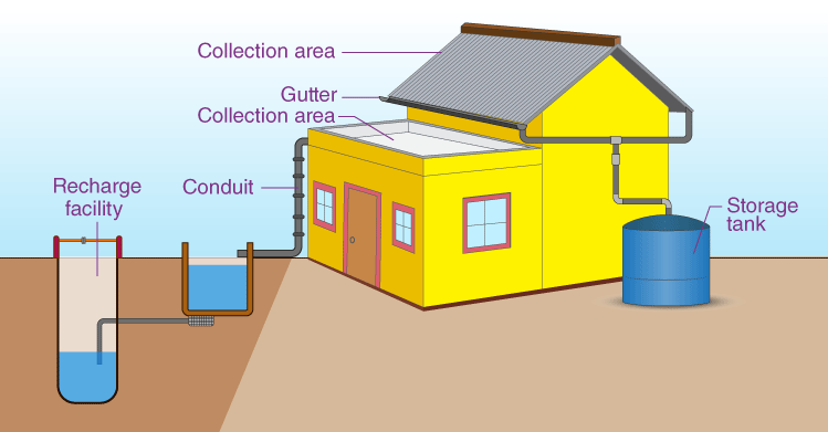
How Rainwater Harvesting Systems Work
A basic rainwater harvesting system follows a simple path:
Catchment – Rain lands on a roof, terrace, courtyard or paved surface.
Conveyance – Sloped surfaces and pipes direct the water toward a collection point.
Filtration – A first-flush diverter and filter screen remove dust, leaves and debris from the initial runoff.
Storage or recharge – Water is either stored in a tank for reuse or channeled into a recharge well or pit to replenish groundwater.
Stored rainwater is generally used for gardening, washing, cleaning, and flushing. It is not safe for drinking unless it passes through proper treatment and testing.
Storage Tanks vs Recharge Wells -Rainwater Harvesting Pakistan
System
Best suited for
What it does
Storage tank
Homes, farmhouses, offices
Collects water for direct household reuse
Recharge pit
Small plots, gardens, open land
Lets filtered water percolate into the soil
Recharge well
Large properties, mosques, apartment blocks
Sends filtered surplus water deep underground to recharge the aquifer
Most well-designed projects use a combination: a tank for everyday reuse and a recharge point for any overflow during heavy rain.
Rainwater Harvesting Pakistan in Practice: Cities and Deserts
Urban Recharge Wells in Islamabad and Lahore
The Capital Development Authority has made rooftop rainwater harvesting mandatory for new construction in Islamabad under its building bylaws.
The authority has also been installing groundwater recharge wells across the city, working alongside the Pakistan Council of Research in Water Resources (PCRWR).
At one recharge site in Islamabad, researchers recorded a rise in the water table of nearly five metres after monitoring rainfall between May and September.
In Lahore, the Water and Sanitation Agency has built underground water tanks in flood-prone neighbourhoods. One such tank, built at a cost of Rs. 140 million, can hold 1.4 million gallons of rainwater drawn from a 30-acre catchment area.
The collected water is later used to irrigate public parks and green belts, easing pressure on piped supply while also reducing urban flooding.
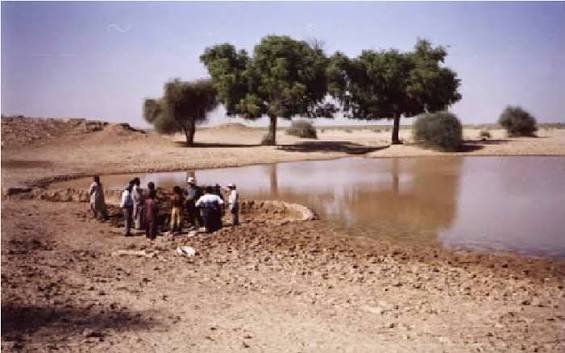
Rainwater Harvesting in the Cholistan Desert
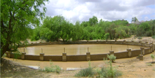
Rainwater harvesting Pakistan also plays a critical role far from major cities. In the Cholistan desert, rainfall is the only realistic water source for nomadic communities and their livestock. PCRWR has built a network of over 110 reservoirs across 26,000 square kilometers of desert, with a combined storage capacity of 440 million gallons.
This network, paired with newly drilled tubewells, has cut seasonal migration and saved an estimated Rs. 6 billion a year in losses linked to livestock movement and water shortages.
Benefits of Rainwater Harvesting Pakistan
Reduces dependence on groundwater, slowing the decline of water tables in over-extracted areas.
Lowers urban flood risk by capturing runoff before it overwhelms drains and roads.
Provides a backup water source for gardening, cleaning, and non-drinking household use during dry spells.
Supports agriculture and livestock in arid and desert regions where canal water never reaches.
Improves long-term building resilience, especially in cities where municipal supply is already intermittent.
Common Mistakes That Cause Rainwater Harvesting Pakistan Systems to Fail
Rainwater harvesting projects in Pakistan often fail for avoidable reasons:
Sending unfiltered roof water directly into a recharge well, which pushes silt and pollutants into the aquifer.
Undersized overflow pipes that cannot handle monsoon-level rainfall.
Tanks and filter chambers buried under finished paving with no access for cleaning.
Using one generic design across very different properties, rather than sizing the system to the actual roof area, rainfall pattern, and household need.
A system built without proper filtration and maintenance access may look fine in its first year and then fail during the next serious monsoon.
Not without treatment. Most systems are designed for gardening, washing, cleaning, and flushing rather than direct drinking use.
What causes water scarcity in Pakistan?
Rapid population growth, heavy reliance on a single river system, limited water storage infrastructure, and increasingly erratic rainfall linked to climate change in Pakistan have combined to push per capita water availability below internationally recognised scarcity thresholds.
Does rainwater harvesting Pakistan help with urban flooding?
Yes. Storing and redirecting heavy rainfall through tanks and recharge wells reduces the volume of runoff that would otherwise overwhelm city drains.
Final Word
Rainwater harvesting in Pakistan sits at the intersection of two growing problems: worsening water scarcity in Pakistan and the unpredictable rainfall brought on by climate change in Pakistan. Government-led projects in Islamabad, Lahore and the Cholistan desert show that the approach works at very different scales, from a single rooftop system to a desert-wide reservoir network. For households, builders and communities alike, treating rainwater as a resource rather than a runoff problem is one of the most direct ways to respond to Pakistan’s deepening water crisis.
BBC-featured Content Specialist with a sharp eye for search intent and a proven ability to turn content into a growth engine. I leverage cutting-edge digital marketing tools to craft strategies that fuel organic traffic, amplify brand growth, and own the local SEO landscape, particularly across the competitive real estate market. I help brands dominate search rankings and convert visibility into measurable business success.
Water shortage is a real problem in most cities today. Borewells run dry. Water bills keep rising. Groundwater levels keep falling. A rainwater harvesting system offers a simple, low-cost fix. It collects rain that would otherwise run off your roof or yard and turns it into a usable water source for drinking, irrigation, flushing, or simply topping up the ground beneath your feet.
This guide covers everything about a rainwater harvesting system: what it is, how it works, its components, methods, benefits, cost, water quality standards, and the rules that apply in Pakistan. By the end, you will know exactly how to plan one for your home, office, or institution.
What Is a Rainwater Harvesting System?
According to Encyclopaedia Britannica, a rainwater harvesting system is a technology that collects and stores rainwater for human use. Systems range from simple rain barrels to elaborate structures with pumps, tanks, and purification units. The stored water can irrigate landscaping, flush toilets, launder clothes, or even be purified for drinking.
Instead of letting rain run into the street or drain away, a rainwater harvesting system directs it through gutters and pipes into a storage tank or into the ground. Researchers describe every rainwater harvesting system (RWHS) as sharing four core parts: a catchment area, gutters, pipes, and a storage system. Everything else- filters, pumps, recharge wells, treatment units- builds on that basic four-part foundation.
The idea itself is old. People have collected rainwater for thousands of years. Ancient cisterns dating back to 2500 BC have been found in the Middle East, and rainwater harvesting for irrigation dates back to roughly 4500 BC in southern Mesopotamia. Roman cities used rooftop channels and aqueducts long before modern gutters existed.
Farming communities in Balochistan practiced rainwater harvesting around 300 BC. The method has simply been refined with better tanks, filters, and monitoring tools, and in some university research projects today, even Building Information Modeling (BIM) and augmented reality.
Why a Rainwater Harvesting System Matters Right Now
Water stress is no longer a distant concern. Reports cited by industry sources suggest more than half the world’s population will be living in water-stressed regions by 2050.
Pakistan is a clear example. According to Abamet Pakistan, an environmental engineering firm, Pakistan is technically a “water-stressed” country rather than a “water-scarce” one, but it wastes nearly 10 trillion gallons of water every year due to poor conservation.
A rainwater harvesting system is one of the most direct ways to close that gap, because it captures free water at the exact point where it is needed most.
In Semarang, Indonesia, a city badly affected by climate-driven flooding and drought, a rainwater harvesting system built into public schools now channels collected water into daily use and groundwater recharge, directly benefiting more than 20,500 people.
This shows how a single, simple technology can serve two opposite climate problems at once: it eases drought by storing water, and it eases flooding by capturing runoff before it overwhelms drains.
How Does a Rainwater Harvesting System Work?
A rainwater harvesting system works in four simple stages: catchment, conveyance, filtration, and storage or recharge.
Catchment: Rain falls on a roof, terrace, or paved surface. This surface is called the catchment area.
Conveyance: Gutters and downpipes carry the water from the roof to the storage point.
Filtration: Before the water reaches the tank, it passes through a first-flush diverter and a filter. This removes dust, leaves, and bird droppings.
Storage or recharge: Clean water is stored in a tank for reuse, or it is directed into a recharge well or pit so it seeps into the ground and refills the water table.
Gravity does most of the work in a well-designed rainwater harvesting system. Pumps are only needed when water must move uphill, into upper floors, or through pressurised taps.
Methods of Rainwater Harvesting
There are two broad methods used in any rainwater harvesting system, and within each, two purpose-based categories worth knowing.
1. Rooftop Rainwater Harvesting
This is the most common method for homes, apartments, schools, and offices. Rain falling on the roof is captured through gutters and either stored in a tank or directed to a recharge well.
Roof runoff is generally of higher quality than surface runoff and can often be used with only basic treatment. It is simple, affordable, and works well for houses, mosques, factories, hotels, and multi-storey buildings.
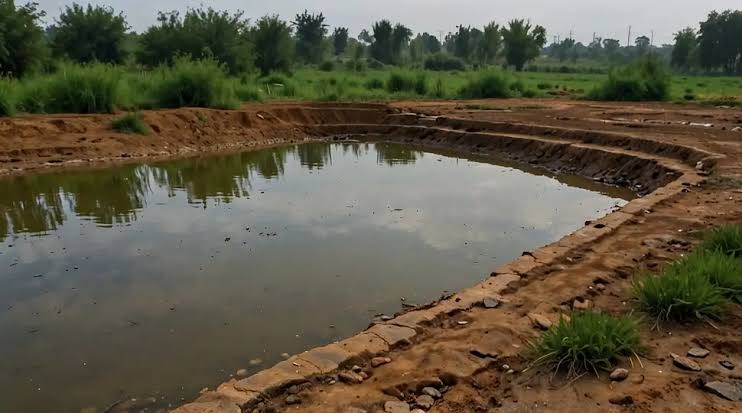
2. Surface Runoff Harvesting
This method collects rainwater flowing across the ground, such as from a courtyard, driveway, or open plot. The runoff is channelled into a storage tank or recharge pit below ground level.
It works well for larger plots and is often used alongside rooftop systems to capture every drop of rain falling on a property, while also cutting soil erosion, water pollution, and street flooding.
Domestic vs. Agricultural Rainwater Harvesting
Beyond catchment type, rainwater harvesting is also split by purpose. Domestic rainwater harvesting (DRWH) serves household needs: drinking, washing, gardening, and flushing.
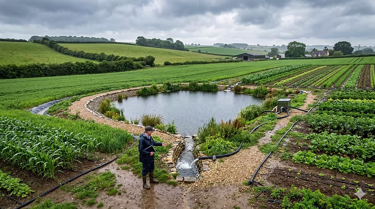
Agricultural and livestock rainwater harvesting (ARWH) serves larger-scale needs through pans, hafir dams, birkads, check dams, sand dams, and agricultural bunds, structures built to trap surface runoff for crops, livestock, and groundwater recharge in arid and semi-arid regions.
Both approaches share the same underlying goal: intercept rain before it is lost, and put it to productive use.
Key Components of a Rainwater Harvesting System
Every rainwater harvesting system, small or large, domestic or industrial, is built from a similar set of parts.
Catchment surface: Usually a roof, terrace, or courtyard. Roofing material affects water quality. Metal sheets and glazed tiles perform well; thatched roofs discolour the water and lower quality.
Coarse mesh: A screen at the roof or tank inlet that prevents leaves and large debris from entering the system.
Gutters: Channels fixed along the roof edge that collect rain and guide it toward a downpipe. Gutters should be sized 10–15% larger than the expected peak flow so they do not overflow, and given a gentle slope of about 10 mm fall per metre to avoid standing water.
Downpipes (conduits): Pipes, usually PVC or galvanised iron, that carry water from the gutter down to ground level. Pipe diameter should match rainfall intensity and roof area; a larger, high-intensity roof needs a wider downpipe to avoid backflow during heavy storms.
First-flush diverter: A valve that discards the initial rainfall, which carries the most dust, pollen, and pollutants washed off a dry roof.
Filter: A chamber filled with sand, gravel, charcoal, or fine mesh that removes suspended particles before water enters the tank. Filter designs range from simple household charcoal and sand filters to advanced multi-chamber units like the Dewas filter, the VARUN drum filter, horizontal roughing and slow sand filters (HRF/SSF), and compact potable-conversion units such as the RainPC, which combines screening, flocculation, and membrane filtration to bring rainwater up to WHO drinking-water standards.
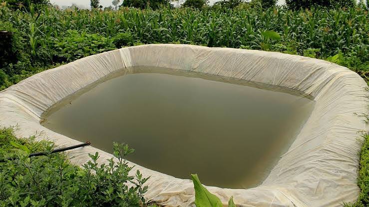
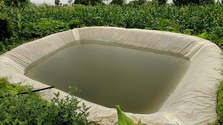
Storage tank: Can be built above ground, underground, or partly buried. Common materials include reinforced concrete, ferrocement, masonry, HDPE plastic, fibreglass, and galvanised steel. Tank scale varies enormously, from small garden water butts of a few hundred litres to large underground commercial tanks holding well over 100,000 litres.
Overflow pipe: Directs excess water away safely once the tank is full, so it does not flood the roof, driveway, or a building’s boundary wall.
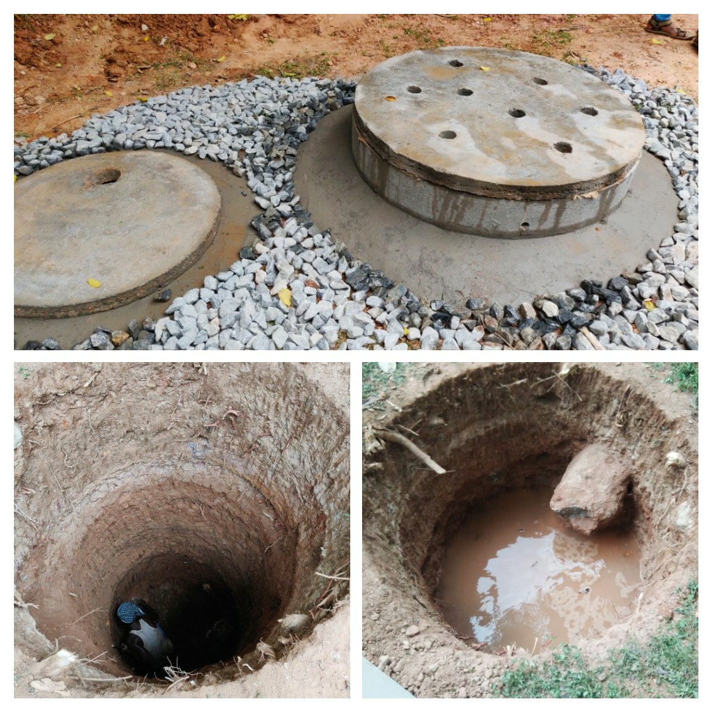
Recharge structures: Where storage is not the only goal, surplus filtered water can be sent into recharge wells, recharge pits, recharge trenches, recharge troughs, or modified injection wells, all designed to let water percolate into the ground and restore the local aquifer rather than run to waste.
Pump and controls (optional): Used when water needs to reach upper floors or pressurised taps. A water level indicator and flow meter with a data logger help track usage and detect problems early.
Backflow preventer: Stops rainwater from flowing backwards into a municipal or well water supply under negative pressure, an important safety feature for any hybrid system.
Treatment unit (optional): UV lights, chlorination, or fine membrane filters, needed only if the water will be used for drinking. Full potable treatment typically removes at least 99% of particles 3 microns or larger and includes daily water-quality testing.
Step-by-Step: How to Set Up a Rainwater Harvesting System
Installing an efficient rainwater harvesting system generally follows four practical steps:
Determine and clean your catchment area. Identify the terrace, courtyard, or roof section that will feed the system, and clean it thoroughly to prevent contamination at the very first stage.
Plan the layout. Decide where tanks and pipelines will sit to make the best use of your available collection surfaces. Common layouts include a single large tank or a cluster of smaller linked tanks.
Set up storage. Every drainpipe and collection point should include a mesh filter and first-flush diverter, a filtration stage before the tank, an air gap to prevent backflow, and an overflow route, ideally connected to a recharge system rather than a storm drain.
Install the pipes and tanks. Lay pipes with a single, consistent fall to avoid sediment traps that are hard to clean. Secure the tanks on a stable stand, connect them so they function as a single storage volume, install isolation valves for maintenance, and finish with a tank gauge so water levels can be monitored at a glance.
How Much Water Can You Actually Collect?
You can estimate the water your roof can capture with a simple formula, essentially the same one used by both the U.S. Department of Energy’s Federal Energy Management Program and independent engineering manuals:
Water collected (litres) = Roof area (m²) × Rainfall (mm) × Runoff coefficient
For example, a 300 m² roof catching 25 mm of rain, with a runoff coefficient of 0.9 for a smooth metal or tiled roof, would collect roughly 6,750 litres in a single rain event, before losses from the first-flush diverter and minor leaks. The U.S. Department of Energy recommends applying a collection factor of 75–90% to account for real-world system losses.
The runoff coefficient changes with roof material:
Roof Type
Runoff Coefficient
Metal (GI) sheet
0.8–0.9
Glazed tiles
0.6–0.9
Concrete/RCC roof
0.7–0.8
Asbestos (existing roofs only)
0.8–0.9
Thatched roof
0.2
There are three broad approaches used to size a storage tank:
Common-side approach: Uses mean annual rainfall to estimate how much water a roof can realistically supply, then sizes the tank to meet roughly a quarter’s worth of demand.
Demand-side approach: Bases tank size on daily consumption per person, household size, and the longest expected dry spell, useful where rainfall is plentiful and reliable.
Supply-side approach: Compares monthly rainfall potential against monthly demand across a full year, useful in low-rainfall or uneven-rainfall regions where storage must bridge real seasonal gaps.
Whichever method is used, tank size should reflect realistic demand, not the theoretical maximum a roof could ever collect.
Benefits of a Rainwater Harvesting System
Research reviews covering the environmental, economic, and social aspects of rainwater harvesting systems consistently find the same core advantages, echoed across engineering, government, and NGO sources alike.
Lowers water bills. Once the upfront cost of the system is paid off, harvested rainwater is essentially free. UK homes with rainwater systems commonly cut mains water use by 20–30%, and sometimes by 50% or more, a figure matched by European tank manufacturers who report up to 50% savings on drinking-water demand for homes using underground rainwater harvesting.
Supports groundwater levels. Directing surplus rainwater into recharge wells helps restore water tables that have dropped due to overuse of borewells, and reduces the risk of saltwater or brackish intrusion in coastal and low-lying aquifers.
Reduces flooding and stormwater runoff. Capturing rain before it reaches the street lowers the load on stormwater drains and reduces non-point source pollution reaching rivers and lakes, especially valuable during monsoon downpours.
Improves water security during drought. Stored rainwater acts as a backup source when mains supply is cut, a well runs low, or a drought hits. It can also serve as a main supply for new homes with no access to municipal water.
Requires low maintenance. Once installed, a system needs only routine gutter cleaning and periodic tank inspection; tanks and pipework can last 15 to 30 years with basic upkeep.
Reduces energy use and emissions. Because rainwater is used close to where it falls, it cuts the energy needed to pump and transport water across a city, and lowers the broader carbon footprint of urban water supply.
Adds long-term property value. Buildings with a working rainwater harvesting system often score points under green-building rating programs, and some municipalities offer rebates, tax exemptions, or property-tax reductions for installing one.
Supports climate adaptation. International climate bodies now class rainwater harvesting as a formal adaptation measure: it simultaneously builds drought resilience and reduces flood risk, which is why it appears in UN-backed community projects from Indonesia to Jamaica.
Cuts soil erosion. In open plots and agricultural land, capturing runoff reduces the speed and volume of water that would otherwise wash away topsoil.
Cost of a Rainwater Harvesting System and Return on Investment
Cost depends on tank size, excavation depth, pipe length, filtration quality, and whether the project is new construction or a retrofit. Broadly, price rises with:
Tank material (plastic tanks generally cost less than reinforced concrete)
Underground versus above-ground placement
Filtration and disinfection equipment, especially if the water will be used for drinking
Pump requirements
Site conditions, such as soil type and depth to the water table
Independent studies looking at hospital, residential, and office installations found payback periods of roughly 1 year for a hospital-scale system, up to 8 years for an office block, and around 21 years for a smaller residential system, showing that larger, higher-demand buildings generally see a faster return on a rainwater harvesting system than single homes.
Some cities also offer direct incentives: rebates covering up to half the system cost, sales-tax exemptions on harvesting equipment, and property-tax reductions tied to construction costs, all of which shorten the payback period further.
Retrofitting an existing building costs more than planning the system during original construction, since pipe runs and tank pits must work around finished structures.
Architects and engineers recommend including rainwater harvesting in the design stage, alongside plumbing and drainage drawings, rather than adding it as an afterthought.
Water Quality and Safety
Rainwater itself is naturally low in salinity and, scientifically as well as traditionally, considered one of the cleanest available water sources. However, once it touches a roof, it can pick up dust, bird droppings, moss, airborne pollutants, and even trace pesticides during the first rain after a dry spell. This is why filtration matters at every stage of a rainwater harvesting system.
For non-potable use, such as flushing, gardening, and washing, a first-flush diverter plus a basic sand, charcoal, or mesh filter is usually enough. For drinking water, additional treatment is required: fine filtration down to a few microns, plus disinfection through UV light, chlorination, or ozone, often used in combination.
Health authorities recommend boiling harvested rainwater as an added safety step where treatment systems are basic. Regular water testing is essential if a system is intended to supply drinking water, since contamination can occur even in a well-designed setup, and cisterns should also be checked periodically to prevent mosquito breeding.
Recent engineering research has gone a step further, developing integrated rainwater harvesting units that combine collection with on-site disinfection and mineral fortification to produce drinking water directly at the household level, with reported economic payback periods of around eight years for such compact potable units.
Maintenance of a Rainwater Harvesting System
A rainwater harvesting system needs simple, regular upkeep to keep working well:
Weekly: Clear debris from gutters and the roof surface, especially after storms, and check inlet filters for blockages.
Monthly: Check the first-flush diverter, overflow pipe, water level indicator, and any pumps or controls for proper function.
Annually: Inspect the storage tank for cracks or sediment buildup, and have backflow preventers tested by a qualified professional if the system connects to mains water.
As needed: Replace filter cartridges and UV lamps per the manufacturer’s schedule, particularly for systems used for drinking water, since a UV lamp typically loses effectiveness after about a year.
Storage tanks and pipework typically carry warranties of 15 to 30 years, while pumps last 2 to 10 years depending on use.
Rainwater Harvesting in Pakistan
Pakistan faces serious water stress, and a rainwater harvesting system is increasingly part of the national response, both in cities and in dry rural regions.
In arid zones like the Cholistan Desert, groundwater is often unusable due to salinity, so rainfall is the main source of drinking water for people and livestock. The Pakistan Council of Research in Water Resources (PCRWR) has developed a rainwater harvesting network of 110 specially designed reservoirs spread across 26,000 sq. km of Cholistan, storing around 440 million gallons of water.
Twenty deep tubewells add roughly 1,405 million gallons of annual discharge where groundwater is usable. Together, these measures have significantly cut seasonal migration among nomadic communities searching for water and are estimated to save around Rs. 6 billion a year.
In urban Pakistan, the picture is different but just as urgent. Falling groundwater levels in cities like Lahore, Islamabad, and Rawalpindi have pushed local authorities to act. The Capital Development Authority (CDA) has made rooftop rainwater harvesting mandatory for new buildings in Islamabad under updated building bylaws, aiming to raise groundwater levels and reduce water wastage.
Academic and engineering institutions are also pushing the technology forward locally. A recent civil engineering project at COMSATS University Islamabad’s Wah Campus designed a full rainwater harvesting system using Building Information Modeling (BIM), GIS, and integrated AR/VR technology, drawing on precipitation data from NASA and the Pakistan Meteorological Department, and applying the SCS Curve Number and Rational Method to estimate runoff.
The project paired a designed recharge well and anthracite filtration system with pre- and post-filtration water quality testing, illustrating how modern design tools are now being applied to a very old technology in a Pakistani context.
For homeowners and developers in Pakistan, practical design guidance includes:
Combine a storage tank (for reuse in gardening, washing, and flushing) with a recharge well (to support groundwater levels).
Always install a first-flush diverter and filter chamber before the water reaches a recharge well, so silt and pollutants do not enter the aquifer.
Keep gutters, downpipes, and tanks accessible for regular cleaning and inspection.
Plan the system with the architecture and plumbing drawings, not after construction has already started.
Size storage and recharge separately for different property types. A 5-marla house, a 1-kanal villa, a farmhouse, and an apartment building all need different catchment and storage strategies.
Harvested rainwater in Pakistani homes is generally safe for gardening, car washing, floor cleaning, and toilet flushing. It should not be used for drinking unless it undergoes proper filtration, disinfection, and water quality testing, in accordance with both PCRWR guidance and international drinking-water standards.
Frequently Asked Questions
Is a rainwater harvesting system worth it for a single home?
Yes. Even a basic setup with a storage tank and filter can meaningfully cut water bills and provide backup supply during shortages, especially in areas with unreliable mains water. Studies show payback periods for residential systems can run longer than for commercial buildings, but the system still pays for itself over its 15–30-year lifespan.
Can I drink harvested rainwater directly?
Not without proper treatment. Rainwater needs filtration and disinfection to meet drinking-water standards, ideally with regular testing. Most households use it for non-potable purposes like gardening, washing, and flushing.
Is rainwater harvesting mandatory in Pakistan?
It is mandatory for new buildings in Islamabad under CDA bylaws. Other cities and housing societies are increasingly encouraging or requiring it as groundwater levels continue to fall, echoing similar mandatory rules already applied in several Indian cities.
What is the difference between a storage tank and a recharge well?
A storage tank holds water for direct reuse. A recharge well, recharge pit, or recharge trench sends filtered surplus water underground to restore the water table. Most well-designed systems use both together.
How long does a rainwater harvesting system last?
With regular maintenance, storage tanks and pipework can last 15 to 30 years. Pumps and filters need more frequent servicing or replacement, typically every 2 to 10 years.
Does a rainwater harvesting system help with climate change?
Yes. International climate bodies, including the IPCC, list rainwater harvesting as a recognised adaptation measure, since it builds drought resilience while also reducing flood risk from heavy rainfall events.
Final Thoughts
A rainwater harvesting system turns a free, renewable resource into real savings and long-term water security. Whether it is a small rooftop setup for a single home, a BIM-designed university project, or a large recharge network across a desert region, the basic principle stays the same: catch the rain, filter it, and use every drop wisely. With water stress rising across Pakistan and beyond, installing a rainwater harvesting system is no longer just an environmental choice. It is a practical and increasingly necessary one.
BBC-featured Content Specialist with a sharp eye for search intent and a proven ability to turn content into a growth engine. I leverage cutting-edge digital marketing tools to craft strategies that fuel organic traffic, amplify brand growth, and own the local SEO landscape, particularly across the competitive real estate market. I help brands dominate search rankings and convert visibility into measurable business success.
GILGIT: Flash floods triggered by heavy rainfall have caused extensive damage across Diamer district, with disaster officials confirming flooding at six locations early Monday.
The floods damaged houses, the Karakoram Highway (KKH), link roads, crops, agricultural land, and public and private property. Flooding was reported in Khanbari, Niyat, Thore, Gaspayan, Gasbala, Bunar and surrounding areas.
In Thore Valley’s Thunraka area, flood debris entered several homes, while standing crops, agricultural land and fruit trees sustained heavy damage. The valley’s main road was washed away at multiple points, completely suspending traffic.
Power transmission lines were also damaged, cutting electricity to Thore Valley and nearby areas. In Chilas’ Niyat area, floodwaters damaged link roads, disrupting transportation for local communities.
In Khanbari, a severe flash flood swept away two houses along with their contents, as well as several livestock. A private company working on the Diamer-Bhasha Dam project reported major losses after floodwaters swept away 13 dumpers, an excavator, a crushing plant and two water tankers, halting construction activities.
Landslides and debris blocked the KKH at Bonar Das, stranding domestic and foreign travellers for several hours. While the highway was later reopened, link roads to remote areas remained blocked, and power supply had not been restored in several affected localities.
Affected residents have called for immediate relief operations, restoration of roads and electricity, and financial assistance for impacted families.
Officials noted that Gilgit-Baltistan is witnessing a sharp rise in climate-linked disasters, including cloudbursts, flash floods, landslides and glacial lake outburst floods (GLOFs), driven by rising temperatures and accelerated glacier melt.
The region, home to roughly 8,400 glaciers and over 4,000 glacial lakes, faces mounting long-term water security risks. Authorities say emergency response arrangements remain in place.
BBC-featured Content Specialist with a sharp eye for search intent and a proven ability to turn content into a growth engine. I leverage cutting-edge digital marketing tools to craft strategies that fuel organic traffic, amplify brand growth, and own the local SEO landscape, particularly across the competitive real estate market. I help brands dominate search rankings and convert visibility into measurable business success.
LAHORE: CM Punjab Maryam Nawaz has placed all provincial line departments on high alert following the onset of the monsoon season, directing commissioners, deputy commissioners and field officers across the province to maintain round-the-clock preparedness and ensure rapid emergency response.
The Chief Minister emphasised that all concerned officers and staff must remain vigilant, stating there would be no tolerance for negligence or irresponsibility during the monsoon period.
Rescue 1122 and WASA have been directed to keep personnel and machinery on standby, with priority given to swift-water drainage from low-lying areas and identified choke points. Continuous monitoring of stormwater drains and nullahs was also ordered to prevent water stagnation in urban areas.
The Irrigation Department has been instructed to keep teams on high alert to monitor canal water flow, while authorities were directed to ensure all manholes across urban and rural areas remain properly covered.
Additional safety arrangements were ordered at construction sites, alongside special monitoring of dilapidated and structurally vulnerable buildings. The Safe City Authority and Chief Traffic Officer teams have been directed to ensure smooth traffic flow on highways and main roads during periods of rainfall.
Field teams have been instructed to remain fully prepared to support public guidance, traffic management, and the protection of lives and property throughout the monsoon season.
BBC-featured Content Specialist with a sharp eye for search intent and a proven ability to turn content into a growth engine. I leverage cutting-edge digital marketing tools to craft strategies that fuel organic traffic, amplify brand growth, and own the local SEO landscape, particularly across the competitive real estate market. I help brands dominate search rankings and convert visibility into measurable business success.
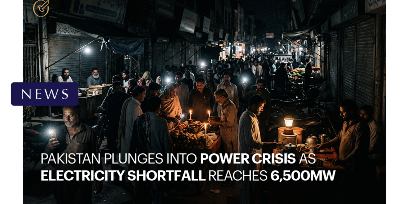
LAHORE/ISLAMABAD: Pakistan is currently grappling with one of its most acute electricity crises in recent years, as the nationwide power shortfall has surged to 6,500 megawatts, plunging millions of households and businesses into prolonged darkness.
According to official data, total electricity demand has climbed to approximately 22,000MW, while the national grid is generating only 15,400MW, a gap that has translated into 8 to 16 hours of outages in various parts of the country. The energy mix currently comprises thermal, nuclear, hydro, wind, solar, and bagasse sources, with thermal contributing the largest share at 9,250MW.
Two primary factors are driving the shortfall. First, hydropower generation has taken a significant hit due to reduced water releases from the country’s dams, with output falling by nearly 2,000MW during peak nighttime hours. Second, gas supply to thermal power plants has been sharply curtailed following a halt in liquefied natural gas (LNG) cargo shipments, which are not expected to resume until early May. Only limited volumes of indigenous gas are currently being diverted to the power sector.
The worst-affected regions include areas under the Multan Electric Power Company, where residents report near-routine outages of 12 to 16 hours. Major cities, including Lahore, Faisalabad, and Kasur, are experiencing recurring power cuts of 3 to 8 hours, contradicting official claims of a minimal urban shortfall.
The Power Division issued a public apology and urged citizens to adopt energy-saving practices, particularly during nighttime hours. Authorities expressed optimism that the situation would ease as the dam water levels rise and RLNG supplies resume.
Meanwhile, a petition has been filed in the Lahore High Court challenging unannounced load shedding, as businesses report mounting losses and households struggle with the onset of summer heat. With peak demand season still ahead, the crisis shows little sign of immediate resolution.
Dedicated and detail-oriented SEO Content Writer, Real Estate Writer, and Research Analyst based in Islamabad, with proven expertise in developing accurate, valuable, and well-researched content. Skilled in analytical writing, market research, and reporting, with the ability to turn insights into clear, professional, and impactful content. Passionate about exploring new ideas, analyzing industry trends, and contributing to high-quality writing and research-driven projects.
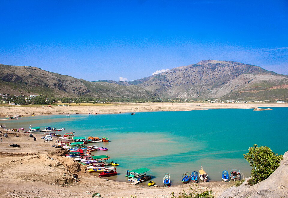
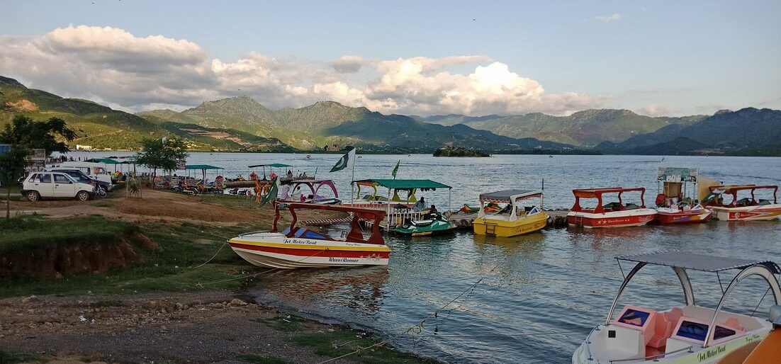
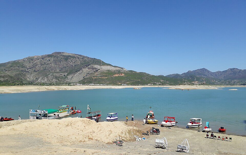
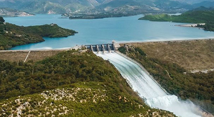
Khanpur Dam is one of the most exciting and scenic outdoor destinations near Islamabad. Known for its turquoise waters, rocky hills, and high-energy adventure scene, the dam has become a favourite spot for families, students, photographers, and thrill seekers alike.
Beyond being a vital water reservoir, Khanpur Dam now offers water sports, paragliding, camping, hiking, and boating, making it a complete outdoor getaway within easy reach of the capital.
This guide covers Khanpur Dam location, distance, weather, resorts, viewpoints, spillway, water sports, and activities, everything you need to plan the perfect visit.
About Khanpur Dam
Khanpur Dam is a major water reservoir built on the Haro River in Khyber Pakhtunkhwa. While its primary function is to supply drinking water to Islamabad and Rawalpindi and support irrigation, its dramatic landscape has transformed it into a tourism hotspot in Islamabad.
Key Facts at a Glance
Feature
Detail
River
Haro River
Purpose
Water supply + Irrigation
Region
Near Khanpur, Khyber Pakhtunkhwa
Popular For
Tourism, water sports, adventure
Why It’s Famous Today
Crystal-blue lake surrounded by rugged hills
Wide range of adventure sports
Scenic picnic and photography locations
Easy day trip from Islamabad
The mix of natural beauty and outdoor recreation gives the Khanpur Dam Islamabad region a unique appeal.
Khanpur Dam Location and Distance
The Khanpur Dam location is near the town of Khanpur in Khyber Pakhtunkhwa, situated between Taxila and Haripur. The dam is built on the Haro River and lies within a rocky gorge surrounded by low hills, giving the area a dramatic and scenic landscape.
Although it is outside Islamabad’s city limits, the dam is close enough to serve as a convenient day-trip destination for residents of the capital and Rawalpindi.
Its position between historic Taxila and the green hills of Haripur also makes it a natural stop for travellers exploring northern Pakistan.
Khanpur Dam Distance from Major Cities
The dam’s accessibility is one of the reasons it is so popular. Travel times are manageable even for short weekend outings.
Route
Distance
Average Travel Time
Khanpur Dam distance from Islamabad
45–50 km
About 1 hour
Rawalpindi to Khanpur Dam
50–55 km
1–1.5 hours
Taxila to Khanpur Dam
20–25 km
30–40 minutes
Haripur to Khanpur Dam
35–40 km
45–60 minutes
Lahore to Khanpur Dam distance
300–320 km
5–6 hours
Travel times may increase during peak traffic hours or holiday weekends.
Best Routes to Reach Khanpur Dam
Visitors usually choose one of the following road routes:
From Islamabad / Rawalpindi:
Islamabad → Taxila → Khanpur Road
Islamabad → GT Road → Taxila → Khanpur
From the Haripur side:
Haripur → Khanpur Road
These routes are generally well-maintained, but some stretches near the dam become narrow and winding as you approach the hills.
Transport Options
Following are some of the transport options:
By Private Car
Driving is the most convenient option. It allows flexibility for stops at viewpoints and easy transport of picnic supplies or adventure gear.
By Ride-Hailing Services
Ride-hailing apps operate between Islamabad and Khanpur Dam. This is suitable for small groups but may be costlier for round trips.
By Tour Operators
Adventure clubs and tour companies often run:
Day trips from Islamabad
Group packages including water sports
Camping and paragliding tours
Parking and Arrival Area
Near the lakeside activity zones, visitors will find:
Open parking areas for cars and vans
Designated drop-off points for tour groups
Small stalls and adventure operator counters
On busy weekends, parking areas close to the water fill early, so arriving in the morning is recommended.
Travel Tips Based on Distance
Start early if travelling from Islamabad to avoid city traffic
Keep extra travel time during weekends or holidays
Ensure fuel tanks are sufficient, as fuel stations are limited near the dam
Use GPS navigation, but follow local signage near the final approach
Khanpur Dam Weather and Best Time to Visit
The experience at Khanpur Dam can vary greatly depending on the weather. Because most activities here are outdoors, including boating, water sports, hiking, and paragliding, choosing the right season and time of day can make a big difference.
Khanpur Dam Weather Overview
Khanpur Dam has a semi-arid climate with hot summers and mild winters. The surrounding rocky hills can intensify daytime heat, while evenings near the water often feel cooler due to lake breezes.
Season
Temperature Trend
Conditions
Spring (Mar–Apr)
Mild to warm
Clear skies, pleasant
Summer (May–Aug)
Hot
Sunny, strong sunlight
Monsoon (Jul–Sep)
Warm with rain
Occasional showers
Autumn (Oct–Nov)
Comfortable
Dry and clear
Winter (Dec–Feb)
Cool
Crisp air, sunny days
Best Time to Visit Khanpur Dam
Spring
Spring is considered one of the best times to visit. The weather is pleasant, the landscape looks fresh, and outdoor activities are comfortable throughout the day.
Best for:
Water sports
Hiking and sightseeing
Photography
Summer
Summer is peak season for water-based fun, though daytime temperatures can be high.
Tips for summer visits:
Plan water sports in the morning or late afternoon
Carry sun protection and plenty of water
Avoid rocky hikes during peak heat
Monsoon
The monsoon season brings occasional rain, making the scenery greener but also increasing the risk of slippery surfaces.
Keep in mind:
Water activities may be paused during heavy rain
Trails and rocks can be slippery
Always check the forecast before visiting
Autumn
Autumn offers comfortable weather and clear skies, making it another excellent time to visit.
Ideal for:
Paragliding
Picnics and family outings
Scenic drives and viewpoints
Winter
Winter days are cool but often sunny, making them suitable for relaxed outdoor trips.
Best for:
Hiking and nature walks
Photography
Quiet picnics
Water sports may be less popular due to cooler water temperatures.
Best Time of Day to Visit
Time of Day
Experience
Morning
Cool air, calm water, fewer crowds
Midday
Bright sunlight, peak for water sports
Late Afternoon
Pleasant breeze, good for sightseeing
Evening
Scenic sunsets, relaxing atmosphere
Mornings and evenings are the most comfortable, especially in summer.
Weather Tips for Visitors
Check the forecast before planning paragliding or boating
Wear breathable clothing in summer
Bring a light jacket in winter evenings
Use sunscreen and hats year-round
Stay hydrated, especially during hot months
Quick Planning Guide
Goal
Best Season
Best Time
Water sports
Spring, Summer
Morning / Late afternoon
Paragliding
Spring, Autumn
Late morning
Hiking
Autumn, Winter
Morning
Photography
Autumn, Winter
Sunrise / Sunset
Family picnic
Spring, Autumn
Afternoon
Khanpur Dam Activities and Things to Do
There is no shortage of Khanpur Dam activities for visitors of all ages.
Khanpur Dam Water Sports
The dam is widely known for its water adventure scene.
Popular water sports include:
Jet skiing
Speed boating
Banana boat rides
Wake tubing
Cliff diving (with guides)
These activities are operated by local adventure providers near the lakeshore.
Paragliding in Khanpur Dam
Paragliding at Khanpur Dam is a major highlight for thrill-seekers.
Khanpur Dam Paragliding offers:
Tandem flights with trained pilots
Panoramic views of the lake and hills
Unique photo and video opportunities
Flights operate depending on wind and weather conditions.
Land-Based Adventure Activities
Land adventures include:
Rock climbing
Rappelling
Hiking trails in the surrounding hills
Camping under the stars
These activities make the area popular for student trips and group outings.
Khanpur Dam Island and Viewpoints
One of the most visually striking aspects of Khanpur Dam is its combination of open water, rugged hills, and elevated vantage points. These natural features create excellent opportunities for sightseeing, photography, and peaceful moments away from the more crowded adventure zones.
Khanpur Dam Island
A small landmass commonly referred to as Khanpur Dam Island sits within the reservoir and is one of the lake’s most talked-about features. While not a developed island in the traditional sense, it appears like an isolated patch of land surrounded by deep blue water, making it a scenic highlight.
What Makes the Island Special
Surrounded by calm lake waters
Dramatic backdrop of rocky hills
Popular stop during boat rides
Ideal for photography from a distance
Boat operators often take visitors near the island area, giving them a close-up view and a chance to capture panoramic photos of the reservoir.
Things to Know Before Visiting
Direct access to the island itself may not always be permitted
Conditions depend on water levels and operator policies
Always follow safety instructions during boat trips
Khanpur Dam Viewpoint Areas
The surrounding terrain offers several natural Khanpur Dam viewpoints where visitors can enjoy elevated views of the reservoir.
Common Viewpoint Locations
Hilltops along the approach road
Rocky ledges near adventure activity zones
Elevated roadside stops overlooking the lake
These spots allow visitors to see the full expanse of the water, the spillway area in the distance, and the surrounding landscape.
Best Times to Visit Viewpoints
Time
Why It’s Ideal
Early Morning
Soft light, calm surroundings
Late Afternoon
Cooler weather, clearer skies
Sunset
Golden reflections on the lake
Sunset is particularly popular because the changing light enhances the contrast between the blue water and the brown hills.
Photography Opportunities
The island and viewpoints are especially attractive to photographers.
Popular photo subjects include:
Wide landscape shots of the reservoir
Boats moving across the water
Reflections during sunset
Aerial-style views from higher ground
A zoom lens can help capture the island more clearly from a distance.
Why These Spots Are Worth Visiting
The Khanpur Dam Island and surrounding viewpoints offer a calmer, more scenic side of the destination. They balance out the high-energy water sports areas by providing space for:
Quiet reflection
Scenic walks
Photography
Enjoying nature’s scale and beauty
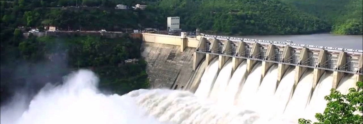
Khanpur Dam Spillway
The Khanpur Dam spillway is one of the most important structural features of the dam. While many visitors come for recreation and adventure, the spillway highlights the dam’s engineering and plays a vital role in water management and safety.
What is the Spillway?
A spillway is a controlled channel that allows excess water to flow out of a reservoir when water levels rise beyond safe limits. At Khanpur Dam, the spillway helps regulate the reservoir’s capacity and prevents overflow that could damage the structure or surrounding areas.
Viewing the Khanpur Dam Spillway
Direct access to the spillway is often restricted for safety reasons, but visitors may view it from:
Elevated viewpoints around the reservoir
Designated observation areas
Roadside vantage points at a safe distance
Always follow local guidelines and avoid entering restricted zones.
Photography Opportunities
The spillway becomes especially impressive when water is flowing at full force.
Ideal conditions for photos:
After heavy rainfall
Clear daylight for sharp contrast
From elevated viewpoints for a wide-angle shot
Long-exposure photography can capture the smooth motion of cascading water.
Khanpur Dam Resort and Hotels
While many visitors explore Khanpur Dam as a day trip, staying overnight allows more time to enjoy the scenery, adventure activities, and peaceful atmosphere around the reservoir. Accommodation options range from basic guest houses to private resorts and organised camping experiences.
Khanpur Dam Resort Options
A few private facilities and lakeside setups operate near the dam, offering a resort-style experience for visitors who want comfort alongside adventure.
What Resorts Typically Offer
Rooms or huts with views of the lake or surrounding hills
On-site dining or BBQ arrangements
Activity packages including water sports or paragliding
Outdoor seating areas for relaxation
These resorts are often chosen by families, couples, and corporate groups looking for a short getaway close to nature.
Area
Type of Accommodation
Distance to Dam
Khanpur Town
Guest houses, small hotels
10–15 minutes
Taxila
Budget and mid-range hotels
30–40 minutes
Haripur
Hotels and lodges
45–60 minutes
Islamabad
Wide range of hotels
About 1 hour
Staying in Islamabad provides the most comfort and dining options, while staying closer to Khanpur allows earlier access to activities.
Camping Near Khanpur Dam
Camping is a popular alternative for adventure enthusiasts.
Camping Options Include
Organised camping trips by adventure clubs
Tented stays near designated safe areas
Group camping packages with meals and activities
Camping allows visitors to enjoy the night sky, early morning lake views, and a quieter environment after day tourists leave.
Travel Tips for Visiting Khanpur Dam
Safety Tips
Always wear life jackets during water sports
Choose certified operators
Avoid slippery rocks during the monsoon
Comfort Tips
Carry sunscreen and hats
Wear sturdy shoes
Bring extra water
Timing Tips
Arrive early on weekends
Avoid midday heat in summer
Check the weather before booking paragliding
Frequently Asked Questions
How far is Khanpur Dam from Islamabad?
The Khanpur Dam distance from Islamabad is about 45–50 km.
What activities are available at Khanpur Dam?
Visitors can enjoy water sports, paragliding, hiking, camping, boating, and photography.
Is paragliding available at Khanpur Dam?
Yes, Khanpur Dam Paragliding is a popular activity when weather conditions are suitable.
What is the best season to visit Khanpur Dam?
Spring and autumn provide the most comfortable weather.
Final Thoughts
Khanpur Dam offers a rare blend of natural beauty and high-energy adventure close to Islamabad. With its exciting water sports, scenic viewpoints, paragliding experiences, and relaxing picnic spots, it remains one of the top outdoor destinations in the region. Whether you’re looking for adrenaline or a peaceful lakeside escape, Khanpur Dam delivers both in one unforgettable setting.
BBC-featured Content Specialist with a sharp eye for search intent and a proven ability to turn content into a growth engine. I leverage cutting-edge digital marketing tools to craft strategies that fuel organic traffic, amplify brand growth, and own the local SEO landscape, particularly across the competitive real estate market. I help brands dominate search rankings and convert visibility into measurable business success.
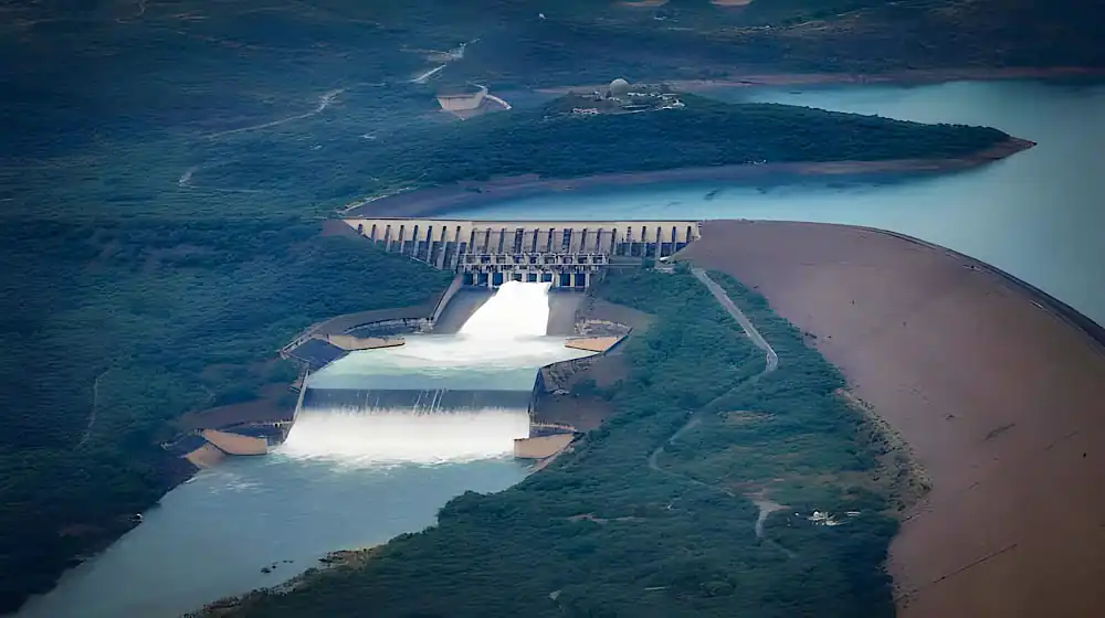
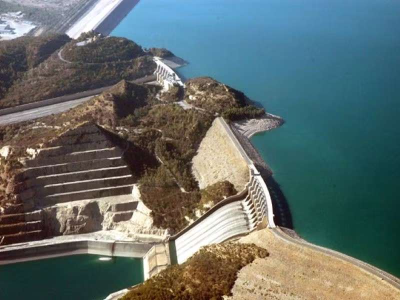
Mangla Dam is more than concrete and rock, it’s a lifeline for Pakistan’s water and energy needs. Built on the Jhelum River in the 1960s, this engineering marvel has powered irrigation, generated clean electricity, and shielded millions from floods for decades. Today, it stands not only as a symbol of national progress but also as a reminder of the urgent need to manage water and energy resources wisely in a changing climate.
Fast Facts & Key Specs
Feature
Details
Location
Jhelum River, near Mirpur (AJK) and Jhelum District, Punjab
The story of Mangla Dam begins in the 1950s, when Pakistan faced urgent challenges of water scarcity and irrigation management after the signing of the Indus Waters Treaty. To ensure secure and reliable water supplies, the project became part of the broader Indus Basin Replacement Works.
1950s–1960s: Planning and Launch
The dam was designed to harness the Jhelum River’s potential for irrigation and power generation.
Construction began in 1961, led by international engineers and local expertise, marking one of the largest development projects in Pakistan at the time.
Engineering Adaptations
Mangla was built under a “design as you build” philosophy. Engineers adapted to on-site conditions such as sheared clays and included auxiliary works like the Jari Dam to stabilize the system.
These adaptations allowed the project to maintain momentum and reach completion ahead of schedule.
Completion in 1967
By 1967, Mangla was fully operational, ranking as one of the largest earth and rockfill dams in the world.
Initial features included:
Four main embankments forming the dam structure.
Main and emergency spillways for safe water discharge.
Five tunnels constructed for water conveyance and power generation.
A staged powerhouse designed for phased installation of turbines and expansion over time.
Mangla Dam’s construction not only transformed Pakistan’s irrigation and energy landscape but also set a benchmark in large-scale engineering for the region.
The Raising Project (2004–2009)
By the early 2000s, Mangla Dam had lost a significant share of its storage due to continuous sedimentation. This reduction threatened irrigation supplies, power generation, and flood protection. To overcome these challenges, the Mangla Dam Raising Project was launched between 2004 and 2009, marking one of Pakistan’s most ambitious water infrastructure upgrades.
Why It Was Carried Out
Sedimentation had reduced effective storage, undermining agricultural and energy needs.
Flood routing capacity was compromised, raising risks during high inflows.
Pakistan’s growing energy demand called for restoring and expanding hydropower potential.
Key Works Undertaken
The project raised the dam’s height by 30 feet, which transformed its capacity and resilience. Major engineering works included:
Dam and dyke raising to increase reservoir volume.
Spillway throttling to manage higher water levels safely.
Construction of a control weir for better water regulation.
Foundation drainage and seepage control to strengthen long-term structural stability.
Outcomes Achieved
Restored lost storage and added ~2.9 million acre-feet (MAF) of new capacity.
Boosted annual energy benefits by approximately 644 GWh, enough to power millions of homes.
Enhanced flood routing efficiency, providing better protection for downstream communities.
Increased gross storage to ~7.49 MAF, about 27% higher than the original 1967 design.
At-a-Glance Metrics
Dam Height Increase: 30 feet
Additional Storage: ~2.9 MAF
Total Gross Capacity: ~7.49 MAF
Annual Power Gain: ≈644 GWh
Project Duration: 2004–2009
Investment Scale: Multi-billion rupees, one of the largest infrastructure undertakings of its time
Mangla Dam is not only a water reservoir but also a cornerstone of Pakistan’s clean energy production. Its powerhouse plays a critical role in meeting the nation’s electricity demand.
Existing Setup
The dam is equipped with 10 Francis-type turbines.
Each unit ranges between 100–135 MW, operating under a rated head of about 295 feet.
After the raising project, the total installed capacity reached approximately 1,070–1,120 MW, making it one of Pakistan’s largest hydropower stations.
Ongoing & Planned Refurbishments
Refurbishment programs are underway to extend the lifespan of the existing turbines and improve efficiency.
Modernization of control systems, gates, and auxiliary equipment is being carried out to enhance safety and reliability.
Expansion concepts are under review to further increase generation capacity, leveraging the additional water head created by the raising project.
Long-Term Benefits
Sustained supply of renewable electricity to reduce reliance on fossil fuels.
Improved performance and reliability of the turbines under high sediment load conditions.
Contribution to Pakistan’s broader goals of energy security and climate resilience.
Irrigation Role & Flood Management
Mangla Dam has been central to transforming Pakistan’s water system from unpredictable flows to a regulated network that sustains agriculture across the Indus plain. Before its construction, farmers relied on seasonal fluctuations of the Jhelum River. With Mangla’s reservoir and controlled releases, irrigation became more reliable, boosting crop yields and ensuring water availability even in drier months.
Reliable Water for the Indus Basin
The reservoir provides dependable irrigation water to millions of acres of farmland.
Its regulated releases support wheat, rice, and cotton production, which form the backbone of Pakistan’s economy.
By acting as a buffer, the dam ensures year-round supply, reducing the dependency on monsoon rains.
Flood Moderation Role
Mangla is not only about storage and irrigation—it is also a major shield against floods.
A notable example was the 1992 floods, where the dam absorbed peak inflows and reduced downstream devastation by cutting flood peaks.
Controlled releases allow for “peak shaving,” which helps reduce the severity of floods along the Indus system.
2025 Context: New Challenges
In recent years, inflow volatility has increased, with some seasons bringing late or reduced river flows.
In 2025, filling delays highlighted the dam’s vulnerability to changing rainfall and snowmelt patterns.
Coordination with the National Disaster Management Authority (NDMA) has become crucial. Real-time monitoring and early-warning systems are now used to balance water storage with flood risk, ensuring communities downstream remain protected while keeping enough water in reserve.
Sedimentation: Current Status, Risks & Engineering Options
One of the most pressing long-term challenges for Mangla Dam is sedimentation. Over time, silt and debris carried by the Jhelum River settle in the reservoir, reducing its effective storage and threatening both irrigation supply and hydropower generation.
Current Status
By 2010, measured deposition had already reduced storage by around 1.29 million acre-feet (MAF).
On average, the dam loses about 0.5% of its capacity each year, a trend that, if unchecked, will continue to erode its usefulness.
Risks from Sediment Advance
The sediment delta is gradually moving closer to the intake structures, raising the risk of blockage and reduced efficiency.
If it reaches critical points, it could severely impact turbine operations and irrigation outlets.
Engineering Options for Side-Pocket Storages
Mangla’s reservoir includes side pockets such as Poonch, Khud-Jari, and Kanshi. Over time, sedimentation may isolate these areas from the main pool. To utilize them effectively, engineers are considering long-term options such as:
Cutting channels to reconnect them with the main reservoir.
Tunnels or siphon systems to draw water.
Targeted dredging windows during low inflow periods to recover storage.
Downstream Morphology & Operational Timing
Increased sediment outflow can reshape riverbeds downstream, affecting canals and distributaries.
This raises the risk of canal siltation, making irrigation networks harder to maintain.
Operators often lower reservoir levels in February–March to flush sediments when inflows are low, but this strategy has limits.
Impact on Hydropower Systems
High sediment load increases turbine wear, reducing efficiency and raising maintenance costs.
Cooling systems and auxiliary equipment face extra stress during peak silt periods.
Contingency planning now includes advanced monitoring, improved turbine design, and predictive maintenance schedules to minimize risks.
Irrigation Role & Flood Management
Mangla Dam has been a game-changer for Pakistan’s irrigation system. Before its construction, farmers in the Indus basin had to depend on unpredictable river flows. With the dam in place, flows are regulated, and water is released according to demand.
This shift from unregulated flows to controlled releases has brought greater reliability to agriculture across the plains. Millions of acres of farmland now benefit from timely irrigation, helping boost food production and ensuring water security throughout the year.
Regulated Releases for the Indus Basin
Provides consistent irrigation supplies across Punjab and Sindh.
Stabilizes cropping cycles for wheat, rice, and cotton.
Ensures water availability in dry months, reducing reliance on rainfall.
Flood Moderation Role
Mangla is also critical for flood control. By storing floodwaters and releasing them gradually, the dam reduces peak flows that would otherwise devastate downstream communities.
A striking example was the 1992 flood, one of the worst in Pakistan’s history. Mangla played a vital role in peak shaving, absorbing massive inflows and cutting the scale of destruction.
This flood moderation capacity remains one of its greatest contributions to national safety.
2025 Context: New Challenges
In 2025, Mangla faced inflow volatility due to shifting rainfall and snowmelt patterns. The dam’s filling was delayed despite monsoon rains, highlighting the vulnerability of storage systems under climate change.
Coordination with the National Disaster Management Authority (NDMA) has become central, with early-warning systems and real-time monitoring in place.
Operators now balance the need for storage with flood-risk reduction, making Mangla an active player in disaster management as well as irrigation.
Sedimentation: Current Status, Risks & Engineering Options
Sedimentation is one of the biggest threats to the long-term effectiveness of Mangla Dam. The Jhelum River carries heavy silt, which settles in the reservoir and gradually reduces its capacity.
Current Status
By 2010, Mangla had already lost about 1.29 million acre-feet (MAF) of capacity to silt deposits.
On average, the reservoir loses around 0.5% of capacity each year.
This continuous buildup reduces both irrigation water availability and hydropower efficiency.
Risks from Sediment Delta Advance
The sediment delta has been moving closer to the dam’s intake structures. If it reaches critical points, it could block or damage the intakes, disrupting power generation and irrigation flows. Managing this advance is essential to keep the system functional.
Side-Pocket Storage Challenges
Mangla has several side pockets such as Poonch, Khud-Jari, and Kanshi. Over time, sedimentation can cut these pockets off from the main reservoir, reducing usable capacity. Engineers have explored solutions like:
Cutting channels to reconnect side pockets.
Building tunnels or siphons to draw water from isolated zones.
Targeted dredging during low inflow seasons to recover capacity.
Downstream Morphology & Siltation Risks
Sediment released from Mangla can alter riverbeds downstream. This has implications for irrigation canals, which may experience higher siltation rates, raising maintenance costs.
Operators often schedule drawdowns in February and March to flush sediments, but this approach has its limits and cannot fully offset long-term deposition.
Cooling systems: Sediment clogs and stresses auxiliary equipment, raising the risk of breakdowns.
Contingency planning: Modern approaches now focus on predictive maintenance, upgraded turbine designs, and real-time monitoring of sediment flow to protect hydropower output.
Social & Environmental Dimensions
Mangla Dam is more than an engineering project, it has shaped communities, livelihoods, and landscapes for over half a century. While it brought irrigation, power, and flood protection, it also came with major social and environmental trade-offs.
Original Displacement (1960s)
When Mangla Dam was first built, nearly 81,000 people were displaced from their ancestral lands. Approximately 67,800 acres of land were acquired to create the reservoir. The scale of resettlement was unprecedented at the time and left lasting social impacts.
Families lost farmland, villages were submerged, and entire communities were forced to adapt to new environments. These experiences provided lessons in planning and managing resettlement for future projects in Pakistan.
Raising Resettlement (2000s)
The Mangla Raising Project (2004–2009) required another round of displacement. About 63,000 more people were resettled as the higher dam levels submerged additional areas.
To address this, the government developed New Mirpur City along with four model towns, complete with roads, schools, and basic services. A structured compensation package was introduced for landowners and affected families.
Notably, resettlement and rehabilitation costs formed a significant portion of the project budget, showing how central social issues had become in large-scale infrastructure planning.
Changing Livelihoods on the Rim
Over time, life around Mangla has evolved. Communities have developed new economic activities, including:
Fisheries in the reservoir, creating both food supply and income sources.
Brick kilns and construction-related industries benefiting from urban expansion.
Vocational training programs to help younger generations shift into new professions.
These shifts reflect the resilience of local populations as they adapt to a transformed social and environmental landscape.
Operations in 2025: Water Stress vs. Flood Risk
In 2025, Mangla Dam once again proved its importance but also revealed new vulnerabilities under climate stress and water scarcity.
Dead-Level Episode (March 2025)
In March 2025, the reservoir dropped to its dead storage level of 1,050 feet, halting water releases and curtailing hydropower production. This rare event highlighted how reduced inflows and shifting weather patterns can put extreme stress on Pakistan’s water and power systems. Farmers faced irrigation shortages, while electricity generation was cut back, increasing reliance on costlier energy sources.
Monsoon 2025: Filling Delays
Despite heavy rains during the monsoon season, Mangla’s filling remained slow. Erratic inflows and unusual timing of rainfall disrupted normal reservoir operations. Storage levels stayed below targets, limiting both irrigation reserves and electricity generation headroom. This underscored the growing challenge of balancing water supply with changing climate conditions.
Real-Time Risk Management
To address these risks, NDMA and WAPDA coordinated closely during 2025. Flood advisories for the Jhelum River were issued in real time, and multi-agency teams created readiness checklists for downstream communities. This included early warning systems, pre-evacuation planning, and tighter monitoring of reservoir levels. These steps show how Mangla’s operations are now as much about disaster risk management as they are about irrigation and hydropower.
Rehabilitation & Modernization Programs
Mangla Dam, now over five decades old, requires continuous upgrades to remain efficient and safe. Rehabilitation and modernization programs have been launched with the dual goal of extending the dam’s operational life and boosting energy output.
Goals of Rehabilitation
Extend the dam’s service life well into the next century.
Increase electricity generation by up to 90 MW, adding around 750 GWh of clean energy annually.
Enhance irrigation reliability for millions of farmers.
Improve safety systems to cope with changing hydrological conditions and seismic risks.
Priority Focus Areas
Unit refurbishment: Overhaul of turbines and generators to restore efficiency.
Gate and hoist reliability: Upgrades to spillway gates and control systems for secure water management.
SCADA systems: Modern digital controls for real-time monitoring and automation.
Sediment monitoring: Installation of advanced tools to track sediment inflow and reservoir health.
Safety instrumentation: Enhanced sensors and monitoring devices to ensure structural integrity and early warning in case of stress events.
These modernization efforts are designed not only to secure Mangla’s future performance but also to align it with modern sustainability and safety standards.
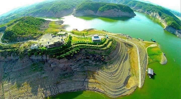
Tourism, Local Economy & Heritage
Mangla is more than a water and energy asset—it has also become a hub for tourism and local economic activity.
Recreational Value: The vast Mangla Lake is a popular destination for boating, fishing, and water sports. Its scenic setting attracts visitors from nearby cities and beyond.
Local Economy: Tourism and hospitality industries in Mirpur and Jhelum benefit directly, with hotels, restaurants, and small businesses thriving around the reservoir.
Heritage Sites: The region hosts historical and cultural attractions, including remnants of old Mirpur submerged under the lake, which remain a point of identity for locals.
Visitor Highlights: District portals regularly promote Mangla as a tourism gem, emphasizing eco-tourism, recreational development, and weekend getaways for families.
Tourism has turned Mangla into not just an engineering landmark, but also a symbol of cultural and economic vitality.
2025–2040 Challenges & Strategy Roadmap
Looking ahead, Mangla Dam faces significant challenges that require proactive strategies to ensure long-term sustainability.
Water Balance & Climate Variability
Increasing demand for irrigation water is placing stress on limited resources.
Climate variability has made inflows unpredictable, disrupting filling schedules.
Strategies now emphasize multi-year storage planning and careful release protocols to balance supply and demand.
Sediment Management
Adaptive operational rules are being developed to manage minimum drawdown levels.
Engineering options include connecting side pockets like Poonch and Kanshi with channels or tunnels to maintain usable storage.
Targeted dredging windows during low-inflow periods are under consideration to recover lost capacity.
Asset Health
Protecting turbines during high-silt inflows is a growing concern.
Cooling system redesigns are being studied to improve resilience against clogging and wear.
Predictive maintenance programs are being developed to anticipate failures and extend turbine life.
Community & Resettlement Stewardship
Long-term stewardship involves supporting communities displaced during both the original project and the raising.
Focus areas include land compensation, housing development, and livelihood restoration.
Grievance redress mechanisms and phased completion of resettlement towns remain ongoing priorities.
Policy, Governance & Data Transparency
Mangla Dam’s operation is overseen by a web of institutions, each playing a critical role:
WAPDA manages dam operations and hydropower production.
IRSA (Indus River System Authority) regulates water distribution across provinces.
NDMA coordinates disaster risk management and flood response.
Provincial irrigation departments oversee regional irrigation supply and infrastructure.
Transparency has become increasingly important. Public dashboards now provide real-time reservoir levels (maximum 1242 ft, dead level 1050 ft), while routine updates are shared through multiple platforms to improve communication with stakeholders and communities
Q1. What is Mangla Dam’s current capacity and conservation level?
Mangla’s current gross capacity is about 7.49 MAF, with a conservation level of 1242 feet and a dead storage level of 1050 feet.
Q2. Why did Mangla hit dead level in March 2025?
A combination of low inflows, erratic rainfall, and higher water demand caused the reservoir to fall to dead storage, halting releases and reducing hydropower output.
Q3. How does sediment threaten turbines and canals?
Sediment advances toward intakes, reducing water flow and efficiency. Downstream, excess silt increases canal blockages, while abrasive particles wear down turbine blades and auxiliary systems.
Q4. What did the raising project achieve?
The 2004–2009 raising project increased dam height by 30 feet, restoring lost storage and adding ~2.9 MAF. It also improved flood routing and enhanced hydropower generation by an additional ~644 GWh annually.
Q5. How many people were resettled and how?
The original dam displaced about 81,000 people in the 1960s. The raising project displaced another 63,000, resettled in New Mirpur City and surrounding towns with compensation and planned infrastructure.
BBC-featured Content Specialist with a sharp eye for search intent and a proven ability to turn content into a growth engine. I leverage cutting-edge digital marketing tools to craft strategies that fuel organic traffic, amplify brand growth, and own the local SEO landscape, particularly across the competitive real estate market. I help brands dominate search rankings and convert visibility into measurable business success.